 W
WRonald Francis (Ron) Abler is an American geographer at Pennsylvania State University and an Elected Fellow of the American Association for the Advancement of Science.
 W
WLeoncio Afonso Perez was a professor of geography and an intellectual of the Canary Islands. He made considerable contributions to the study of geography in the region, and he was bestowed an honorary doctorate from the University of La Laguna on 7 March 1997, in recognition of his life's work. His career was dedicated, among other things, to the study of the geography, history and toponymics of the Canary Islands.
 W
WKarl Andree was a German geographer.
 W
WArthur Westlake Andrews was a British geographer, poet, rock-climber, mountaineer and amateur tennis and badminton player.
 W
WPeter Anich (1723–1766) was an Austrian cartographer and maker of mathematical instruments.
 W
WJohn Christopher Bartholomew was a Scottish cartographer and geographer.
 W
WJohn Bartholomew Sr. was a Scottish cartographer and engraver.
 W
WWalter Emmerich Behrmann was a German geographer. He is remembered for introducing a cylindrical map projection known as the "Behrmann projection".
 W
WRoland Napoléon Bonaparte, 6th Prince of Canino and Musignano was a French prince and president of the Société de Géographie from 1910 until his death. He was the last direct descendant of Lucien Bonaparte, the genetically senior branch of the family since 1844.
 W
WStefano Bonsignori or Buonsignori was an Italian Olivetan monk and cartographer to Francesco I, Grand Duke of Tuscany. He was born in Florence and is most notable for his eponymous Bonsignori Map of Florence.
 W
WJean Brunhes was a French geographer. His most famous book is La géographie humaine.
 W
WPhilippe Buache was a French geographer, known for inventing a new system of geography and popularizing this field.
 W
WClaudius Clavus (Suartho) also known as Nicholas Niger,, , was a Danish geographer sometimes considered to be the first Nordic cartographer.
 W
WFélix Delamarche was a French geographer and engineer who flourished during the 18th century and early 19th century. His father was the map publisher Charles Francois Delamarche.
 W
WJohann Georg August Galletti was a German historian and geographer.
 W
WJohann Gottlieb Georgi was a German botanist, naturalist and geographer.
 W
WProf Andrew John Herbertson FRSE FRGS FRMS was a Scottish geographer.
 W
WHenning Filip Hjulström was a Swedish geographer. Hjulström was professor of geography at Uppsala University from 1944, and in 1949, when the subject of geography was split, he became professor of Physical Geography.
 W
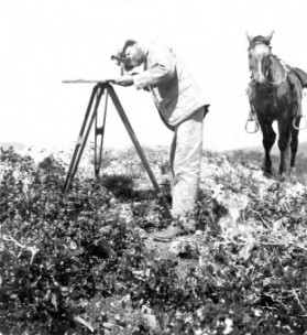
WWillard Drake Johnson (1860-1917) was an American glaciologist, topographer, cartographer, hydrographer, geologist, geographer, and ethnologist. His career began under the tutelage of Grove Karl Gilbert on the Lake Bonneville survey. In 1882 he joined US Geological Survey under John Wesley Powell. From 1882 until 1896 he was in the topographic portion of the survey. In 1888 he co-founded the National Geographic Society. From 1888 until 1890 he surveyed the Arkansas River in Colorado. In 1891 he became the chief of the California, where he co-founded the Sierra Club and became a good friend of John Muir. In 1895 Johnson went on an expedition to Sonora, where he studied the Seri Indians. In 1897 he joined the Water Resources Branch of the US Geological Survey, where he worked in Oklahoma. From 1904 until 1905 he worked in Utah and the Sierra Nevada, where he studied glacial geology. After that he worked for the US Forest Service in Portland, Oregon until 1916. He worked in the Grand Canyon until his death there on February 13, 1917.
 W
WAlexander Keith Johnston was a Scottish explorer, cartographer and geographer.
 W
WFelix Philipp Kanitz was an Austro-Hungarian naturalist, geographer, ethnographer, archaeologist and author of travel notes.
 W
WAurel Krause was a German geographer known today for his early ethnography of the Tlingit Indians of southeast Alaska, published in 1885.
 W
WYves Lacoste is a French geographer and geopolitician. He was born in Fes, Morocco. In 1976 he established the French geopolitical journal Hérodote and published a work that shook the French academy, La Géographie ça sert d'abord à faire la guerre; its central thesis was that "geography was a form of strategic and political knowledge, central to the military strategy and the exercise of political power". Lacoste had earlier earned international renown in 1972 during the Vietnam War by publishing a spatial forensics analysis of the US bombing campaign of the Red River Delta. He agreed with claims from the North Vietnamese government that the US was deliberately targeting the hydrological infrastructure of the river in an attempt to trigger flooding and cause mass civilian casualties, which it called a war crime.
 W
WElisabeth Lichtenberger was an Austrian geographer. Her research focus was on urban geography and mountain research, particularly in Central and Eastern Europe and North America. She taught at the University of Vienna, and was awarded the Austrian Decoration for Science and Art in 1999. She was a fellow of the British Academy, a member of Academia Europaea and the Austrian Academy of Sciences, and holder of honorary doctorates from the University of Chicago and Leipzig University.
 W
WAkinlawon Ladipo "Akin" Mabogunje is a Nigerian geographer. He was the first African president of the International Geographical Union. In 1999, he was the first African to be elected as a Foreign Associate of the United States National Academy of Sciences. In 2017, he was elected a Foreign Honorary Member of the American Academy of Arts and Sciences and received the Vautrin Lud Prize.
 W
WEmmanuel Marie Pierre Martin Jacquin de Margerie ForMemRS was a French geographer after whom the Margerie Glacier was named, which he visited in 1913.
 W
WCount Ludwig August Mellin was a Baltic German politician, cartographer, writer and publicist. He is best known for creating the first professional atlas visualizing Livonia, the Atlas von Liefland, oder von den beyden Gouvernementern u. Herzogthümern Lief- und Ehstland, und der Provinz Oesel in 1798.
 W
WAlfred Merz was an Austrian geographer, oceanographer and director of the Institute of Marine Science in Berlin. He died of pneumonia in Buenos Aires while on an expedition to survey the South Atlantic and is buried in Perchtoldsdorf. Merz Peninsula is named after him.
 W
WDorothy Middleton was a writer and geographer who held several roles at the Royal Geographical Society. Her best-known work is Victorian Lady Travellers (1965).
 W
WSamuel Augustus Mitchell was an American geographer.
 W
WMogami Tokunai was a Japanese samurai, geographer and explorer.
 W
WFilippo Pigafetta (1533–1604) was an Italian mathematician and explorer.
 W
WYeshayahu Press was a prominent researcher of the land of Israel. He was born in Jerusalem, which his father, Haim Press, helped build. Givat Yeshayahu was named after him. He wrote Topographical-Historical Encyclopedia of the Land of Israel. During the Ottoman rule over Palestine, Press served as the first Secretary of the Teachers' Union, during which time he also helped to establish the Jewish Palestine Exploration Society. With the founding the political state of Modern Israel, Press was among the driving force behind the establishment of the "Government Naming Committee" in 1949.
 W
WJohn Spilsbury was a British cartographer and engraver. He is credited as the inventor of the jigsaw puzzle. Spilsbury created them for educational purposes, and called them “Dissected Maps”.
 W
WJohn Thomson (1777-c1840), was a Scottish cartographer from Edinburgh, celebrated for his 1817 New General Atlas, published by himself in Edinburgh, John Cumming in Dublin, and Baldwin, Cradock, and Joy in London.
 W
WWilhelm Tomaschek, or Vilém Tomášek was a Czech-Austrian geographer and orientalist. He is known for his work in the fields of historical topography and historical ethnography.
 W
WEdward Louis Ullman, son of classical scholar Berthold Ullman, was trained as a geographer at University of Chicago where he was influenced by the urban and economic emphasis in social science. He was an urban geographer, transportation researcher and regional development specialist and became the champion of applied geography. His study and dissertation on the economic aspects of Mobile, Ullman began a career of transit studies. He was the Office of Strategic Services transportation specialist in World War II.
 W
WAlbertinus de Virga was a 15th-century Venetian cartographer.
 W
WAndreas Walsperger was a German cartographer of the 15th century. The son of a carpenter, he became a Benedictine monk at St. Peter's in Salzburg in 1434. He left the monastery in 1442. Little more is known about him except that in 1448/9 he created his map in Konstanz.
 W
WBertrand Westphal, is a French scholar and essayist.
 W
WRichard Norris Wolfenden (1854-1926) was an English physician and oceanographer