 W
WÅkersvika is a 424-hectare (1,050-acre) wetland nature reserve and Ramsar site in Hamar, Norway. It became Norway's first Ramsar site in 1974. Vikingskipet, the speed skating venue for the 1994 Winter Olympics, was built in the site, creating controversy. European Route E6 also runs through the site, and the Norwegian Public Roads Administration has plans to expand the road to a four-lane motorway.
 W
WAnden or Anda is a small island in the municipality of Øksnes in Nordland county, Norway. It lies in the Vesterålen archipelago, about 5 kilometres (3.1 mi) north of the village of Stø on the northern tip of the large island of Langøya, and about 14 kilometres (8.7 mi) west of the large island of Andøya. It is home to the Anda Lighthouse, which was the last lighthouse in Norway to be automated.
 W
WBear Island is the southernmost island of the Norwegian Svalbard archipelago. The island is located in the western part of the Barents Sea, approximately halfway between Spitsbergen and the North Cape.
 W
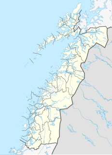
WBliksvær or Briksvær is an island group in the Vestfjorden in Bodø Municipality in Nordland county, Norway. The islands are located about 15 kilometres (9.3 mi) west of the town of Bodø. The Helligvær islands are about 12 kilometres (7.5 mi) to the north, Landegode island is 13 kilometres (8.1 mi) to the northeast, and the islands of Røstlandet and Værøya around about 75 kilometres (47 mi) to the west.
 W
WThe Blindheimsvik Wildlife Sanctuary is located on the south side of Vigra island in the municipality of Giske in Møre og Romsdal county, Norway.
 W
WDunøyane is a group of islands north of Hornsund, outside Wedel Jarlsberg Land at the western coast of Spitsbergen, Svalbard. The island group is a nesting site for barnacle goose, common eider and Arctic tern. Hunters used to collect eiderdown at the islands. Dunøyane are included in the Dunøyane Bird Sanctuary, and part of the Sør-Spitsbergen National Park.
Forlandet National Park lies on the Norwegian archipelago of Svalbard. The park was created by a royal resolution on June 1, 1973 and covers the entire island of Prins Karls Forland and well as the sea around it. The Norwegian national park has an area of 616 km2 and a marine area of 4031 km2.
WThe Giske Wetlands System is a Ramsar site located in the municipality of Giske in Møre og Romsdal county, Norway. It consists of six separate protected areas: two nature reserves and four wildlife sanctuaries. One of the nature reserves lies on the island of Giske and the five other areas are located on the island of Vigra in the same municipality.
WThe Giske Wildlife Sanctuary is located in the Makkevika inlet on Giiske island in the municipality of Giske in Møre og Romsdal county, Norway.
 W
WThe Glomma, or Glåma, is Norway's longest and most voluminous river. With a total length of 621 kilometres, it has a drainage basin that covers fully 13% of Norway's surface area, all in the southern part of the country.
WThe Grasøyane Bird Sanctuary is a bird sanctuary and Ramsar site northeast of the island of Runde in the municipality of Ulstein in Møre og Romsdal county, Norway. The area was protected in 1981 together with three other bird sanctuaries in order to "take care of rich and interesting bird life and a bird habitat, especially with respect to seabirds," according to the conservation regulations. The four sites have a total area of 2.6 square kilometers (1.0 sq mi).
 W
WHarøya is a swampy island in Ålesund Municipality in Møre og Romsdal county, Norway. At 13.6 square kilometres (5.3 sq mi), it is the largest island in the municipality. The island is located between the islands of Finnøya and Fjørtofta.
WThe Harøya Wetlands System is a Ramsar site located on Harøya island in the municipality of Ålesund in Møre og Romsdal county, Norway. It consists of six separate protected areas: three nature reserves plus a large wildlife sanctuary containing two smaller bird sanctuaries.
WThe Hellestien-Blåfjellet-Kløfjellet-Geita Bird Sanctuary is a bird sanctuary and Ramsar site on the island of Runde in the municipality of Herøy in Møre og Romsdal county, Norway. The area was protected in 1981 together with three other bird sanctuaries in order to "take care of rich and interesting bird life and a bird habitat, especially with respect to seabirds," according to the conservation regulations. The four sites have a total area of 2.6 square kilometers (1.0 sq mi).
 W
WHopen is an island in the southeastern part of the Svalbard archipelago (Norway). Hopen was discovered in 1596 by Jan Cornelisz Rijp during the third expedition by Willem Barentsz, trying to find the Northeast Passage. Later, in 1613, its name was given by Thomas Marmaduke of Hull, who named it after his former command, the Hopewell.
 W
WIngeborgfjellet is a mountain in Nordenskiöld Land in Spitsbergen, Svalbard. It has a height of 715 m with a secondary peak of 620 m. It is included in the Nordenskiöld Land National Park, and has an important bird cliff. Ingeborgfjellet is located north of Bellsund and west of the glacier Fridtjovbreen. It forms a characteristic ridge and is an easily recognized landmark viewed from sea.
 W
WIsøyane is a group of small islands in Wedel Jarlsberg Land at Spitsbergen, Svalbard. They are located north of Dunøyane at the western coast of Spitsbergen, and is a continuation of the middle moraine ridge of the glacier Torellbreen, with an extension of about 3.5 nautical miles. The largest island is Nordre Isøya. The northernmost islet is called Aurholmen, and to the south are Isøyskjera, a group of skerries and islets. Nordre Isøya and Isøykalven are protected as a bird reserve, with restricted access for the public.
 W
WKongsfjorden is an inlet on the west coast of Spitsbergen, an island which is part of the Svalbard archipelago in the Arctic Ocean. The inlet is 26 km (16 mi) long and ranges in width from 6 to 14 km. Two glaciers, Kronebreen and Kongsvegen, head the fjord.
WKongsfjorden Bird Sanctuary is a 140 ha bird reserve at Svalbard, Norway, established in 1973. It includes islands and islets in Kongsfjorden, Haakon VII Land. It lies at the inner end of the fjord and consists of about ten islands, mainly covered with grassy vegetation and having small freshwater ponds. The fjord is surrounded by steep mountains, cliffs, glaciers and tundra. The reserve has been recognised as a wetland of international importance by designation under the Ramsar Convention. It has also been identified as an Important Bird Area (IBA) by BirdLife International. It supports breeding populations of pink-footed and barnacle geese, common and king eiders, long-tailed ducks, purple sandpipers, red phalaropes, glaucous gulls, long-tailed jaegers and snow buntings. Ivory gulls have been recorded.
WThe Lomstjønna Nature Reserve is located on Harøya island in the municipality of Ålesund in Møre og Romsdal county, Norway.
WThe Lyngholman Nature Reserve is located on Finnøya island in the municipality of Ålesund in Møre og Romsdal county, Norway.
WThe Malesanden and Huse Wildlife Sanctuary is located on the east side of Harøya island in the municipality of Ålesund in Møre og Romsdal county, Norway.
WThe Melland Nature Reserve is located on the western part of Skardsøya island in the municipality of Aure in Møre og Romsdal county, Norway. The nature reserve has the status of a Ramsar site because of its importance for migratory birds.
WThe Mellandsvågen Nature Reserve is located on the western part of Skardsøya island in the municipality of Aure in Møre og Romsdal county, Norway. Since 1996, the nature reserve has had the status of a Ramsar site because of its importance for migratory birds.
Nordenskiöld Land National Park lies on Spitsbergen island in the Svalbard archipelago, Norway. Its area includes also the icefree Reindalen. The park was opened in 2003.
 W
WØyeren is a lake in the Glomma River watershed, southeast of Lillestrøm. It is located within the municipalities of Enebakk, Skedsmo, Fet, and Rælingen in Akershus county and Spydeberg and Trøgstad municipalities in Østfold county.
 W
WPasvik Nature Reserve is a bilateral nature reserve located in the valley of Pasvikdalen in Norway and Russia. The nature reserve was established in 1992 (Russia) and 1993 (Norway), and covers an area of 166.4 square kilometers (64.2 sq mi). The Norwegian part, in the municipality of Sør-Varanger, covers 19.1 square kilometers (7.4 sq mi), while the Russian part, in Pechengsky District, Murmansk Oblast, covers 147.3 square kilometers (56.9 sq mi). The nature reserve includes unexploited parts of Pasvikelva and has a rich birdlife.
 W
WRisøysundet is a strait between the islands of Andøya and Hinnøya in the Vesterålen archipelago in Norway. It is located in Andøy Municipality in Nordland county. The 24-kilometre (15 mi) long strait has only one road crossing: the Andøy Bridge as part of the Norwegian County Road 82 connecting the villages of Risøyhamn and Dragnes.
WThe Roaldsand Wildlife Sanctuary is located on the east side of Vigra island in the municipality of Giske in Møre og Romsdal county, Norway.
WThe Rørvikvågen Wildlife Sanctuary is located on the west side of Vigra island in the municipality of Giske in Møre og Romsdal county, Norway.
WThe Rørvikvatnet Nature Reserve is located on the southeast part of Vigra island in the municipality of Giske in Møre og Romsdal county, Norway.
 W
WRunde is an island in the municipality of Herøy in Møre og Romsdal county, Norway. The island has a population of 113 people, and it is connected by the Runde Bridge to the island of Remøya to the south.
WThe Runde North Side Bird Sanctuary is a bird sanctuary and Ramsar site on the island of Runde in the municipality of Herøy in Møre og Romsdal county, Norway. The area was protected in 1981 together with three other bird sanctuaries in order to "take care of rich and interesting bird life and a bird habitat, especially with respect to seabirds," according to the conservation regulations. The four sites have a total area of 2.6 square kilometers (1.0 sq mi).
WThe Runde Ramsar Site is a Ramsar Convention area consisting of five previously approved protected areas in the municipalities of Herøy and Ulstein in Møre og Romsdal county, Norway. The area was established in 2013.
WThe Runde West Side Bird Sanctuary is a bird sanctuary and Ramsar site on the island of Runde in the municipality of Herøy in Møre og Romsdal county, Norway. The area was protected in 1981 together with three other bird sanctuaries in order to "take care of rich and interesting bird life and a bird habitat, especially with respect to seabirds," according to the conservation regulations. The four sites have a total area of 2.6 square kilometers (1.0 sq mi).
WThe Selvikvågen Nature Reserve is located on Harøya island in the municipality of Ålesund in Møre og Romsdal county, Norway.
Sør-Spitsbergen National Park encompasses the southern end of Spitsbergen island in the Svalbard archipelago, Norway. The park was opened in 1973 and includes Wedel Jarlsberg Land, Torell Land and Sørkapp Land. Over 65% of the region is ice cap, with much of the rest tundra.
 W
WSørkapp is the southernmost point on Sørkappøya, 8 kilometres (5.0 mi) south of Spitsbergen, the largest island in the Svalbard archipelago, Arctic Norway. It was originally named Point Lookout (1612). The cape itself is 1 kilometre (0.62 mi) long. The point is bordered by the Greenland Sea to the west, the Norwegian Sea to the south and the Barents Sea to the east. The point is within the Sørkapp Bird Sanctuary.
WThe Synesvågen Nature Reserve is located on the southwest part of Vigra island in the municipality of Giske in Møre og Romsdal county, Norway.
 W
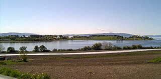
WTautra is an island in the municipality of Frosta in Trøndelag county, Norway. It is located in the Trondheimsfjord, just north of the city of Trondheim. The island is connected to the rest of Frosta by a 2.3-kilometre (1.4 mi) long causeway bridge.
 W
WTyrifjorden is a lake in Norway. It lies 40 kilometres (25 mi) northwest of Oslo and is the nation's fifth largest lake with an area of 139 km2. It has a volume of 13 km3, is 295 meters deep at its deepest, and lies 63 meters above sea level. The lake's primary source is the Begna river, which discharges into Tyrifjorden at Hønefoss where the river forms the waterfall of Hønefossen. Its primary outlet is at Vikersund near the lake's southwest corner, where Tyrifjorden discharges into the Drammenselva river.