 W
WAbtsrodaer Kuppe is a mountain of Hesse, Germany. It is close to the summit of Wasserkuppe and belongs to the Rhön Mountains.
 W
WArnsberg is a mountain in the Bavarian part of the Rhön Mountains, Germany.
 W
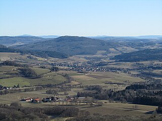
WThe Auersberg is a mountain, 756.9 m above sea level (NN), in the Rhön, that rises immediately north of Hilders. East of the wooded peak lies Simmershausen, a village in the municipality of Hilders, and to the north is Lahrbach, in the municipality of Tann (Rhön). On the southwestern slopes of the mountain are the ruins of Auersburg Castle. Like the western side of the peak these are on the Main-Werra Way, a tourist path managed by the Rhön Club. The Ulster flows past the Auersberg just to the west. The Auersberg near Hilders should not be confused with the Großer and Kleiner Auersberg near Wildflecken in the Bavarian part of the Rhön.
 W
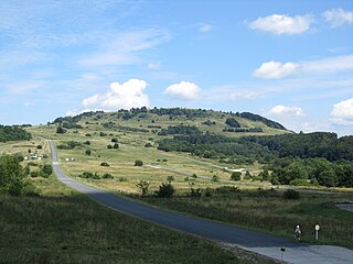
WThe Großer Auersberg is a mountain, 808.6 m above sea level (NN), in the Bavarian part of the Rhön mountains. It is located in an unparished area, 4.68 km² in area, in the county of Bad Kissingen, three kilometres southwest of the village centre of Wildflecken. The Großer Auersberg is covered by dense deciduous forest and lies within the Wildflecken Training Area, established in 1938. The entire terrain is a military out-of-bounds area, which civilians may not enter. A good two kilometres to the west-southwest rises the slightly less high Kleiner Auersberg. Neither should be confused with the Auersberg near Hilders in the Hessian part of the Rhön.
 W
WThe Kleiner Auersberg is a mountain, 808 m above sea level (NN), in the Bavarian part of the Rhön mountains. It is situated five kilometres southwest of the centre of Wildflecken in the county of Bad Kissingen on the watershed between the Sinn and Kleiner Sinn.
 W
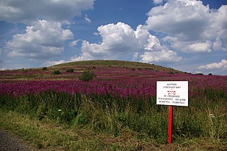
WAt 927.9 m above sea level (NN) the Dammersfeldkuppe in Bavaria is the second highest mountain after the Wasserkuppe in the Rhön, a low mountain range straddling the states of Bavaria, Hesse and Thuringia in Germany.
 W
WThe Dreistelzberg, also called the Dreistelzkopf and frequently shortened to Dreistelz, is a mountain, 660.4 m above sea level (NHN), in the Bavarian part of the Rhön Mountains.
 W
WEbersberg is a mountain of Hesse, Germany.
 W
WThe Ellenbogen is an 814-metre high extinct volcano in the Thuringian Rhön in the district of Landkreis Schmalkalden-Meiningen, Thuringia, Germany.
 W
WThe Feldberg is a hill, 570.2 m above sea level (NHN), in the Bavarian Rhön, northeast of Sandberg and south of the village of Kilianshof. The Feldberg is a southeastern spur of the des Kreuzbergs.
 W
WThe Feldberg is a mountain in the Rhön highlands in the German state of Hesse. It is 815.2 m above sea level (NN).
 W
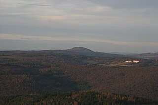
WThe Gebaberg, also called the Hohe Geba or Die Geba, near Geba in the county of Schmalkalden-Meiningen in southern Thuringia, Germany, is 750.7 m above sea level (NHN), and thus the highest point of the Anterior Rhön.
 W
WGroße Haube is a mountain of Bavaria, Germany. It is 658 metres above sea level. The mountain is part of a large, low mountain range located in Bavaria. The name "Große Haube" is German for "large hood".
 W
WThe Großer Nickus is a hill in Hesse, Germany.
 W
WThe Haag is a hill in Hesse, Germany.
 W
WThe Heidelstein, between Bischofsheim an der Rhön in the Bavarian county of Rhön-Grabfeld and Wüstensachsen in the Hessian county of Fulda, is a mountain, 925.7 m above sea level (NHN) high, on the state border in the mountains of the High Rhön, part of the German Central Upland range of Rhön. Its actual summit is in Bavaria. Sometimes its main peak is also called Schwabenhimmel.
 W
WThe Hessian Skittles are a group of nine extinct volcanoes in the northwestern and lowest part of the Rhön Mountains in East Hesse, Germany. This striking collection of domed hills or kuppen is located in the counties of Hersfeld-Rotenburg and Fulda in the northwestern part of the Kuppen Rhön east of Eiterfeld and south of Schenklengsfeld.
 W
WThe Himmeldunkberg or Himmeldunk is a 887.9 m above sea level (NN) m high, extinct volcano in the High Rhön in Germany. It straddles the Bavarian-Hessian state border.
 W
WHohe Hölle is a mountain of Bavaria, Germany.
 W
WThe Hohe Schule, formerly also the Aalhauck, near Völkershausen in the Bavarian county of Rhön-Grabfeld is, at about 538 m above sea level (NHN), the second highest hill in the Eastern Rhön Foreland after the Wurmberg (547.7 m). The area includes ramparts and finds from the Hallstatt culture and the Latene Culture, section of the Landwehr, and the Rhine-Weser Watershed.
 W
WThe Kleiner Nickus is a hill in Hesse, Germany.
 W
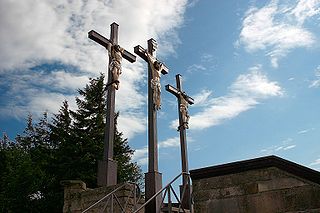
WThe Kreuzberg is one of the Rhön Mountains in southern Germany. With about 928 m (3,045 ft) high it is the highest elevation of the Bavarian part of the Rhön, in the province of Lower Franconia. The Kreuzberg — also referred to as the "sacred mountain of the Franconians" — is near the town of Bischofsheim an der Rhön in the district Rhön-Grabfeld.
 W
WLandecker Berg is a mountain of Hesse, Germany.
 W
WLindenstumpf is a mountain of Bavaria, Germany.
 W
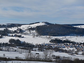
WMathesberg is a mountain of Hesse, located in the Rhön Mountains, Germany.
 W
WMaulkuppe is a mountain of Hesse, Germany.
 W
WThe Mengshäuser Kuppe is a hill in Hesse, Germany.
 W
WMettermich is a mountain of Bavaria, Germany.
 W
WThe Milseburg is an extinct volcano and at 835 metres (2,740 ft) above sea level the second highest elevation in the Hessian part of the Rhön Mountains, Germany. The hill is located east of Fulda, near the villages of Kleinsassen and Danzwiesen. It is a popular destination for hikers and bikers. Scientifically, Milseburg is most notable for the remains of a large Celtic oppidum. It also features several other structures on the peak, including a chapel dedicated to St Gangulphus.
 W
WMittelberg (Rhön) is a mountain of Bavaria, Germany.
 W
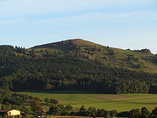
WPferdskopf is a mountain of Hesse, Germany, in the vicinity of the Wasserkuppe in the Rhön Mountains.
 W
WThe Pleß is a mountain, 645.4 m above sea level (NHN), in the county of Schmalkalden-Meiningen in the Salzungen Werra Highland in the German state of Thuringia.
 W
WRother Kuppe is a mountain in Bavaria, Germany.
 W
WSoisberg is a mountain of Hesse, Germany.
 W
WSteinkopf is a mountain of Hesse, Germany.
 W
WSteinwand is a mountain of Hesse, Germany.
 W
WStirnberg is a mountain of Bavaria, Germany.
 W
WStoppelsberg is a mountain of Hesse, Germany.
 W
WThe Stoppelsberg is a hill in Hesse, Germany.
 W
WThe Totnansberg, occasionally also called the Totmannsberg, is the highest peak in the Black Mountains, a subunit of the Rhön in central Germany.
 W
WWachtküppel is a mountain of Hesse, Germany in the vicinity of the Wasserkuppe in the Rhön Mountains.
 W
WThe Wasserkuppe (help·info) is a mountain within the German state of Hesse. It is a large plateau formation at an elevation of 950 metres (3,120 ft) and is the highest peak in the Rhön Mountains. Great advances in sailplane development took place on the mountain during the interwar period, driven by annual contests. Near the summit there is still an airfield used by gliding clubs and pilots of light aircraft.