 W
WAwakeri is a village located southwest of Whakatane in the Bay of Plenty region of New Zealand's North Island. It is located in a farming and fruit-growing area, has basic amenities and a primary school for students aged 5 to 13, and is best known for nearby hot springs.
 W
WHairini is a suburb of Tauranga in the Bay of Plenty region of New Zealand's North Island.
 W
WThe Hawai River is a river of New Zealand. It flows from the Raukumara Range northeast into the Bay of Plenty. The locality of Tōrere is 7 kilometres (4 mi) southwest of the river mouth, and Houpoto is 8 kilometres (5 mi) northeast.
WIwitahi is a rural locality in the Taupo District and Bay of Plenty Region of New Zealand's North Island. It is situated on State Highway 5 between Taupo and Napier, about 20 km southeast of Taupo. It is a farming area, largely surrounded by forest, close to the plains of the upper Rangitaiki River. The locality was formerly known as Iwatahi.
 W
WThe Kaimai Mamaku Conservation Park is a protected area in the North Island of New Zealand. It was formed in 1975 as the Kaimai-Mamaku Forest Park, defined as a Conservation Park in 1987, and renamed in 2009. The park forms a barrier between the Waikato and Bay of Plenty regions, and runs from the Karangahake Gorge in the north, almost to Rotorua in the south. The park covers an area of around 37,000 hectares.
 W
WLake Aroarotamahine, also known as Green Lake, is one of two small crater lakes on Mayor Island / Tuhua in the Bay of Plenty, New Zealand. Its outlet is a wetland leading to the smaller Lake Te Paritu or Black lake.
 W
WLake Matahina is a reservoir in the Bay of Plenty region of New Zealand, located immediately south of the settlement of Te Mahoe and 50 km east of Rotorua. The lake was formed by the construction of the 86 m tall Matahina dam on the Rangitaiki River, which was completed in 1967.
WLake Rerewhakaaitu is a small, shallow lake in northern New Zealand, located 30 kilometres to the east of Rotorua. It is immediately south of the active volcano Mount Tarawera, and the geography was substantially altered by a major eruption in 1886. Often the scene of Dog shows, like those from Rotorua, Agility during Easter, and the rather tedious obedience show in January.
 W
WThe Mangakarengorengo River is a river of the Bay of Plenty Region of New Zealand. It is a tributary of the Wairoa River.
 W
WThe Mangapapa River is a river of the Bay of Plenty Region of New Zealand's North Island. It rises on the north slopes of the Mamaku Plateau at the southern end of the Kaimai Range and meets the Opuiaki River at the head of Lake McLaren, which discharges to the Wairoa River a short distance downstream from the lake at the confluence with the Mangakarengorengo River.
WMatapihi is a suburb and peninsula of Tauranga in the Bay of Plenty region of New Zealand's North Island, surrounded on most sides by the Tauranga Harbour.
WMaungatapu is a suburb and peninsula of Tauranga in the Bay of Plenty region of New Zealand's North Island. It is north-east of Hairini and south-east of Matapihi.
WMinginui is a town in Whakatane District and Bay of Plenty Region on New Zealand's North Island.
 W
WMotu River is a major waterway in the eastern portion of the North Island of New Zealand. It rises on the slopes of Maungahaumi on the southern side of the Raukumara Range south of Opotiki, heads east and cuts its way through the range, where its important tributaries merge with it, and empties into the Bay of Plenty to the north.
 W
WMoturiki Island, known as "Leisure Island" in English, is located just off Mount Maunganui beach. It is connected to the beach by a man made land bridge. NIWA maintains a tide meter on Moturiki Island. Moturiki Island offers rock climbing opportunities.
 W
WMourea is a settlement in Rotorua Lakes within the Bay of Plenty Region of New Zealand's North Island.
WNewdicks Beach is located on the southeastern side of Okurei Point in the Bay of Plenty in the North Island of New Zealand.
 W
WOhinemutu or Ōhinemutu is a suburb in Rotorua, New Zealand. It is a living Māori village and the original settlement of Rotorua
 W
WLake Okataina is the northernmost and largest of four smaller lakes lying between Lake Rotorua and Lake Tarawera in the Bay of Plenty region of New Zealand's North Island. The others are Lake Rotokakahi, Lake Tikitapu, and Lake Okareka. All lie within the Okataina caldera, along its western edge.
 W
WThe Omanawa River is a river of the Bay of Plenty Region of New Zealand's North Island.
WOnepu is a rural community in the Whakatane District and Bay of Plenty Region of the North Island of New Zealand. It is situated between Kawerau and Te Teko along State Highway 34, and lies immediately north-east of the Norske Skog Tasman pulp and paper mill.
 W
WThe Otara River is found in the north of New Zealand's North Island. It flows north for 35 kilometres (22 mi), reaching the sea at Opotiki in the eastern Bay of Plenty. It shares its estuary with the Waioeka River.
WPaengaroa is a village in the Bay of Plenty, New Zealand which lies 11 km from Te Puke, 35 km from Tauranga and 46.2 km from Rotorua.
WParoa is a rural locality situated near Whakatane in the Bay of Plenty region of New Zealand. The small, predominantly Māori community is located along State Highway 30, and contains a school and a sports rugby club.
WPekatahi is a small locality south of Whakatane in the Bay of Plenty region of New Zealand's North Island. The Whakatane River passes through Pekatahi as it flows northwards to its mouth on the Pacific Ocean.
WPikowai is a rural community located near the beach on the shoreline of the Eastern Bay of Plenty in the North Island of New Zealand. Pikowai is located 34 km southeast of Te Puke and 10 kilometres northwest of Matata. It is said to be a place where the Mataatua Canoe made landfall on its journey along the coast from Tauranga. Known for its fishing, the beach itself is well used for surf casting.
 W
WPohutu Geyser is a geyser in the Whakarewarewa Thermal Valley, Rotorua, in the North Island of New Zealand. Pohutu means "big splash" or "explosion".
 W
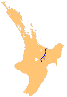
WThe Rangitaiki River is the longest river in the Bay of Plenty region in New Zealand's North Island. It is 155 kilometres (96 mi) long, and rises inland from northern Hawkes Bay to the east of the Kaingaroa Forest. The Rangitaiki catchment covers an area of 3005 km2. It flows in a generally northeastward direction, passing through the town of Murupara and skirting close to the western edge of Te Urewera National Park before turning northwards, flowing past Edgecumbe and into the Bay of Plenty close to Thornton.
 W
WRaukokore is a small settlement close to the East Cape in the northeastern North Island of New Zealand. It is located on State Highway 35, close to the mouth of the Raukokore River, 40 kilometres to the west of Hicks Bay.
 W
WLake Rotoehu is the smallest in a chain of three lakes to the northeast of Lake Rotorua in New Zealand's North Island. It is located between the city of Rotorua and town of Whakatane. The southern end of the lake occupies part of the Okataina caldera. It is fed by Lake Rotoma to the east, and flows westward joining Lake Rotoiti. The lake is one of the least visited, but offers great Kayaking and fishing. It has two access points, Otautu Bay and Kennedy bay and is well located centrally to many other places e.g. the ocean, mountain biking, hiking etc. It has very good wildlife and birdlife with several rarely seen birds. In particular the endangered Kokako is located close by.
 W
WLake Rotokākahi or Green Lake, is one of four small lakes lying between Lake Rotorua and Lake Tarawera in the Bay of Plenty region of New Zealand's North Island. The others are Lake Tikitapu, Lake Okareka, and Lake Okataina. All lie within the Okataina caldera, along its western edge.
 W
WThe Rotorua Caldera, a large rhyolitic caldera, is one of several large volcanoes located in the Taupo Volcanic Zone on the North Island of New Zealand. The caldera's last major eruption, about 240,000 years ago, had a Volcanic Explosivity Index of 7. At this time, the Mamaku ignimbrite, covering about 4,000 km2 (1,500 sq mi), was deposited. After the eruption, the magma chamber underneath the volcano collapsed. The circular depression left behind is the current caldera, about 22 km (14 mi) in diameter and now occupied by Lake Rotorua. Mokoia Island, close to the centre of the lake, is a rhyolite dome. There are other domes like Hinemoa Point, Ngongotahā, Pohaturoa and Pukeroa. The most recent magmatic eruption occurred less than 25,000 years ago, creating some of the smaller lava domes. The major regional settlement of Rotorua is located in the caldera. There is geothermal activity in the town of Rotorua.
 W
WRuatahuna is a town in the northeast of New Zealand's North Island, 90 kilometres west of Gisborne, and 18 kilometres northwest of Lake Waikaremoana. It is situated on the unsealed part of SH38, from Wai-O-Tapu via Murupara to Wairoa.
WRuatoki or 'Rūātoki is a locality in the Bay of Plenty Region of New Zealand. It is located at the base of the Urewera Valley, approximately 20 km south of Whakatāne.
 W
WTaneatua is a small town in the Bay of Plenty region of New Zealand's North Island. The town is located southeast of Pekatahi, a similarly small settlement; Whakatāne is the nearest significantly sized town. Just to the southwest of Taneatua, the Whakatane River and Waimana Rivers meet. The Whakatane River itself flows to the west of Taneatua, while the Waimana River is south of the township.
 W
WTarawera Falls is a 65 m high waterfall on the Tarawera River in the Bay of Plenty region in New Zealand's North Island.
WTe Kaha is a small New Zealand community situated in the Bay of Plenty near Ōpōtiki.
 W
WTe Whaiti or Te Whāiti is a forested area in the Whakatane District and Bay of Plenty Region of New Zealand's North Island. It is located in the Whirinaki River Valley, near Minginui.
WThornton is a settlement in the Bay of Plenty Region of New Zealand. Thornton is located 13 kilometres (8.1 mi) west of Whakatāne, and is on the true right of the Rangitaiki River.
 W
WLake Tikitapu or Blue Lake is the smallest of four small lakes lying between Lake Rotorua and Lake Tarawera in the Bay of Plenty region of New Zealand's North Island. The other three are Lake Rotokakahi, Lake Okareka, and Lake Okataina.
 W
WThe Waioeka River is found in the north of New Zealand's North Island. It flows north for 65 kilometres (40 mi) from Te Urewera National Park to reach the sea at Opotiki. It shares its estuary with the Otara River.
WWelcome Bay is a suburb of Tauranga, New Zealand. In the 2013 census the population of the greater Welcome Bay area was 8670, which includes Kaitemako (1419), Welcome Bay East (3582), and Welcome Bay West (3669). It is located 7 kilometres (4.3 mi) from central Tauranga. Neighbouring suburbs include Hairini and Maungatapu. There are a number of schools in Welcome Bay, including three primary schools.
 W
WWhakatāne Airport is an airport serving the town of Whakatāne, New Zealand, the Eastern Bay of Plenty and the tourist attractions of Mount Tarawera and White Island.
 W
WThe Whakatāne River is a major river of the Bay of Plenty Region in the North Island of New Zealand.