 W
WAreia Branca is a municipality located in the Brazilian state of Sergipe. Its population was 18,329 (2016) and it covers 148.13 km2 (57.19 sq mi). Areia Branca has a population density of 120 inhabitants per square kilometer. It is located 36 km (22 mi) from the state capital of Sergipe, Aracaju. The municipality contains part of the Serra de Itabaiana National Park.
 W
WBrejo Grande is the easternmost municipality in the Brazilian state of Sergipe. Its population was 22,534 (2008) and its area is 149.2 km².
 W
WCanindé de São Francisco is a municipality located in the Brazilian state of Sergipe. Its population was 28,832 (2016) and its area is 902.2 km2 (348.3 sq mi).
 W
WCarira is a municipality located in the Brazilian state of Sergipe. Its population was 21,665 (2016) and its area is 636.5 km2 (245.8 sq mi). Carira has a population density of 34 inhabitants per square kilometer. Carira is located 112 km (70 mi) from the state capital of Sergipe, Aracaju.
 W
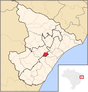
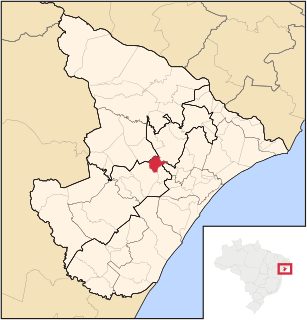
WCarmópolis is a municipality located in the Brazilian state of Sergipe. Its population was 15,952 (2016). Carmópolis covers 45.66 km2 (17.63 sq mi) and has a population density of X inhabitants per square kilometer. It is located 30.6 km (19.0 mi) from the state capital of Sergipe, Aracaju. Carmópolis borders on the municipalities of Japaratuba, Rosário do Catete, General Maynard, and Santo Amaro das Brotas, all in the state of Sergipe.
 W
WCedro de São João is a municipality located in the Brazilian state of Sergipe. Its population was 5,538 (2005) and its area is 80 km².
 W
WCristinápolis is the southernmost municipality in the Brazilian state of Sergipe. Its population was 16,365 in the year 2008, and its area is 251.3 km².
 W
WCumbe is a municipality located in the Brazilian state of Sergipe. Its population was 3,847 (2005) and its area is 129 km².
 W
WEstância is a municipality located in the Brazilian state of Sergipe. Its population is 68,846 (2016). Estância covers 644.5 km2 (248.8 sq mi), and has a population density of 110 inhabitants per square kilometer. It is located 66 km (41 mi) from the state capital of Sergipe, Aracaju. The city is the seat of the Roman Catholic Diocese of Estância.
 W
WFeira Nova is a municipality located in the Brazilian state of Sergipe. Its population was 5,595 in 2016, and its area is 183.3 km2 (70.8 sq mi).
 W
WFrei Paulo is a municipality located in the Brazilian state of Sergipe. Its population was 15,200 (2016). Frei Paulo covers 400.4 km2 (154.6 sq mi), and has a population density of 38 inhabitants per square kilometer.
 W
WGararu is a municipality located in the Brazilian state of Sergipe. Its population was 11,730 (2016), covers 654.4 km2 (252.7 sq mi), and has a population density of 18 inhabitants per square kilometer.
 W
WGeneral Maynard is a municipality located in the Brazilian state of Sergipe. Its population was 2,558 (2005) and its area is 20 km².
 W
WGracho Cardoso is a municipality located in the Brazilian state of Sergipe. It covers 242.5 km2 (93.6 sq mi), and has a population of 5,859 with a population density of 24 inhabitants per square kilometer.
 W
WIlha das Flores is a municipality in the state of Sergipe (SE) in Brazil. The population is 8,597 in an area of 54.64 km2 (21.10 sq mi). The elevation is 3 m (9.8 ft).
 W
WItabaiana is a municipality located in the Brazilian state of Sergipe. Its population was 91,873 (2013) and its area is 336.685 km².
 W
WItabaianinha is a municipality located in the Brazilian state of Sergipe. Its population was 38,886 (2012) and its area is 493 km².
 W
WItabi is a municipality located in the Brazilian state of Sergipe. In 2016, its population was 5,002. Its area is 184.4 km2 (71.2 sq mi) and has a population density of 27 inhabitants per square kilometer.
 W
WJaparatuba is a municipality located in the Brazilian state of Sergipe. Its population was 15,528 (2005) and its area is 360 km².
 W
WJapoatã is a municipality located in the Brazilian state of Sergipe. Its population was 14,568 (2005) and its area is 420 km².
 W
WLagarto is a municipality located in the Brazilian state of Sergipe. Its population is greater than 103,576 inhabitants and its area is 969 km².
 W
WLaranjeiras is a municipality located in the Brazilian state of Sergipe. Its population was 29,418 (2016) and covers 162.27 km2 (62.65 sq mi). Laranjeiras has a population density of 180 inhabitants per square kilometer. Laranjeiras is located 19 km (12 mi) from the state capital of Sergipe, Aracaju. It borders the municipalities of Riachuelo, Areia Branca, Nossa Senhora do Socorro, São Cristóvão, Maruim, and Santo Amaro das Brotas, all within the state of Sergipe. The municipality contains part of the Serra de Itabaiana National Park.
 W
WMalhador is a municipality located in the Brazilian state of Sergipe. It is a little city in a rural area. It is located near Itabaiana. Its population was 12,598 (2015) and its area is 101 km².
 W
WMaruim is a municipality located in the Brazilian state of Sergipe. Its population was 17,225 (2016) and covers 95.55 km2 (36.89 sq mi). Maruim has a population density of 180 inhabitants per square kilometer. It is located 30 km (19 mi) from the state capital of Sergipe, Aracaju. Maruim borders the municipalities of Laranjeiras, Rosário do Catete, and Santo Amaro das Brotas, all within the state of Sergipe.
 W
WMoita Bonita is a municipality located in the Brazilian state of Sergipe. Its population was 11,416 (2016) and covers 96.53 km2 (37.27 sq mi). Moita Bonita has a population density of 120 inhabitants per square kilometer. Moita Bonita is located 64 km (40 mi) from the state capital of Sergipe, Aracaju. Riachuelo borders the municipalities of Itabaiana, Ribeirópolis, Nossa Senhora das Dores, Santa Rosa de Lima, and Malhador, all within the state of Sergipe.
 W
WMonte Alegre de Sergipe is a municipality located in the Brazilian state of Sergipe. Its population was 15,017 (2016). Monte Alegre de Sergipe covers 407 km2 (157 sq mi) with a population density of 37 inhabitants per square kilometer.
WNossa Senhora Aparecida is a municipality located in the Brazilian state of Sergipe. Its population was 8,850 (2016) and its area is 341 km2 (132 sq mi). Nossa Senhora Aparecida has a population density of 26 inhabitants per square kilometer. It is located 99.1 km (61.6 mi) from the state capital of Sergipe, Aracaju.
WNossa Senhora da Glória is a municipality located in the Brazilian state of Sergipe. Its population was 36,174 (2016) and its area is 757.45 km2 (292.45 sq mi). It has a population density of 48 inhabitants per square kilometer. Nossa Senhora da Glória is located 126 km2 (49 sq mi) from the state capital of Sergipe, Aracaju.
 W
WNossa Senhora do Socorro is a municipality located in the Brazilian state of Sergipe. Its population was 179,661 (2016) and its area is 155.02 km2 (59.85 sq mi). Nossa Senhora do Socorro is located 36 km (22 mi) from the state capital of Sergipe, Aracaju.
WPedrinhas is a municipality in the state of Sergipe in Brazil. Its area is 33.144 km2 (12.797 sq mi), and its population is 9,538 inhabitants. It has an elevation of 165 m.
 W
WPinhão is a municipality located in the Brazilian state of Sergipe. Its population was 6,499 (2013) and its area is 156.1 km2 (60.3 sq mi). Pinhão has a population density of 42 inhabitants per square kilometer. Pinhão is located 80.7 km (50.1 mi) from the state capital of Sergipe, Aracaju.
WPirambu is a municipality located in the Brazilian state of Sergipe. Its population was 8,769 (2005) and its area is 218 km².
 W
WPoço Redondo is a municipality located in the Brazilian state of Sergipe. Its population is 31,614 (2012) and its area is 1,212 km², which makes it the largest municipality in that state.
WPoço Verde is the westernmost municipality in the Brazilian state of Sergipe. Its population was 21,721 as of 2008 and its area is 431 square kilometers.
 W
WPorto da Folha is a municipality located in the Brazilian state of Sergipe. It has a population of 28,615 (2015) and cover 876.67 km2 (338.48 sq mi). Porto da Folha has a population density of 33 inhabitants per square kilometer. It is located 165 km (103 mi) from the state capital of Sergipe, Aracaju.
 W
WThe Poxim River is a river of Sergipe state in northeastern Brazil. The river runs through the sertão region of Sergipe. Its upper reaches are occupied by sugarcane farms (50%) and pastures (35%) and its mouth by an industrial zone. Almost all vegetation in the basin of the river and its tributaries has been removed, resulting in little diversity of flora and fauna in the region.
 W
WPropriá is a municipality located in the Brazilian state of Sergipe. Its population was 28,822 (2005) and its area is 95 km².
 W
WThe Real River or Rio Real is a river in Brazil. It forms the border between the states of Sergipe to its north and Bahia to its south. It gave its name to the nearby municipality of Rio Real, Brazil.
WRiachuelo is a municipality located in the Brazilian state of Sergipe. Its population was 10,116 (2016) and covers 78.31 km2 (30.24 sq mi). Riachuelo has a population density of 130 inhabitants per square kilometer. Riachuelo is located 23 km (14 mi) from the state capital of Sergipe, Aracaju. Riachuelo borders the municipalities of Laranjeiras, Divina Pastora, Santa Rosa de Lima, and Areia Branca, all within the state of Sergipe. The municipality is site of the Nossa Senhora da Penha Sugar Plantation and the Chapel of the Nossa Senhora da Penha Sugar Plantation. The chapel was listed as a historic structure by National Institute of Historic and Artistic Heritage (IPHAN) in 1943, but has fallen into an advanced state of neglect and decay and is considered abandoned.
 W
WSalgado is a municipality located in the Brazilian state of Sergipe. It has an area of 248 km2 (96 sq mi) and an estimated population of 20,000 (2018).
 W
WThe Sergipe River is a river of Sergipe state in northeastern Brazil.
 W
WTobias Barreto is a municipality located in the Brazilian state of Sergipe. Its population is 46,677 (2005) and its area is 1,033 km².
WTomar do Geru is a municipality located in the Brazilian state of Sergipe. Its population was 13,204 (2016) and it covers 305 km2 (118 sq mi). Tomar do Geru has a population density of 43 inhabitants per square kilometer. It is located 131 km (81 mi) from the state capital of Sergipe, Aracaju. The Church of Nossa Senhora do Socorro was built by the Society of Jesus in 1688. It was listed as a historic structure by the Brazilian National Institute of Historic and Artistic Heritage (IPHAN) in 1943.
 W
WUmbaúba is a municipality located in the Brazilian state of Sergipe. Its population was 24,832 (2016). Umbaúba covers 118.86 km2 (45.89 sq mi) and has a population density of 210 inhabitants per square kilometer. The municipality is located 95 km (59 mi) from the state capital of Sergipe, Aracaju.
 W
WThe Vaza-Barris River is a river in northeastern Brazil. The Vaza-Barris originates in northeastern Bahia state, and flows east through Bahia and Sergipe states to empty into the Atlantic Ocean near São Cristóvão.