 W
WThe geology of Scotland is unusually varied for a country of its size, with a large number of differing geological features. There are three main geographical sub-divisions: the Highlands and Islands is a diverse area which lies to the north and west of the Highland Boundary Fault; the Central Lowlands is a rift valley mainly comprising Palaeozoic formations; and the Southern Uplands, which lie south of the Southern Uplands Fault, are largely composed of Silurian deposits.
 W
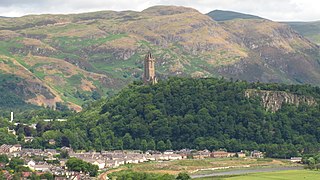
WThe Abbey Craig is the hill upon which the Wallace Monument stands, at Causewayhead, just to the north of Stirling, Scotland.
 W
WThe Ardvreck Group is a stratigraphic group of early Cambrian age found in the Northwest Highlands of Scotland. It lies unconformably on gneisses of the Lewisian complex or sandstones of the Torridonian Supergroup. It consists of two formations, the basal quartzites and quartz arenites of the Eriboll Formation and the overlying dolomitic siltstones and sandstones and quartz arenites of the An-t-Sron Formation. It is overlain conformably by the Ghrudaidh Formation of the Durness Group. The Ardvreck Group was at one time known as the "Eriboll Group".
 W
WThe Argyll Group is a thick sequence of metamorphosed Neoproterozoic sedimentary rocks that outcrop across the Central Highlands of Scotland, east of the Great Glen, as well as appearing in the north of Ireland. It is a subdivision of the Dalradian Supergroup and is itself divided into four units; from oldest to youngest these are the Islay, Easdale, Crinan and Tayvallich subgroups.
 W
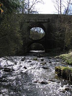
WThe Bannock Burn is a stream which rises at about 1,300 feet on Touchadam Moor, NS715891, just to the north of Earl's Hill in the Touch Hills to the south-west of Stirling in central Scotland. The Bannock flows eastward and enters the River Forth to the east of Stirling, close to the site of the Battle of Bannockburn (1314), about 7.58 miles from its source. The burn itself meanders and is considerably longer. A nearby town, nowadays a suburb of Stirling, is accordingly called Bannockburn.
 W
WThe Barra Fan and Hebrides Terrace Seamount is the name given to a Nature Conservation Marine Protected Area that lies in Scottish waters to the west of the Outer Hebrides, adjacent to the boundary with Ireland. It covers two distinct geological features of the North Atlantic Ocean: the Barra Fan and the Hebrides Terrace Seamount.
 W
WBlack Rock Gorge is a deep and narrow cleft in Old Red Sandstone conglomerate through which the Allt Graad flows in Easter Ross, Scotland. It was caused by rapids heavily burdened with sediment being carried upwards as part of the great Post-glacial rebound.
 W
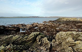
WThe Bowmore Sandstone Group is a sequence of metasedimentary rocks, dominantly sandstones, of probable Neoproterozoic age. Their outcrop on the island of Islay in the Inner Hebrides is entirely fault-bounded, between the Loch Gruinart Fault to the west and the Loch Skerrols Shear Zone to the east.
 W
WThe Central Lowlands, sometimes called the Midland Valley or Central Valley, is a geologically defined area of relatively low-lying land in southern Scotland. It consists of a rift valley between the Highland Boundary Fault to the north and the Southern Uplands Fault to the south. The Central Lowlands are one of the three main geographical sub-divisions of Scotland, the other two being the Highlands and Islands which lie to the north, northwest and the Southern Uplands, which lie south of the associated second fault line.
 W
WThe Colonsay Group is an estimated 5,000 m thick sequence of mildly metamorphosed Neoproterozoic sedimentary rocks that outcrop on the islands of Colonsay, Islay and Oronsay and the surrounding seabed. They have been correlated with the Grampian Group, the oldest part of the Dalradian Supergroup.
 W
WThe Cullaidh Shale Formation is a geological formation in Scotland, and the lowermost unit of the Great Estuarine Group. It is Bajocian in age. The lithlology largely consists of organic rich mudstone and shales, including oil shale developed near the base.
 W
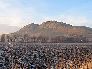
WDumyat or Dunmyat is a hill at the western extremity of the Ochil Hills in central Scotland. The name is thought to originate from Dun of the Maeatae.
 W
WDynamic Earth is a not-for-profit visitor attraction and science centre in Edinburgh and is Scotland's largest interactive visitor attraction. It is located in the Holyrood area, beside the Scottish Parliament building and at the foot of Salisbury Crags. It is a registered charity under Scottish law and is owned as The Dynamic Earth Charitable Trust. The centre was opened by Queen Elizabeth II in 1999.
 W
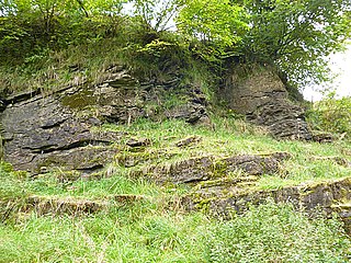
WEast Kirkton Quarry is a former limestone quarry in West Lothian, Scotland, now better known as a fossil site known for terrestrial fossils from the fossil-poor Romer's gap, a 15 million year period at the beginning of the Carboniferous. The rocks and fossils are of Visean age, about 335 million years old. Best known are the labyrinthodont fossils, as the period coincides with the time where the modern lineages of tetrapods are thought to have evolved.
 W
WThe Elgol Sandstone Formation is a geological formation in Scotland, part of the Great Estuarine Group. It spans the transition between the Bajocian and Bathonian stages of the Middle Jurassic. The lithology consists of clay rich sandstone interbedded with silty fissile mudstone.
 W
WThe Faroe-Shetland Channel is stretch of the North Atlantic lying between the two island groups of Shetland and the Faroe Islands. The channel is a rift basin that separates the Scottish and the Faroese continental shelves, and has a maximum depth of 1900 m, compared to the surrounding seabed which mostly lies at 200 m. It was first noted by Charles Wyville Thomson during the mid-nineteenth century.
 W
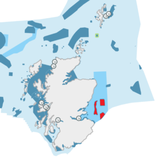
WThe name Firth of Forth Banks Complex refers to a complex of sand and gravel sea banks in the North Sea, lying at the mouth of the Firth of Forth in the seas off the east coast of Scotland. From south to north the banks are named the Berwick Bank, the Scalp Bank, the Wee Bankie and the Montrose Bank. Since 2014 the banks have been protected as a single Nature Conservation Marine Protected Area, which comprises three discrete zones covering a total area of 213,000 hectares (2,130 km2) of Scottish Offshore Waters.
 W
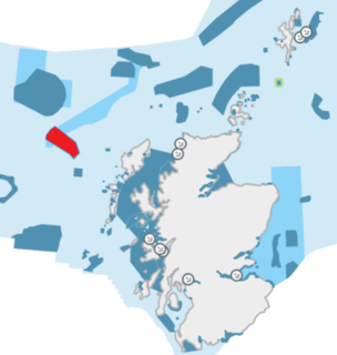
WThe Geikie Slide is a submarine landslide on the seabed of the North Atlantic Ocean to the northwest of Scotland. The slide occurs in a region known as the Hebridean Slope, the continental slope where the seabed drops from the continental shelf surrounding Britain into the deep ocean. Since 2014 an area of 2,215 square kilometres (855 sq mi) has been designated as a Nature Conservation Marine Protected Area under the name Geikie Slide and Hebridean Slope MPA.
 W
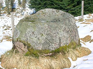
WThe name gowk stane has been applied to certain standing stones and glacial erratics in Scotland, often found in prominent geographical situations. Other spelling variants, such as gowke, gouk, gouke, goilk, goik, gok, goke, gook are found.
 W
WVariations in the strength of gravity occur from place to place according to the density distribution of the rocks beneath the surface. Such gravity anomalies have been mapped across the British Isles and adjacent areas and they reveal aspects of these islands’ geological structure.
 W
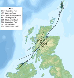
WThe Great Glen Fault is a long strike-slip fault that runs through its namesake the Great Glen in Scotland.
 W
WOf the many unconformities (gaps) observed in geological strata, the term Great Unconformity is frequently applied to either the unconformity observed by James Hutton in 1787 at Siccar Point in Scotland, or that observed by John Wesley Powell in the Grand Canyon in 1869. Both instances are exceptional examples of where the contacts between sedimentary strata and either sedimentary or crystalline strata of greatly different ages, origins, and structure represent periods of geologic time sufficiently long to raise great mountains and then erode them away.
 W
WThe Heart Stone or Clach Cridhe in Perth and Kinross, Scotland is an ancient landmark on Rannoch Moor situated on the old 'Road to the Isles'. During the construction of the B846 road from Kinloch Rannoch to Rannoch railway station it was seen as an obstacle and was drilled and split and later it was moved to its present location in the 1950s to prevent it being submerged in the artificially enlarged Loch Eigheach Gaur Reservoir. The stone now stands beside the B846 road from the station to Kinloch Rannoch.
 W
WThe Hebridean Terrane is one of the terranes that form part of the Caledonian orogenic belt in northwest Scotland. Its boundary with the neighbouring Northern Highland Terrane is formed by the Moine Thrust Belt. The basement is formed by Archaean and Paleoproterozoic gneisses of the Lewisian complex, unconformably overlain by the Neoproterozoic Torridonian sediments, which in turn are unconformably overlain by a sequence of Cambro–Ordovician sediments. It formed part of the Laurentian foreland during the Caledonian continental collision.
 W
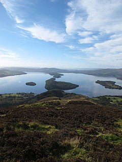
WThe Highland Boundary Fault is a major fault zone that traverses Scotland from Arran and Helensburgh on the west coast to Stonehaven in the east. It separates two different geological terranes which give rise to two distinct physiographic terrains: the Highlands and the Lowlands, and in most places it is recognisable as a change in topography. Where rivers cross the fault, they often pass through gorges, and the associated waterfalls can be a barrier to salmon migration.
 W
WInchnadamph is a hamlet in Assynt, Sutherland, Scotland. The name is an anglicisation of the Gaelic name Innis nan Damh meaning 'meadow of the stags'. Assynt is a remote area with a low population density and Inchnadamph contains a few houses, a lodge and a hotel.
 W
WIn geology, the Inner Hebrides Group is a lithostratigraphical division containing a range of rocks mainly of Upper Cretaceous age which occur around the west coast of the Scottish Highlands. It comprises the following formations:Beinn Iadain Mudstone Formation Strathaird Limestone Formation Feorlin Sandstone Formation Griburn Chalk Formation Coire Riabhach Phosphatic Formation Lochaline White Sandstone Formation Morvern Greensand Formation
 W
WThe Kinnesswood Formation is a geological formation in the Central Lowlands of Scotland. The lithology largely consists of sandstone with interbeds of limestone and siltstone
 W
WThe Lairg gravity low is a possible impact crater in Scotland about 40 kilometres in diameter, with a centre near the town of Lairg in the Scottish Highlands. Its identity as an impact crater is suspected due to the impact deposits present in the Stac Fada Member 50 km to the west. However, this has been disputed, with other studies suggesting that an impact in The Minch is more likely.
 W
WThe Lewisian complex or Lewisian gneiss is a suite of Precambrian metamorphic rocks that outcrop in the northwestern part of Scotland, forming part of the Hebridean Terrane and the North Atlantic Craton. These rocks are of Archaean and Paleoproterozoic age, ranging from 3.0–1.7 billion years (Ga). They form the basement on which the Torridonian and Moine Supergroup sediments were deposited. The Lewisian consists mainly of granitic gneisses with a minor amount of supracrustal rocks. Rocks of the Lewisian complex were caught up in the Caledonian orogeny, appearing in the hanging walls of many of the thrust faults formed during the late stages of this tectonic event.
 W
WThe Moffat Hills are a range of hills in the Southern Uplands of Scotland. They form a roughly triangular shape with a west facing side, a north facing side, and a south-east facing side. It is 17 kilometres from east to west across this triangle and some 16 kilometres north to south. The highest point is White Coomb at 821 m (2694 ft). The town of Moffat lies just south of the Moffat hills and along with Tweedsmuir, at the northern extremity, is the only centre of population around these hills. In some older maps, the northern part of the Moffat Hills is called the Tweedsmuir Hills, but can also be known by the title Manor Hills.
 W
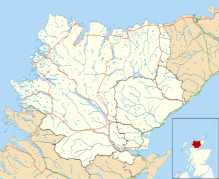
WThe Moine Thrust Belt or Moine Thrust Zone is a linear tectonic feature in the Scottish Highlands which runs from Loch Eriboll on the north coast 190 kilometres (120 mi) south-west to the Sleat peninsula on the Isle of Skye. The thrust belt consists of a series of thrust faults that branch off the Moine Thrust itself. Topographically, the belt marks a change from rugged, terraced mountains with steep sides sculptured from weathered igneous, sedimentary and metamorphic rocks in the west to an extensive landscape of rolling hills over a metamorphic rock base to the east. Mountains within the belt display complexly folded and faulted layers and the width of the main part of the zone varies up to 10 kilometres (6.2 mi), although it is significantly wider on Skye.
 W
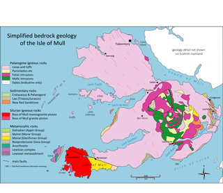
WThe geology of the Isle of Mull in Scotland is dominated by the development during the early Palaeogene period of a ‘volcanic central complex’ associated with the opening of the Atlantic Ocean. The bedrock of the larger part of the island is formed by basalt lava flows ascribed to the Mull Lava Group erupted onto a succession of Mesozoic sedimentary rocks during the Palaeocene epoch. Precambrian and Palaeozoic rocks occur at the island's margins. A number of distinct deposits and features such as raised beaches were formed during the Quaternary period.
 W
WMyreton Hill is a peak near the village of Menstrie in the Ochil Hills of Scotland.
 W
WThe North West Highlands Geopark is a geopark in the Scottish Highlands. Awarded UNESCO geopark status in 2004, it was Scotland's first geopark, featuring some of the oldest rocks in Europe, around 3,000 million years old. The park contains many notable geological features, such as the Moine Thrust Belt and Smoo Cave and covers an area of around 2,000 square kilometres (770 sq mi).
 W
WThe Ochil Fault is the geological feature which defines the southern edge of the Ochil Hills escarpment in Scotland.
 W
WThe geology of the Orkney islands in northern Scotland is dominated by the Devonian age Old Red Sandstone (ORS). In the southwestern part of Mainland, this sequence can be seen to rest unconformably on a Moinian type metamorphic basement.
 W
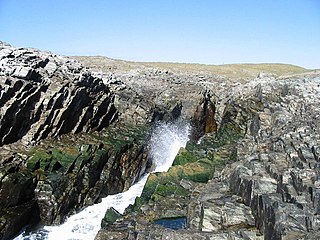
WPitchstone is a dull black glassy volcanic rock formed when felsic lava or magma cools quickly. It is similar to obsidian but is defined by the International Union of Geological Sciences as having a higher water content. It is a volcanic glass; however, unlike a glass, pitchstone has an irregular hackly fracture not a conchoidal fracture. That is due to its coarser crystal structure. Pitchstone has a resinous lustre, or silky in some cases, and a variable composition. Its colour may be mottled, streaked, or uniform brown, red, green, gray, or black. It is an extrusive rock that is very resistant to erosion.
 W
WThe Rhinns complex is a deformed Palaeoproterozoic igneous complex that is considered to form the basement to the Colonsay Group of metasedimentary rocks. The largest outcrop of the complex is on the Rhinns of Islay, from where the complex gets its name. It has also been recognised in three other inliers extending to the southwest as far as Inishtrahull, off the north coast of Donegal.
 W
WThe Rockall Trough is a deep-water bathymetric feature to the northwest of Scotland and Ireland, running roughly from southwest to northeast, flanked on the north by the Rockall Plateau and to the south by the Porcupine Seabight. At the northern end, the channel is bounded by the Wyville-Thomson Ridge, named after Charles Wyville Thomson, professor of zoology at the University of Edinburgh and driving force behind the Challenger Expedition. At the southern end, the trough opens into the Porcupine abyssal plain. The Rockall Basin is a large sedimentary basin that lies beneath the trough. Both are named after Rockall, a rocky islet lying 301.4 km west of St Kilda.
 W
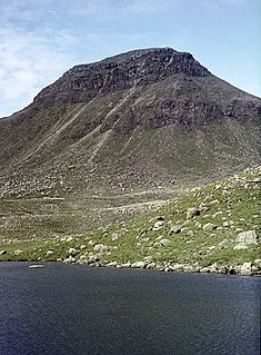
WThe Rum layered intrusion is located in Scotland, on the island of Rùm. It is a mass of intrusive rock, of mafic-ultramafic composition, the remains of the eroded, solidified magma chamber of an extinct volcano that was active during the Palaeogene Period. It is associated with the nearby Skye intrusion and Skye, Mull and Egg lavas. It was emplaced 60 million years ago above the Iceland hotspot.
 W
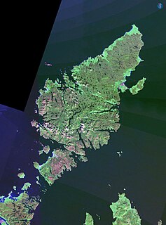
WThe Shiant Islands or Shiant Isles are a privately owned island group in the Minch, east of Harris in the Outer Hebrides of Scotland. They are five miles southeast of the Isle of Lewis.
 W
WSiccar Point is a rocky promontory in the county of Berwickshire on the east coast of Scotland. It is famous in the history of geology for Hutton's Unconformity found in 1788, which James Hutton regarded as conclusive proof of his uniformitarian theory of geological development.
 W
WThe Silver Glen lies approximately 1 kilometre (0.62 mi) to the east of the town of Alva, Clackmannanshire, Scotland, and takes its name from the silver that was mined there in the early 18th century. The deposit, the richest deposit of native silver ever found in the British Isles, was discovered just as the Jacobite rising of 1715 was breaking out, and its owner, Sir John Erskine, left to join the rebels, leaving his wife in charge of the mine. Some 40 tons of ore were raised and buried in barrels in the grounds of Alva House at the foot of the Ochil Hills, about 10 kilometers east of Stirling, whilst the richest of the ore was smelted and the ingots concealed under floorboards inside the house. The mine was then filled in during the aftermath of the failed rising, but its existence was revealed to the government by an employee of the Erskines. Samples of the ore were analysed by Sir Isaac Newton and found to be very rich. Sir John was later able to secure a pardon for his role in the rising, on condition he revealed all he knew about the mine, and gave a tenth of the proceeds to the government. Mining resumed a few years later and the remainder of the deposit was extracted. Later, in 1759, a vein carrying erythrite, an ore of cobalt, was found and gave a new lease of life to the mines, but it was soon exhausted.
 W
WThe geology of the Isle of Skye in Scotland is highly varied and the island's landscape reflects changes in the underlying nature of the rocks. A wide range of rock types are exposed on the island, sedimentary, metamorphic and igneous, ranging in age from the Archaean through to the Quaternary.
 W
WThe Southern Highland Group is a sequence of metamorphosed Neoproterozoic sedimentary rocks that outcrop across the Central Highlands of Scotland, east of the Great Glen. It forms the uppermost/youngest part of the Dalradian Supergroup and is divided into two formations. Volcanism is recorded by the Loch Avich Lavas Formation which divides the Loch Avich Grits Formation into lower and upper parts – the grits are turbidite and submarine fan deposits. In Perthshire and on Deeside, the Leny Limestone, which has been dated to 514 Ma, is present. A tillite, the Macduff Boulder Bed is known from the upper part of the group in northeast Scotland.
 W
WThe Southern Uplands are the southernmost and least populous of mainland Scotland's three major geographic areas. The term is used both to describe the geographical region and to collectively denote the various ranges of hills and mountains within this region. An overwhelmingly rural and agricultural region, the Southern Uplands are partly forested and contain many areas of open moorland.
 W
WThe Southern Uplands Fault is a fault in Scotland that runs from Girvan to Dunbar on the East coast. It marks the southern boundary of the Scottish Midland Valley and the northern margin of the Southern Uplands; indeed it is recognised as a boundary between these two terranes. Both sinistral and dextral strike-slip movement is recorded from parts of the fault as are down-north and down-south normal movements suggestive of a complex history.
 W
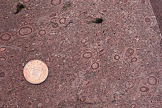
WThe Stac Fada Member is a distinctive layer towards the top of the Mesoproterozoic Bay of Stoer Formation, part of the Stoer Group in northwest Scotland. This rock unit is generally 10 to 15 metres thick and is made of sandstone that contains accretionary lapilli and many dark green glassy fragments of mafic composition.
 W
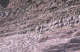
WStrontianite (SrCO3) is an important raw material for the extraction of strontium. It is a rare carbonate mineral and one of only a few strontium minerals. It is a member of the aragonite group.
 W
WIn geology, the term Torridonian is the informal name for the Torridonian Group, a series of Mesoproterozoic to Neoproterozoic arenaceous and argillaceous sedimentary rocks, which occur extensively in the Northwest Highlands of Scotland. The strata of the Torridonian Group are particularly well exposed in the district of upper Loch Torridon, a circumstance which suggested the name Torridon Sandstone, first applied to these rocks by James Nicol. Stratigraphically, they lie unconformably on gneisses of the Lewisian complex and their outcrop extent is restricted to the Hebridean Terrane.
 W
WThe Turbot Bank is a shelf bank and mound feature of the seabed of the North Sea that lies off the east coast of Scotland, about 44 kilometres (27 mi) east of Peterhead. The depth of water above the bank varies from 60 m below sea level on top of the bank down to 80 m at its margins. It has been designated as a Nature Conservation Marine Protected Area since 2014.