 W
WThe A Shau Valley is a valley in Vietnam's Thừa Thiên-Huế Province, west of the coastal city of Huế, along the border of Laos. The valley runs north and south for 40 kilometers and is a 1.5- kilometer-wide flat bottomland covered with tall elephant grass, flanked by two densely forested mountain ridges whose summits vary in elevation from 900 to 1,800 meters. A Shau Valley was one of the key entry points into South Vietnam for men and material brought along the Ho Chi Minh trail by the North Vietnamese Army and was the scene of heavy fighting during the Vietnam War. The A Shau Valley is bisected lengthwise by Route 548. The Ho Chi Minh Highway now runs along the valley floor.
 W
WBa Bể Lake is the largest natural lake in Vietnam. It is located in Nam Mẫu commune, Ba Bể district, Bắc Kạn Province in the Northeast region of the country.
 W
WBa Đình Square is the name of a square in Hanoi where president Ho Chi Minh read the Proclamation of Independence of the Democratic Republic of Vietnam on September 2, 1945. It is named after the Ba Đình Uprising, an anti-French rebellion that occurred in Vietnam in 1886–1887 as part of the Cần Vương movement. When Ho Chi Minh died, the granite Ho Chi Minh Mausoleum was built here to display his embalmed body. It remains a major site of tourism and pilgrimage.
 W
WBác Ái is a district (huyện) of Ninh Thuận Province in southeastern Vietnam.
 W
WBiên Hòa listen) is a former province of South Vietnam originally formed in 1832 containing areas of Đồng Nai Province, Bà Rịa–Vũng Tàu Province and Bình Phước Province with total area of over 17.000 km².
 W
WThe Binh Quoi Tourist Village is a tourist attraction in the Bình Thạnh District of Ho Chi Minh City, in southern Vietnam.
 W
WCà Mau Peninsula makes up the southern tip of Vietnam. It is in Cà Mau Province, and lies between the Gulf of Thailand to the west and the South China Sea to the east.
 W
WCape Cà Mau on Cà Mau Peninsula in Vietnam, is the southernmost point of the Vietnamese mainland.
 W
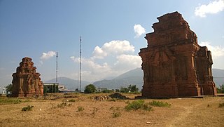
WCát Tiên archaeological site or Cát Tiên Sanctuary is an archaeological site located between the two sectors of Cát Tiên National Park. Accidentally discovered in 1985, this site ranges from Quảng Ngãi Commune to Đức Phổ Commune, with the main archaeological artefacts concentrating in Quảng Ngãi, Cát Tiên District, Lâm Đồng Province, southern Central Highlands. The unknown civilization which developed this site inhabited it between the 4th century and 9th centuries AD.
WChan May Port is located in the south-east corner of Thừa Thiên–Huế Province, Vietnam. It is operated by the Management Board of Chan May-Lang Co Economics Zone. Ownership of the Chan May Port may be assumed by the Vinashin Group in early 2008.
 W
WThe Đà Lạt Plateau is a plateau in southeastern Vietnam.
 W
WThe Dinh Hills are hills that are located to the north west of Bà Rịa, in the Bà Rịa–Vũng Tàu Province, Vietnam.
 W
WDương Tơ is a commune of Phú Quốc, Kien Giang, Vietnam. With an area of 80.4 km², the population in 1999 was 5919 people, with a population density of 74 persons per km².
 W
WGia Lai is a province in the Central Highlands of Vietnam. It is the second-largest province of Vietnam. The name comes from the Jarai people, one of the local indigenous groups.
 W
WThe Gulf of Tonkin is a medium-sized gulf at the northwestern portion of the South China Sea, located off the coasts of northern Vietnam and South China. It is defined in the west and northwest by the northern coastline of Vietnam down to the Hòn La Island, in the north by China's Guangxi Zhuang Autonomous Region, and to the east by the Leizhou Peninsula and Hainan Island.
 W
WHát Dịch secret zone was an area within South Vietnam. It covered the area where the borders of Phước Tuy, Long Khánh and Biên Hòa Provinces met.
WHậu Nghĩa is former province of South Vietnam, that lay to the west of Saigon and bordered on Cambodia. It was formed on October 15, 1963 by separating land from provinces Long An, Bình Dương and Tây Ninh. Its capital city was Khiêm Cường. It had 4 districts: Củ Chi, Đức Hòa, Đức Huệ and Trảng Bàng.
 W
WThe Ho Chi Minh City–Trung Luong Expressway, is a 61.9-kilometre-long (38.5 mi) highway in Vietnam. This six-lane expressway opened on February 3, 2010, connecting Ho Chi Minh City with Tiền Giang Province and the rest of Mekong Delta. The expressway starts at Tan Tao Interchange, Bình Chánh District, Ho Chi Minh City and ends at Than Cuu Nghia Intersection, Châu Thành District, Tiền Giang.There are four entrances to the expressway. The fastest allowed speed is 120 kilometres per hour (75 mph) and the slowest is 60 kilometres per hour (37 mph).
WThe Ho Chi Minh City–Long Thanh–Dau Giay Expressway is a 55-kilometre-long (34 mi) highway in Vietnam. This expressway opened in February 2015, connects Ho Chi Minh City with Thong Nhat, Dong Nai. The estimated investment capital is around 18,000 billion VND. The expressway starts at An Phu Intersection, District 2, Ho Chi Minh City and ends at Dau Giay Interchange, Thong Nhat, Dong Nai. At Dau Giay, it ends at a partially completed cloverleaf interchange with the north-south highway. From here, the planned Dau Giay-Dalat Expressway will start. The North-South Expressway is planned to branch of eastbound in the direction of Phan Thiet.
 W
WIa H'Drai is a district in Kon Tum Province, Vietnam.
 W
WThe Mnong or Munong are an ethnic group from Vietnam and Cambodia.
 W
WMount Mẫu Sơn is a mountain in Lộc Bình District, Lạng Sơn Province, in northeastern Vietnam. It is located about 170 km northeast of the Hanoi and about 30 km east of Lạng Sơn City close to the international border between Vietnam and China. The highest peak of Mount Mẫu Sơn reaches about 1,600 m above sea level.
 W
WMường Ảng is a district (huyện) of Điện Biên Province in the Northwest region of Vietnam.
 W
WMường Lay is a town of Điện Biên Province in the Northwest region of Vietnam.
 W
WNational Route 8 is a highway in Hà Tĩnh Province in North Central of Vietnam, which is managed and maintained by the central government. The route includes two segments. The 85.3 km-long segment from Hồng Lĩnh Township across Đức Thọ and Hương Sơn districts is called National Route 8A. There are 36 bridges in this route in which the two longest are Linh Cảm and Hà Tân bridges. National Route 8A crosses Annamite Range and connects to National Route 1A, Ho Chi Minh Highway and Lao National Route 8.
 W
WNational Route 13 is a highway in southern Vietnam stretching from the northeastern outskirts of Ho Chi Minh City, the commercial centre of the country, towards the border to Cambodia. The highway starts around Thủ Đức on the northern outskirts of Ho Chi Minh City, once the site of the military academy of the Army of the Republic of Vietnam, and travels north through the provinces of Bình Dương and Bình Phước. The highway passes through the districts of Thuận An, Thủ Dầu Một town, Bến Cát, Chơn Thành, Đồng Phú, Bình Long, and Lộc Ninh.
 W
WNational Route 20 is a highway in southern and central Vietnam connecting Dau Giay in Đồng Nai Province with Da Lat in Lâm Đồng Province. It is the main route into the Central Highlands and to Da Lat from Ho Chi Minh City.
 W
WNational Route 22 is a highway in southern Vietnam stretching from the northwestern outskirts of Ho Chi Minh City, the commercial centre of the country, towards the Cambodian border to the northwest. It is the main route for trade and traffic between Cambodia and southern Vietnam. Under French administration, this highway was designated National Road 1.
 W
WNational Route 30 is a highway in the Mekong Delta region of Vietnam stretching from just north of Vĩnh Long, the capital of Vĩnh Long Province, northwest parallel to the Tiền Giang River into Đồng Tháp Province before meeting the Cambodian border along the northeastern bank of the Tiền Giang River. National Route 30 diverges northwest from National Route 1A just north of Vinh Long, on the opposite side of the Tien Giang. It passes through Tiền Giang Province and the towns of Cao Lãnh, Tan Dong, Tam Nông, An Long and Hồng Ngự.
 W
WNational Route 51 is a four-lane highway starting from the city of Biên Hòa to Vũng Tàu in the Southeast region of Vietnam, passing Bình, Long Thành, Bà Rịa town. This is the backbone route linking Bà Rịa–Vũng Tàu Province with Đồng Nai Province and Ho Chi Minh City. With a total length of 85.6 km, with of 15 to 23 km, this road includes 15 bridges, going through several important industrial parks of the Principal Economic Area of South Vietnam, an area which includes province in Southeast region. The towns along this road include: Long Thành, Tam An Town, Nhơn Trạch City, Phú Mỹ. This national road starts from the roundabout in Biên Hòa city, 20 km northeast of Saigon Bridge of Ho Chi Minh City.
 W
WNational Route 91 is highway in the Mekong Delta region of Vietnam, stretching from Cần Thơ, the largest city in the delta, northwest toward the border town of Châu Đốc, near Cambodia. The highway continues into Cambodia as National Route 2 and eventually leads to the Cambodian capital of Phnom Penh.
 W
WThe Ngang Pass is a mountain pass on the border of the provinces of Quảng Bình and Hà Tĩnh, in the North Central Coast of Vietnam. National Route 1A crosses it as it traverses the Hoành Sơn, a side-spur of the larger Annamite Range. The pass is 2,560 m long, ascending to the height of 250 m (750 ft).
WNgọc Linh is a 2,598-metre-high (8,524 ft) mountain of the Annamite Range in Vietnam. It straddles the two provinces of Quảng Nam and Kon Tum. It is considered "the roof of Southern Vietnam".
 W
WNinh Giang is a district (huyện) of Hải Dương Province in the Red River Delta region of Vietnam.
 W
WBắc Trung Bộ is one of the regions of Vietnam. It consists of six provinces: Thanh Hóa, Nghệ An, Hà Tĩnh, Quảng Bình, Quảng Trị, Thừa Thiên–Huế. The last two provinces were the northernmost provinces of South Vietnam until 1975. In the Nguyễn dynasty, this area was known as Hữu Trực Kỳ.
 W
WTây Bắc is one of the regions of Vietnam, located in the mountainous northwestern part of the country. It consists of four provinces: Điện Biên, Lai Châu, Sơn La, and Hòa Bình. Lào Cai and Yên Bái are usually seen as part of the Northwest region. It has a population of about two and a half million.
WPhu Luong is a mountain in Vietnam. It has an elevation of 2,985 metres (9,793 ft) above sea level. With a topographic prominence of 1,930 metres (6,332 ft) it is the fourth most prominent peak in Indochina. Phu Luong is located within the Sơn La Province of Vietnam.
WPu Si Lung, is a mountain in Southeast Asia on the international border between China and Vietnam. The peak, narrowly on the Vietnamese side, is 3,076 metres tall.
 W
WPhu Xai Lai Leng is a mountain of the Annamite Range in Southeast Asia. It is 2720 metres tall and sits on the international border between Laos and Vietnam. It is one of the ultra prominent peaks of Southeast Asia.
 W
WPhước Tuy Province was a province of the former South Vietnam.
WRào Cỏ mountain is a mountain in Southeast Asia. It is one of the ultra prominent peaks of Southeast Asia. The mountain is 2,286 metres tall and sits on the international border between Laos and Vietnam.
WShiceng Dashan is a mountain at the junction of the borders of Laos, China and Vietnam.
 W
WSơn Trà Mountain, also known as Monkey Mountain, is a mountain and peninsula range located on Sơn Trà Peninsula, in Sơn Trà district, Đà Nẵng, Vietnam, overlooking the Bay of Da Nang and the East Sea. Đà Nẵng Port's Tiên Sa Terminal is located at the base of the mountain's western face, as is nearby Tiên Sa Beach.
WSông Bé was a province in southern Vietnam, which bordered Cambodia to the north, Lâm Đồng to the east, Đắk Nông to the northeast, Hồ Chí Minh City to the south and Tây Ninh to the west.
 W
WĐông Nam Bộ is a region in Vietnam. This region includes one municipality, Ho Chi Minh City; and five provinces: Đồng Nai, Bình Dương, Bà Rịa–Vũng Tàu Province, Bình Phước and Tây Ninh. The two southern provinces Ninh Thuận and Bình Thuận are sometimes seen as part of the Southeast region. This region is the most economically developed region in Vietnam. In 2006, this region contributed 148,000 billion VND out of 251,000 billion VND to the state budget. This region is also the most highly urbanized in the country with more than 50% people living in urban areas.
 W
WTân Bình is a rural commune (xã) of Mỏ Cày Bắc District, Bến Tre Province, Mekong Delta region of Vietnam. The commune covers 9.94 km2, with a population of 8493 (2009), and a population density of 854 inhabitants/km2.
 W
WThuận Bắc is a district (huyện) of Ninh Thuận Province in the Southeast region of Vietnam.
 W
WThuận Nam is a district (huyện) of Ninh Thuận Province in the Southeast region of Vietnam.
 W
WTrị An is a hydroelectric dam and lake on the Đồng Nai River in Vĩnh Cửu, Đồng Nai, Vietnam. The power plant has an installed electric capacity of 400 MW and producing around 1.76 TWh of electricity per year. The plant is operated by Trị An Hydropower Company, a subsidiary of Vietnam Electricity.
 W
WTuần Châu is a schist island on the southwest side of Hạ Long City in Vietnam.
 W
WTuy An is a district (huyện) of Phú Yên Province in the South Central Coast region of Vietnam.
 W
WXóm Rộc is a central hamlet of Mai Xa village in Quang Tri, Vietnam. Economic interests include water spinach, fishing and catching small clams.