 W
WBen Anderson Barrage forms part of the Bundaberg Irrigation Scheme, and is located in the Wide Bay–Burnett region of Queensland, Australia, near the towns of Bundaberg, Gin Gin, and Childers. It is composed of water storages, a channel distribution system, and a state government developed irrigation area. Storages in this part of the scheme include Ben Anderson Barrage Walla Weir and Bingera Weir.
WBamboo Dam is one of three man-made bodies of fresh water on Great Palm Island, Queensland, Australia, and is located near the peak of Mount Bentley.
 W
WThe Blue Rock Dam is a minor rock-fill embankment dam with controlled chute spillway across the Tanjil River, located approximately 30 kilometres (19 mi) north of Moe, in the Central Gippsland region of Victoria, Australia. The dam is operated by Southern Rural Water.
WBoobir Creek Dam is a relatively small dam that supplies the town water supply for Blackbutt, Queensland.
WThe Borumba Dam is a rock-fill embankment dam with an un-gated spillway located across the Yabba Creek in the Wide Bay–Burnett region of Queensland, Australia. The main purposes of the dam are for irrigation and potable water supply. The resultant impounded reservoir is called Lake Borumba.
WThe Bromelton Dam is an earth-fill embankment dam located off-stream at Gleneagle in the South East region of Queensland, Australia. The main purpose of the dam is for potable water supply of the Beaudesert area. The resultant reservoir is called Bromelton Offstream Storage.
WBurton Gorge Dam is located on the Isaac River at AMTD 280.3 km, about 40 km upstream of Moranbah, Queensland, Australia. North Goonyella Coal Properties has a licence to take 1,700 ML/year from the dam. Burton Gorge Dam is owned and operated by RAG Australia Coal subsidiaries.
WThe Callide Dam was constructed in 1965 to supply water for a nearby power station in Biloela in the state of Queensland, Australia. Callide Dam holds 136,300 megalitres (3.60×10¹⁰ US gal) at an average depth of 10.5 metres (34 ft) and a surface area of 1,240 hectares (3,100 acres) at full capacity.
WCania Dam is a dam in central Queensland, Australia, 37 kilometres (23 mi) north west of Monto, in the locality of Cania. The dam is situated on Three Moon Creek, a tributary of the Burnett River. It has a surface area is 7.2 square kilometres, an average depth of 12 metres (39 ft) and a capacity of 89,000 ML.
WThe Cedar Grove Weir is a weir located across the Logan River in the South East region of Queensland, Australia. The main purpose of the weir is for potable water storage.
WThe Cedar Pocket Dam is a partially concrete gravity and rock and earth-fill embankment dam with an un-gated spillway located across the Deep Creek in the Wide Bay–Burnett region of Queensland, Australia. The main purpose of the dam is for irrigation, where the dam provides regulated water supplies along Deep Creek, a tributary of the Mary River.
 W
WChurchman Brook Dam is an earthfill embankment dam approximately 30 kilometres (20 mi) south east of Perth, Western Australia in the City of Armadale. The reservoir is a water source for Perth.
WCooloolabin Dam is located to the west of Yandina in the headwaters of the South Maroochy River waterway.
WLake Corella was created in 1959 by the construction of the Clem Walton Dam to provide town water for Mary Kathleen Uranium Mine. When full it has a surface area of 320 hectares and holds 15,300 ML of water at an average depth of 4.8 metres, however a hole in the dam wall prevents this reservoir ever being full.
 W
WCressbrook Dam is one of the three water storages used to supply Toowoomba and the surrounding region in Queensland, Australia. The dam is 33 km (21 mi) north-east of Toowoomba in the locality of Biarra in the Somerset Region. It was constructed in 1983 for the former Toowoomba City Council. The other two storages used for Toowoomba are Perseverance Dam and Cooby Dam.
 W
WThe Darwin Dam is an offstream earthfill embankment saddle dam without a spillway, located in Western Tasmania, Australia. The impounded reservoir, also formed by Crotty Dam, is called Lake Burbury.
 W
WThe E.J. Beardmore Dam, an earth-fill embankment dam with a concrete gravity wall across the Balonne River, is located in South West Queensland, Australia. The main purpose of the dam is for irrigation. The resultant reservoir is called Lake Kajarabie.
WEast Leichhardt Dam is correctly identified as Lake Mary Kathleen, Queensland. The dam is located 25 km east of Mount Isa, Queensland, and 9 km south of the Barkly Highway.
 W
WThe Edgar Dam is an earthfill embankment saddle dam without a spillway, located offstream in the South West region of Tasmania, Australia.
WEungella Dam is a dam in the locality of Eungella Dam, Mackay Region, Queensland, Australia. It is one of Queensland's freshwater fisheries. Eungella has made a name for producing extra oversized sooty grunter and more recently barramundi.
WThe Fred Haigh Dam is a dam in the Bundaberg Region, Queensland, Australia. It was constructed across the Kolan River in 1978 creating Lake Monduran. The dam's catchment area, north of Bundaberg in Queensland, covers 1310 km2. It is named after Frederick Haigh who was Queensland's Commissioner of Irrigation and Water Supply from 1955 to 1974. The Monduran Dam, under construction at the time of his death, was named after him upon completion.
WGattonvale Offstream Storage is a water storage reservoir located 23 km southeast of Collinsville, Central Queensland. It is intended to improve reliability of water supply to the Collinsville Power Station and further enhance reliability of power supply to North Queensland. The storage will be filled by pumping water from the Bowen River Weir during high flows in the river system during the wet season.
WGordonbrook Dam is a dam in Gordonbook, South Burnett Region, Queensland, Australia. It is the main source of water supply for Kingaroy in the Wide Bay-Burnett area. It was built in 1941 to provide water for the Royal Australian Air Force Training Base during World War II. In 1987, due to increased demand, the dam wall was raised, and the inundated area is now 229 hectares.
 W
WIbis Dam is a dam built in 1906 on Ibis Creek that serves as a water supply for the town of Irvinebank, Far North Queensland, Australia. It has a spillway height of 55 feet (17 m). Established by John Moffat, a mining entrepreneur, its construction was supervised by Tom Brodie, a Scottish stonemason. It is located about 1 kilometre (0.62 mi) south of Irvinebank and has been providing water since its construction.
 W
WIrvinebank Dam was constructed initially around 1885 when a tin battery was built. The two creeks which form the basis of the dam at Irvinebank were known as Gibbs Creek and McDonald Creek, after the earliest prospectors. The battery was erected on the Gibbs Creek frontage, and the dam was constructed just below the junction of these two creeks and embraced an area, when full, of about 12 - 13 acres (53,000 m2) of water, with depths varying from about 15 feet (4.6 m) down to about 2 or 3 feet.
WKidston Dam also known as Copperfield Dam is a dam in Lyndhurst, Shire of Etheridge, Queensland, Australia. It is approximately 200 kilometres (120 mi) north of Hughenden and was built for the Kidston Gold Mine. The mine closed July 2001. The lake created by the dam has a capacity of 20,400 megalitres.
WKinchant Dam was built on Sandy Creek to provide irrigation & town water in 1977. Kinchant holds 62,800 ML of water at an average depth of 6.8 m and has a surface area of 920 hectares when full.
WThe Koombooloomba Dam is a concrete gravity dam with a controlled spillway across the Tully River, located west of Tully and south, southeast of Ravenshoe in Far North Queensland, Australia. Built for the purpose of hydroelectric power generation, the dam creates the reservoir, Lake Koombooloomba.
WThe Kroombit Dam is a roller compacted concrete dam, built to replenish the groundwater supply to the Callide Irrigation area. The dam has a maximum height of 25m and used 275,000m³ of zoned earthfill and 100,000m³ of RCC and conventional concrete.
 W
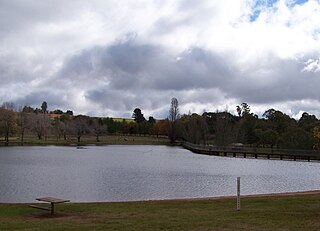
WLake Canobolas is a man-made reservoir located near Orange, in the central west region of New South Wales, Australia. Completed in the early 1900s, between 1918 and 1957 the lake supplied water to Orange and since the 1970s has been used for recreation purposes.
WLake Lenthall is a lake created by the Lenthalls Dam in Duckinwilla, Fraser Coast Region, Queensland, Australia. It was named after the pioneering family in the district. It was constructed in 1984 on the head waters of the Burrum River and raised by 2 metres in 2007. As a result of a 518 square kilometre catchment it takes a short time in moderate rain events to fill Lake Lenthall to 100% capacity.
 W
WLeslie Dam is a dam in the locality of the same name Leslie Dam, Southern Downs Region, Queensland, Australia. It is 11 kilometres (6.8 mi) from Warwick town centre. Freshwater fishing and water sports facilities are available.
WThe Tarong and Tarong North Power Stations source water from the Brisbane River catchment via a pipeline from Wivenhoe Dam. Cooling tower blowdown water is either discharged directly to Tarong Energy's Meandu Creek Dam or supplied to the nearby Tarong Mine owned by Rio Tinto Coal Australia. Excess water from the mine is discharged back to Meandu Creek Dam. Releases from Meandu Creek Dam supply downstream irrigators on Meandu Creek.
WMiddle Creek Dam is located at the head waters of Plane Creek west of Sarina, Queensland.
WThe Mount Crosby Weir is a weir on the Brisbane River at Mount Crosby in South East Queensland, Australia. The project was instigated by John Petrie at the end of the 19th century. The town of Brisbane was expanding and seeking more reliable sources of drinking water than Enoggera Dam and Gold Creek Dam could provide.
 W
WThe Nindooinbah Dam is a decommissioned earth-fill embankment dam with an un-gated spillway located off-stream in the South East region of Queensland, Australia. The sole purpose of the dam is for recreation.
WNumber 7 Dam The largest dam built on the Dee River by Mount Morgan Gold Mining Company Limited, officially known as the No. 7 Dam, was built upstream from the mine in 1900. Due to a serious drought at the time the dam was not filled until May 1904. The wall was raised by 4.5 metres in 1999. It remained unfilled until 22 November 2000 when water poured over the top of the dam for the first time.
WPerseverance Dam is the second largest, and the second oldest dam of Toowoomba city's three water supply dams. The other two storages used for Toowoomba are Cooby Dam and Cressbrook Dam which is located downstream of Perseverance.
 W
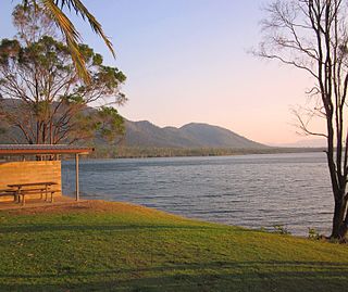
WLake Proserpine, which is also known as Peter Faust Dam is situated 26 kilometres inland from Proserpine, in North Queensland, Australia. Free 72hr camping is now available from October 4th, 2019.
WPlacer Dam, also known as Equigold Dam, is a dam in Queensland, Australia, located 68 kilometres (42 mi) south west of Bundaberg.
WThe Poona Dam is an earth-fill embankment dam with a toe drain with an un-gated spillway across a tributary of the South Maroochy River in Kureelpa, Sunshine Coast Region, Queensland, Australia. The main purpose of the dam is for storage of potable water for the Sunshine Coast region. The impounded reservoir is also called Poona Dam.
 W
WRifle Creek Dam is owned by Mount Isa Mines. With the completion of the East Leichhardt Dam in 1958, Rifle Creek Dam water was completely available for use by the mine.
WThe Serpentine Dam is a rockfill embankment dam with a concrete face and a controlled spillway across the Serpentine River, located in the South West region of Tasmania, Australia.
 W
WThe Serpentine Dam is one of the major water supply dams for Perth, Western Australia. The dam is used to store water which is released at a controlled rate to regulate the level in Serpentine Pipehead Dam, which in turn feeds water to the metropolitan trunk main network depending on demand. Construction of the dam was completed in 1961.
 W
WThe Serpentine Pipehead Dam was constructed to use the Serpentine River, in Western Australia, to convey water from Serpentine Dam to the interconnection with the Metropolitan trunk main network. The dam is also used to store water from the Dandalup scheme whereby water can be pumped or gravity transferred back into Serpentine pipehead dam. The dam site also contains a water treatment plant and picnic area. The pipehead dam is 7 km (4.3 mi) upstream from Serpentine Falls and was constructed in the late 1950s and was opened in 1957. The dam utilized 5,000 cubic metres (180,000 cu ft) of concrete and 10,000 cubic metres (350,000 cu ft) of earth.
WSolomon Dam is the main source of fresh water on Great Palm Island, Queensland, along with Francis Creek Dam.
 W
WSouth Dandalup Dam is a dam in Western Australia. It is located where the South Dandalup River flows out of Lake Banksiadale. The dam was built in 1971 in response to rapid population growth in Perth, Western Australia's capital city, and a resources boom in the Pilbara.
 W
WThe Southedge Dam, also known as the Lake Mitchell Dam, is an earth filled embankment dam across the Mitchell River located in Far North Queensland, Australia. Opened in 1987 as an ornamental lake, the impoundment created by the dam is called Lake Mitchell and at full supply level has an active capacity of 129,000 megalitres.
 W
WThe Splityard Creek Dam is a rock and earth-fill embankment dam with an un-gated spillway across the Pryde Creek that is located in the South East region of Queensland, Australia. The sole purpose of the dam is for the generation of hydroelectricity. The impounded reservoir is called the Splityard Creek Reservoir.
 W
WThe Tallebudgera Creek Dam, or colloquially Tally Dam, is a decommissioned embankment dam across the upper reaches of the Tallebudgera Creek, located in the South East region of Queensland, Australia. The initial purpose of the dam from its establishment until its decommissioning during the 1970s was for the supply of potable water to the Gold Coast region. There is no public access to the dam.
 W
WTeemburra Dam was constructed in 1997 for town water storage and irrigation purposes. It is located approximately 50 km west of Mackay, Queensland. It has a surface area of 1,040 hectares, an average depth of 14.2 metres and holds 147,500 Ml.
 W
WThe Wappa Dam is a mass concrete gravity arch dam with earth-fill abutments and an un-gated spillway across the South Maroochy River that is located in the South East region of Queensland, Australia. The main purpose of the dam is for supply of potable water for the Sunshine Coast region. The impounded reservoir is also called Wappa Dam. The dam and most of the reservoir are within Kiamba with the most northerly part of the reservoir in Cooloolabin, both in the Sunshine Coast Region.
 W
WWinburndale Dam is a concrete gravity dam on the Winburndale Rivulet in New South Wales. Its height is 22 metres (72 ft) and holds back 1,700 megalitres of water. The dam is situated within the Winburndale Nature Reserve, 19 kilometres (12 mi) East of Bathurst, New South Wales. There is no public access to the dam.