 W
WAnnapurna I East is a subsidiary mountain of Annapurna I Main. It is 8,026 meters tall.
 W
WAnnapurna I Central is a subsidiary peak of Annapurna I Main
 W
WAnnapurna III is a mountain in the Annapurna mountain range, and at 7,555 metres (24,787 ft) tall, it is the 42nd highest mountain that is not a subsidiary peak of another mountain.
 W
WAnnapurna IV is a mountain of the Annapurna range in the Himalayas. It is near Annapurna II. It was first climbed in 1955 by a German expedition led by Heinz Steinmetz via the North Face and Northwest Ridge. The summit party comprised Steinmetz, Harald Biller, and Jürgen Wellenkamp.
 W
WBaden-Powell Scout Peak, formerly known as Urkema Peak, in Nepal is part of the Himalayas, the highest mountain range in the world. It is on the border with China about a hundred miles west of Mount Everest. As part of the Scouting 2007 Centenary, the government of Nepal renamed Urkema Peak to Baden-Powell Scout Peak, to commemorate 100 years of Scouting in honor of British soldier Robert Baden-Powell, founder of the World Scouting movement.
 W
WBaruntse is a mountain in the Khumbu region of eastern Nepal, crowned by four peaks and bounded on the south by the Hunku Glacier, on the east by the Barun Glacier, and on the northwest by the Imja Glacier. The mountain was first climbed May 30, 1954 via the south ridge by Colin Todd and Geoff Harrow of a New Zealand expedition led by Sir Edmund Hillary. The first ascent of the East Ridge was made on April 27, 1980 by Lorenzo Ortas, Javier Escartín, Jeronimo Lopez and Carlos Buhler (America) of a Spanish expedition led by Juan José Díaz Ibañez.
WChamar is the highest peak of the Sringi Himal, which is a subrange of the Nepalese Himalayas.
 W
WChamlang is a mountain in the Nepalese Himalayas, near Makalu. It lies in the southern section of the Mahalangur subrange of the Himalayas. Chamlang has an elevation of 7,319 metres (24,012 ft).
WChangla is a mountain in the Himalayas of Asia. It has a summit elevation of 6,721 metres (22,051 ft) above sea level and is located on the international border between Nepal and Tibet, China.
 W
WCho Polu is a mountain in the Khumbu region of eastern Nepal. Southern neighbors include Num Ri and Baruntse while Imja Tse lies immediately to the west.
 W
WCholatse is a mountain in the Khumbu region of the Nepalese Himalaya. Cholatse is connected to Taboche (6,501m) by a long ridge. The Chola glacier descends off the east face. The north and east faces of Cholatse can be seen from Dughla, on the trail to Mount Everest base camp.
 W
WDragmarpo Ri is a mountain on the border between Nepal and People's Republic of China.
 W
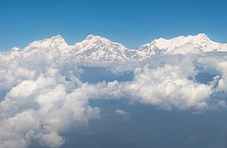
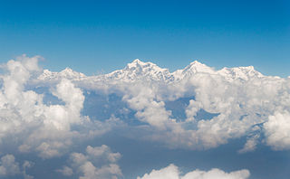
WGokyo Peak is a 5,357 m (17,575 ft)-high peak in the Khumbu region of the Nepal Himalayas. It is located on the west side of the Ngozumpa glacier, which is the largest glacier in Nepal and reputed to be the largest in the whole Himalayas. Gokyo, at the base of Gokyo Ri, is a small hamlet of a few stone houses and one of the highest settlements in the world. From the summit of Gokyo Ri it is possible to see four 8,000-metre peaks: Mount Everest, Lhotse, Makalu and Cho Oyu. The Gokyo Lakes are in the area.
 W
WThe Gurans Himal is a small subrange of the Himalayas in far western Nepal. It is little-known, since it does not contain any 8000 metre peaks, or even any peaks above 7,200 metres. Its highest peak is Api, 7,132 m (23,399 ft), which, despite its relatively low height compared to the major Himalayan peaks, rises dramatically from a low base, as do the other significant peaks of the Gurans Himal.
 W
WHillary Peak is the name which has been proposed by the Government of Nepal for a 7,681 metres (25,200 ft) peak in the Himalayas in honour of Edmund Hillary, who made the first ascent of Everest with Tenzing Norgay in 1953.
 W
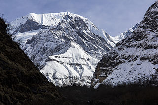
WHiunchuli is a peak situated in the Annapurna massif of the Gandaki province in north-central Nepal. The mountain is an extension of the Annapurna South. Between this peak and the Machapuchare is a narrow section of the Modi Khola valley that constitutes the sole access to the Annapurna Sanctuary.
 W
WJethi Bahurani is mountain in the Himalayas of Nepal. Located in Darchula District, it has a summit elevation of 6,850 meters above sea level.
WJongsong Peak is a mountain in the Janak section of the Himalayas. At 7,462 metres (24,482 ft) it is the 57th highest peak in the world, although it is dominated by 3rd highest, Kangchenjunga, 20 km (12 mi) to the south. Jongsong's summit is on tripoint of India, Nepal and China.
WKang Guru is a mountain in the Manang region of Gandaki Pradesh. It the highest peak of the Larkya sub-range of the Nepalese Himalayas. The Larkya range lies northwest of Mansiri Himal and northeast of the Annapurnas.
 W
WKangtega, known also as The Snow Saddle, is a major mountain peak of the Himalayas in Nepal. Its summit rises 6,782 metres (22,251 ft). It was first ascended in 1963.
 W
WKanjiroba is a mountain in the Himalayas of Dolpa District in Nepal. With a summit elevation of 6,883 meters above sea level, it is the highest peak of the Kanjiroba Himal, a subrange of the Himalayas.
WThe Kanjiroba Himal is an isolated part of the Himalaya range within Nepal, adjacent to the Tibetan border.
 W
WKhumbutse is the first mountain west (6 km) of Mount Everest. It lies at the border between Nepal and China.
 W
WKirat Chuli or Tent Peak is a mountain in the Himalayas. It lies on the border between Nepal and India.
 W
WKongde Ri is a mountain in the Himalaya of eastern Nepal. The mountain is located four km west of Namche Bazaar.
WKubi Gangri is a mountain in the Himalayas of Asia. It has a summit elevation of 6,859 meters above sea level and is located on the international border between Nepal and Tibet, China.
WLangtang Ri is a mountain in the Langtang Himal of the Himalayas. At an elevation of 7,205 m (23,638 ft) it is the 106th highest mountain in the world. Located on the border between the Bagmati Zone of Nepal and Tibet, China, it is part of a group of high peaks that include Shishapangma and Porong Ri.
 W
WLhotse Shar is a subsidiary mountain of Lhotse, and the 5.5th-highest mountain on Earth, at 8,383 m (27,503 ft) high. It has the highest fatality rate of all the eight-thousanders – for every two people who summit the mountain, one person dies attempting to. However, this is primarily because most climbers tend to try to ascend to the primary peak of Lhotse, rather than the lowest summit of the mountain. It was first climbed by Sepp Mayerl and Rolf Walter on May 12, 1970.
 W
WLobuche is a Nepalese mountain which lies close to the Khumbu Glacier and the settlement of Lobuche. There are two main peaks, Lobuche East and Lobuche West. A permit to climb the mountain is required from the National Mountaineering Association (NMA) of Nepal, which classifies Lobuche East (6,119m) as a "trekking peak", and Lobuche West (6,145m) as an "expedition peak". As the easier, trekking peak, the East peak is climbed far more frequently than the West peak, however most of those climbers only do so to a false summit a few hours from the true summit of Lobuche East. Between the two peaks is a long deeply notched ridge, however a steep drop and considerable distance makes approaching the West peak from the East impossible.
 W
WLunag Ri is a mountain in the Rolwaling Himal mountain range of the Himalayas.
 W
WMalika Dhuri is a 3,700 m (12,100 ft) high mountain peak in Muna, Myagdi, Nepal. The name is derived from two local words Malika and Dhuri.
 W
WMardi Himal is a 5,587-metre (18,330 ft) peak beneath the much more prominent Machapuchare in the Annapurna region of Nepal, from which it is separated by a 5,200 metres (17,060 ft) col. It was first summited in 1961 by Basil Goodfellow.
 W
WKhumbila or Khumbu Yül-Lha, roughly translated as "God of Khumbu" is one of the high Himalayan peaks in the Khumbu region of Eastern Nepal within the boundaries of Sagarmatha National Park. Considered too sacred to be climbed by most local Sherpa people, the mountain is considered home to the patron God of the local area. Rising 5,761m above sea level, the mountain overlooks the famous southern approaches to its larger neighbours including Ama Dablam and Mount Everest.
 W
WNemjung is a mountain in the Himalayas of Nepal. It is located approximately 150 kilometres (93 mi) northwest of the Nepalese capital Kathmandu and about 25 km northwest of the eight-thousander, Manaslu. Its summit has an elevation of 7,140 metres (23,425 ft).
 W
WNgadi Chuli is a high summit in the Mansiri Himal, also known as the Gurkha Massif, in Nepal. It is flanked by Manaslu to the north and Himalchuli to the south.
 W
WThe Nilgiri Himal is a range of three peaks in the Annapurna massif in Nepal. It is composed of Nilgiri North (7061 m), Nilgiri Central (6940 m) and Nilgiri South (6839 m).
 W
WNum Ri is a mountain in the Khumbu region of the Nepalese Himalayas. Num Ri consists of a long ridge that culminates eastwards in a pyramid summit. Neighbouring mountains are Island Peak, Baruntse and Cho Polu.
 W
WNupla Khang is a mountain in the Mahalangur Himal section of the Himalayas along the border of Nepal and China. The peak is situated between Cho Oyu to the east and Everest to the west.
WPangpoche is a mountain in the Himalayas of Nepal. It has a summit elevation of 6,620 metres (21,720 ft) above sea level and is located approximately 15 kilometres (9.3 mi) northeast of the world's eighth-highest mountain, Manaslu.
 W
WPaungda Danda is a Himalayan mountain located in Manang District, Western Region, Nepal. The mountain is not significantly prominent, and is a subsidiary peak to the southeast of Pisang Peak. Paungda Danda is notable for its western rock face that rises dramatically 1,500 m (4,900 ft) above the Marshyangdi River. The mountain's smooth western face, also known as the Great Wall of Pisang, is composed of slate rock and formed as a result of an ancient lakebed being uplifted during the creation of the Himalayas. Today, the mountain is a recognizable feature along the Annapurna Circuit, a popular trekking route.
 W
WPisang Peak is a pyramidal trekking peak above Pisang, a village on the Annapurna Circuit, within the Manang District, northern Nepal. It was first climbed by a German Expedition in 1955.
 W
WPokalde Peak is a mountain peak of Nepal situated 12 km southwest of Mount Everest. Pokalde Peak is one of the shortest and easiest trekking peaks in the Everest Region. The majority of the 650 metres (2,130 ft) climb from base camp requires little more than walking with short sections of scrambling up rock.
WPutha Hiunchuli is a mountain in Nepal and part of the Dhaulagiri Range. It lies at the west end of the Dhaulagiri II chain and is 7246 meters high, making it the 95th highest mountain in the world. It was first climbed in 1954 by J. O. M. Roberts and Ang Nyima Sherpa.
WSaipal is a mountain in the Himalayas of north-west Humla district in Nepal.
 W
WSalasungo is a peak of the Ganesh Himal, on the border between Nepal and Tibet (China).
 W
WSingu Chuli is one of the trekking peaks in the Nepali Himalaya range. The peak is located just west of Ganggapurna in the Annapurna Himal. Singu Chuli is on a ridgeline originating at Tarke Kang going south. This ridge continues south of Singu Chuli to Tharpu Chuli. A climbing permit from the NMA costs US$350 for a team of up to four members. The peak requires ice climbing equipment.
 W
WSiraichuli is the highest hill peak of Chitwan District, located in Kaule Village Development Committee in Chitwan District in Narayani Zone of Nepal. The altitude of Siraichuli is 1945 m and it provides views of mountains such as Gausankhar, Dhaulagiri, Langtang, Rolwaling and Manaslu and the Terai belt of southern region of Nepal.
WTaboche is a mountain in the Khumbu region of the Nepalese Himalaya. Taboche is connected to Cholatse by a long ridge. Taboche lies directly across the Imja River from Ama Dablam and above the villages of Pheriche and Dingboche.
WTenzing Peak is the name which has been proposed by the Government of Nepal for a 7,916-metre (25,971 ft) peak in the Himalayas in honour of Tenzing Norgay, who made the first ascent of Everest with Edmund Hillary in 1953. It is also known variously as Ngojumba Kang, Ngozumpa Kang and Ngojumba Ri.
 W
WThamserku is a mountain in the Himalayas of eastern Nepal. The mountain is connected by a ridge leading eastward to Kangtega. Thamserku is a prominent mountain to the east of Namche Bazaar and lies just north of Kusum Kangguru.
WTharpu Chuli or Tent Peak is one of the trekking peaks in the Nepali Himalaya range. The peak has a nice central position in the Annapurna Sanctuary. It is easier to climb than both Hiunchuli and Singu Chuli which also are trekking peaks of the Annapurna. The ascent requires ice climbing equipment. A climbing permit from the NMA used to cost US$350 for a team of up to four members. As of 2017 NMA has removed Tharpu Chuli from its list of Trekking Peaks.
 W
WTilicho Peak is a mountain in the Nepalese Himalaya, near Annapurna. The peak was first seen by Europeans in 1950 by members of the 1950 French Annapurna expedition led by Maurice Herzog who were attempting to find Annapurna I.
 W
WYala Peak is a mountain in the Langtang area in Nepal. It is considered a trekking peak by the Nepal Mountaineering Association, and is a relatively simple, non-technical climb. The summit is renowned for being an excellent vantage point from which Shishapangma (8013m), the highest mountain wholly in Tibet, and the lowest of the 14 eight-thousanders, can be seen.