 W
WThe Atlantic Coast restingas is an ecoregion of the tropical and subtropical moist broadleaf forests biome, and the South American Atlantic Forest biome. It is located along Brazil's Atlantic coast, from the country's northeast to its southeast.
 W
WThe Atlantic dry forests are a tropical dry forest ecoregion of the Atlantic Forest Biome, located in eastern Brazil.
 W
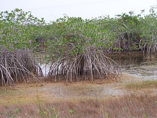
WThe Bahia Mangroves is a tropical ecoregion of the mangroves biome, and the South American Atlantic Forest biome, located in Northeastern Brazil.
 W
WA bayhead or baygall is a specific type of wetland or swamp habitat. The name baygall is derived from sweetbay magnolia and sweet gallberry holly. Baygalls are recognized as a discrete ecosystem by ecologist and the swamps have been described as "distinct wetland communities in the Natural Communities of Louisiana". Baygall swamps are most often found in the low laying margins of floodplains and bottomlands with little or poor drainage to the main creek, bayou, or river channel. Baygall or bayhead swamps found on slopes and hillsides are sometimes referred to as a forest seep or hanging bogs. Hanging bogs are typically found in hardwood-pine forests. Most baygall swamps are semi-permanently saturated, or flooded.
 W
WThe Belizean Coast mangroves form one of the ecoregions that belong to the mangroves biome, as defined by the World Wildlife Fund. This ecoregion is located along the coast of Belize and of Amatique Bay in Guatemala. It covers an area of around 2850 km2.
 W
WThe Belizian pine forests is an ecoregion that represents an example of lowland and premontane pine forests in the Neotropical realm, where the dominant tree species is Caribbean pine. The vegetation here is generally adapted to the xeric, acidic and nutrient-poor conditions along the Belizean near coastal zone of the Caribbean versant.
 W
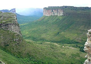
WThe Brazilian Highlands or Brazilian Plateau are an extensive geographical region, covering most of the eastern, southern and central portions of Brazil, in all approximately half of the country's land area, or some 4,500,000 km2. In addition, the vast majority of Brazil's population lives in the highlands or on the narrow coastal region immediately adjacent to it.
 W
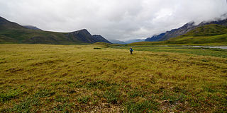
WThe Brooks-British Range tundra is an ecoregion spanning North America and Canada, and is one of the WWF Global 200 ecoregions.
 W
WThe Cape Provinces of South Africa is a biogeographical area used in the World Geographical Scheme for Recording Plant Distributions (WGSRPD). It is part of the WGSRPD region 37 Southern Africa. The area has the code "CPP". It includes the South African provinces of the Eastern Cape, the Northern Cape and the Western Cape, together making up most of the former Cape Province.
 W
WThe Central American dry forests ecoregion, of the tropical and subtropical dry broadleaf forests biome, is located in Central America.
 W
WThe Central American montane forests are an ecoregion of the tropical and subtropical moist broadleaf forests biome, as defined by the World Wildlife Fund, located in mountains of Central America.
 W
WThe Central American pine-oak forests ecoregion, in the tropical and subtropical coniferous forests biome, is found in Central America and Chiapas state of southern Mexico.
 W
WThe Chiapas Depression dry forests form one of the ecoregions that belong to the tropical and subtropical dry broadleaf forests biome, as defined by the World Wildlife Fund, in northwestern Central America.
 W
WThe Coastal forests of eastern Africa is a tropical moist forest region along the east coast of Africa. The region was designated a biodiversity hotspot by Conservation International.
 W
WThe Daba Mountains evergreen forests are a Global 200 endangered ecoregion located on the Daba Mountains in China. The forests are part of temperate broadleaf and mixed forests containing both coniferous and broadleaf trees covering a swath of Central China. Forests here provide a transitional area between evergreen forests to the south and deciduous forests to the north. The Daba Mountains evergreen forests cover areas of northeast Sichuan Province, southern Shaanxi Province, the northern half of Chongqing Municipality, and western Hubei Province.
 W
WThe East African montane forests is a montane tropical moist forest ecoregion of eastern Africa. The ecoregion comprises several separate areas above 2000 meters in the mountains of South Sudan, Uganda, Kenya, and Tanzania.
 W
WA forest steppe is a temperate-climate ecotone and habitat type composed of grassland interspersed with areas of woodland or forest.
 W
WThe Fraser Plateau and Basin Complex is an ecoregion, as defined by the World Wildlife Fund. It encompasses the middle reaches of the watershed of the Fraser River as it traverses the northern part of the Interior Plateau of British Columbia. The WWF ecoregion is similar in description to two of the ecoregions within Environment Canada's Montane Cordillera Ecozone: The Fraser Basin and the Fraser Plateau. Much of the Fraser Plateau is underlain by volcanic rocks which have steep escarpments along rivers and creeks and almost flat upper surfaces.
 W
WGeotope is the geological component of the abiotic matrix present in an ecotope. Example geotopes might be: an exposed outcrop of rocks, an erratic boulder, a grotto or ravine, a cave, an old stone wall marking a property boundary, and so forth.
 W
WThe Hawaiian tropical high shrublands are a tropical savanna ecoregion in the Hawaiian Islands.
 W
WThe Hawaiian tropical low shrublands are a tropical savanna ecoregion in the Hawaiian Islands.
 W
WThe Hengduan Mountains subalpine conifer forests are a temperate forest in the Hengduan Mountains of southwestern China. The forests extend within the Jinsha and Yalong River valleys from approximately 32°N to 27°N. In addition, a portion of the Anning River valley and Mianmian Mountains near Lugu Lake support the subalpine conifer forests. This region covers northern Yunnan Province, western Sichuan Province, and the extreme eastern edge of the Tibet Autonomous Region.
 W
WThe Hobyo grasslands and shrublands is a desert and xeric scrubland ecoregion in Somalia. The ecoregion includes a belt of coastal dunes, 10 to 15 km wide, along the Indian Ocean coast, extending from north of Hobyo to south of Mogadishu.
 W
WThe Honshū alpine conifer forests ecoregion covers 4,400 square miles (11,000 km2) in the high-elevation mountains of central Honshū and the Oshima Peninsula of Hokkaidō, Japan. It is a temperate coniferous forest ecoregion in the Palearctic realm.
 W
WJanca is one of the eight Natural Regions of Peru. It is located in the frozen heights where the condor lives.
 W
WThe Masai xeric grasslands and shrublands is a Desert and xeric shrubland ecoregion in Kenya and Ethiopia. It includes the lowlands around Lake Turkana and the Chalbi Desert east of the lake.
 W
WThe Mosquitia-Nicaraguan Caribbean Coast mangroves ecoregion, in the Mangrove biome, are along the Caribbean coasts of Nicaragua, Honduras, and Costa Rica as well as off shore islands such as the Corn Islands.
 W
WThe Motagua Valley thornscrub is one of the ecoregions that belong to the deserts and xeric shrublands biome, as defined by the World Wildlife Fund. The ecoregion is located in the Motagua valley in eastern Guatemala, and covers an area of 2330 km2.
 W
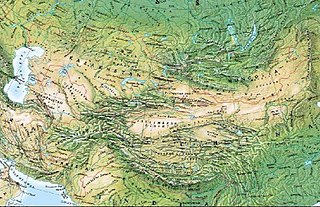
WThe Mountains of Central Asia are a biodiversity hot spot designated by Conservation International which covers several montane and alpine ecoregions of Central Asia, including those of the Pamir and Tian Shan ranges, and extending across portions of Afghanistan, China, Kazakhstan, Kyrgyzstan, Tajikistan, and Uzbekistan.
 W
WThe Northeastern Brazil restingas are an ecoregion of northeastern Brazil. Restingas are coastal forests which form on sandy, acidic, and nutrient-poor soils, and are characterized by medium-sized trees and shrubs adapted to the dry and nutrient-poor conditions found there.
 W
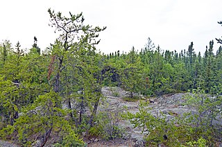
WNorthern Canadian Shield taiga is a taiga ecoregion located in Canada, as defined by the World Wildlife Fund (WWF) categorization system.
 W
WThe Northern Congolian forest-savanna mosaic is a forest and savanna ecoregion of central Africa, part of the belt of transitional forest-savanna mosaic that lie between Africa's equatorial forests and the tropical dry forests, savannas, and grasslands that lie to the north and south.
 W
WThe Northern Honduras mangroves form an ecoregion in the mangroves biome, as defined by the World Wildlife Fund. This ecoregion stretches along most of the Caribbean coast of Honduras, up to the east of Amatique Bay in Guatemala. It covers an area of 1036 km2. The ecoregion is threatened by the expansion of agriculture and livestock production.
 W
WNorthwest Territories taiga is a taiga ecoregion located within the Canadian territories of Northwest Territories and Yukon. It is defined by the World Wildlife Fund (WWF) categorization system as inhabiting the Mackenzie River Valley, as well as the surrounding highlands in the southern portion of the valley.
 W
WThe Northwestern Congolian lowland forests is a tropical moist broadleaf forest ecoregion that spans Cameroon, Gabon, the Republic of Congo, and the Central African Republic. It forms part of the larger Congolian rainforests region in Central Africa.
 W
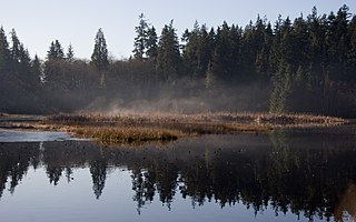
WPuget lowland forests is a temperate coniferous forest ecoregion the Pacific coast of North America, as defined by the World Wildlife Fund (WWF) categorization system.
 W
WThe Qionglai-Minshan conifer forests are a World Wide Fund for Nature ecoregion in Southwest China. These forests are classified as temperate coniferous forests and are part of the Palearctic realm.
 W
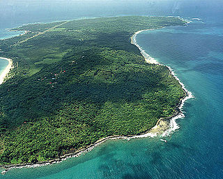
WRestinga — a spit and a distinct type of coastal Tropical and subtropical moist broadleaf forest, found in eastern Brazil.
 W
WRupa-Rupa or High Jungle is one of the eight natural regions of Peru. It is located between 400 and 1,000 m above the sea level. This region has many long, narrow valleys and fluvial mountain trails. The weather is warm, humid, and rainy.
 W
WThe Serengeti volcanic grasslands is a tropical grassland ecoregion of Tanzania. The Serengeti volcanic grasslands are distinctive grasslands growing on deposits of volcanic ash in northern Tanzania. It includes the eastern portion of Serengeti National Park and areas south and east of the Ngorongoro Highlands.
 W
WShrub swamps — also called scrub swamps or buttonbush swamps — are a type of freshwater wetland ecosystem occurring in areas too wet to become swamps, but too dry or too shallow to become marshes. They are often considered transitional (“mid-successional”) between wet meadows or fens and conifer or hardwood swamps.
 W
WThe Sichuan Basin evergreen broadleaf forests are a critically endangered WWF ecoregion. The ecoregion occupies the Sichuan Basin in China and covers an area of 9,816,054 ha. The broadleaf forest habitat once covered the Sichuan Basin, but today is limited to mountains and preserved temple grounds in the basin and around the basin's rim. An especially well-preserved example of remaining forest exists on Mount Emei at the western edge of the Sichuan Basin. The original forests are thought to have been made up of subtropical oaks, laurels, and Schima. Much of the remaining Sichuan Basin has been converted to anthropogenic agricultural use in the last 5,000 years.
 W
WThe Somali montane xeric shrublands is a desert and xeric scrubland ecoregion in Somalia. The ecoregion lies in the rugged Karkaar Mountains, which run parallel and close to Somalia's northern coast on the Gulf of Aden, and follows northern Somalia's Arabian Sea coast from Cape Guardafui south to Eyl.
 W
WThe South Saharan steppe and woodlands, also known as the South Sahara desert, is a deserts and xeric shrublands ecoregion of northern Africa.
 W
WThe Southern Cone Mesopotamian savanna, also known as the Argentine Mesopotamian grasslands, is a flooded grassland ecoregion of Argentina.
 W
WThe Southern miombo woodlands is a tropical grasslands and woodlands ecoregion extending across portions of Malawi, Mozambique, Zambia, and Zimbabwe.
 W
WThe Southwestern Arabian Escarpment shrublands and woodlands, also known as the Southwestern Arabian foothills savanna is a desert and xeric shrubland ecoregion of the southern Arabian Peninsula, covering portions of Saudi Arabia and Yemen. The ecoregion occupies moderate elevations in the peninsula's mountainous southwest, including the Hijaz Mountains and Asir Mountains of Saudi Arabia, and the Sarawat Mountains of Yemen.
 W
WThe Trobriand Islands rain forests are a tropical moist broadleaf forest ecoregion of southeastern Papua New Guinea.
 W
WThe Uruguayan savanna, also known as the Brazilian-Uruguayan savanna, is a subtropical grassland and savanna ecoregion which includes all of Uruguay, some areas of northeastern Argentina and southernmost Brazil.
 W
WThe Western Congolian swamp forests are an ecoregion of the Republic of the Congo and Democratic Republic of the Congo. Together with the adjacent Eastern Congolian swamp forests, it forms one of the largest continuous areas of freshwater swamp forest in the world. It is a flooded forest with a high canopy, dense undergrowth and has a muddy floor. It has not been disturbed very much by outside influences and so remains largely pristine as getting through this forest is called "almost impossible".
 W
WThe Western Guinean lowland forests are a tropical moist broadleaf forest ecoregion of West Africa.
 W
WThe Yucatán moist forests are an ecoregion of the tropical and subtropical moist broadleaf forests biome, as defined by the World Wildlife Fund.
 W
WThe Zacatonal is a montane grassland and shrubland ecoregion of central Mexico, and Guatemala. The term is also used to refer to montane grasslands.
 W
WThe Zambezian Baikiaea woodlands is an ecoregion in Africa. It includes dry deciduous forest and woodland, thicket, and grassland, dominated by the tree Baikiaea plurijuga. The ecoregion has a semi-arid climate, and is a transition between more humid miombo woodlands to the north, and the drier Kalahari Acacia-Baikiaea woodlands to the south.
 W
WThe Zambezian region is a large biogeographical region in Africa. The Zambezian region includes woodlands, savannas, grasslands, and thickets, extending from east to west in a broad belt across the continent. The Zambezian region lies south of the rainforests of the Guineo-Congolian region. The Zambezian region is bounded by deserts and xeric shrublands on the southwest, the Highveld grasslands of South Africa to the south, and the subtropical Maputaland forests on the southeast.