 W
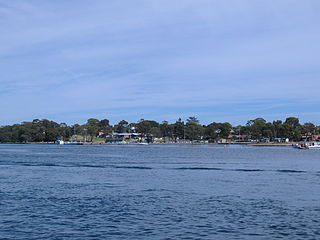
WArno Bay is a small fishing and tourist town on the east coast of Eyre Peninsula in South Australia, located on the Lincoln Highway about halfway between Whyalla and Port Lincoln. First proclaimed under the name Bligh in 1883, the current name dates back to 1940. It is a recreational town with a number of marine and nature based attractions, including fishing, surfing and swimming.
 W
WBaird Bay is a small fishing village located 50 kilometres south of Streaky Bay on the west coast of Eyre Peninsula in South Australia. It is situated on the east coast of a bay named Baird Bay which opens into the north end of Anxious Bay.
 W
WBarangaroo is an area of central Sydney, New South Wales, Australia. It is located on the north-western edge of the Sydney central business district and the southern end of the Sydney Harbour Bridge. It is part of the local government area of the City of Sydney; it was part of the territory of the Cadigal people, the traditional owners of the Sydney city region. The area was used for fishing and hunting by Indigenous Australians prior to colonial settlement. The area is inclusive of The Hungry Mile, the name harbourside workers gave to the docklands area of Darling Harbour East during The Great Depression, where workers would walk from wharf to wharf in search of a job, often failing to find one.
 W
WBeauty Point is a town by the Tamar River, in the north-east of Tasmania, Australia. It lies 45 km north of Launceston, on the West Tamar Highway and at the 2016 census, had a population of 1,222. It is part of the Municipality of West Tamar Council.
 W
WBoyne Island is a coastal town and locality in Queensland, Australia, 25 kilometres (16 mi) south of Gladstone. It is part of the local government area of Gladstone Region. At the 2016 census, Boyne Island had a population of 4,760.
 W
WBrunswick Heads is a small town on the north coast of New South Wales, Australia in Byron Shire. At the 2016 census, the town had a population of 1,737 people.
 W
WByron Bay is a beachside town located in the far-northeastern corner of the state of New South Wales, Australia. It is located 772 kilometres (480 mi) north of Sydney and 165 kilometres (103 mi) south of Brisbane. Cape Byron, a headland adjacent to the town, is the easternmost point of mainland Australia. At the 2016 census, the town had a permanent population of 9,246. It is the largest town of Byron Shire, though not the shire's administrative centre.
 W
WCairns is a city in Queensland, Australia, on the east coast of Far North Queensland. The city is the 5th-most-populous in Queensland, and 14th in Australia.
 W
WCarpenter Rocks is a town and locality located 35 kilometres (22 mi) south-west of Mount Gambier in the south-east of South Australia. The area faces the Southern Ocean and is renowned for its rugged coastline which provides exceptional fishing and diving locations.
 W
WCeduna is a town in South Australia located on the shores of Murat Bay on the west coast of Eyre Peninsula. It lies west of the junction of the Flinders and Eyre Highways around 786 km northwest of the capital Adelaide. The port town/suburb of Thevenard lies 3 km to the west on Cape Thevenard. It is in the District Council of Ceduna, the federal Division of Grey, and the state electoral district of Flinders.
 W
WClifton Gardens is an urban locality in the suburb of Mosman in Sydney, New South Wales, Australia. Clifton Gardens is located in the local government area of the Municipality of Mosman and is part of the Lower North Shore. Clifton Gardens is adjacent Chowder Bay.
 W
WCrescent Head is a town on the Tasman Sea coast, 340 km north-northeast of Sydney, in Kempsey Shire, New South Wales, Australia. At the 2011 census, Crescent Head had a population of 1,586 people. Its major industries include tourism and fishing. It has a small golf course overlooking the sea.
 W
WCurrarong is a small coastal fishing and tourist village in the Shoalhaven area of New South Wales, Australia. At the 2011 census, Currarong had a population of 452. The village is a haven for fishermen, with several underwater rises where fish are abundant. Currarong has a small general store, a newsagent and a cafe. As of early 2013 there is a fish cafe called Zac's Place, a general store, a licensed club, a caravan park, and several properties available for holiday rental.
 W
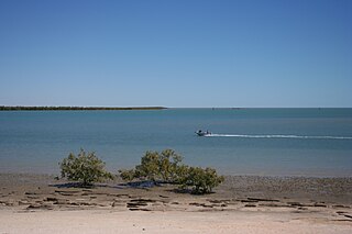
WDenial Bay is a small fishing and tourist village in the west of South Australia that lies on the western side of Murat Bay about 562 kilometres (349 mi) from the Adelaide city centre and about 14 kilometres (8.7 mi) from Ceduna. The town has extensive European history, first built on in 1889, and now hosts a large expanse of oyster farms, one of the largest on the Eyre Peninsula.
WDunalley is a small fishing village on the east coast of Tasmania, Australia. It is part of the Sorell Council. At the 2016 census, Dunalley had a population of 316.
 W
WEden is a coastal town in the South Coast region of New South Wales, Australia. The town is 478 kilometres (297 mi) south of the state capital Sydney and is the most southerly town in New South Wales, located between Nullica Bay to the south and Calle Calle Bay, the northern reach of Twofold Bay, and built on undulating land adjacent to the third-deepest natural harbour in the southern hemisphere, and Snug Cove on its western boundary. At the 2016 census, Eden had a population of 3,151.
 W
WEdenhope is a town in Victoria, Australia. It is located on the Wimmera Highway, 30 kilometres from the South Australian border, in the Shire of West Wimmera local government area. At the 2016 census Edenhope had a population of 946.
 W
WEdithburgh is a small town on the south-east corner of Yorke Peninsula in the Australian state of South Australia. Edithburgh is about 50 km (31 mi) west of Adelaide across Gulf St Vincent, but 226 km (140 mi) away by road. At the 2016 census, the locality had a population of 516 of which 454 lived in its town centre.
 W
WEsperance is a town in the Goldfields-Esperance region of Western Australia, on the Southern Ocean coastline approximately 720 kilometres (450 mi) east-southeast of the state capital, Perth. The urban population of Esperance was 12,145 at June 2018. Its major industries are tourism, agriculture, and fishing.
 W
WForster is a coastal town in the Mid North Coast region of New South Wales, Australia, in the Mid-Coast Council LGA, about 308 km north-north-east of Sydney. It is immediately adjacent to its twin, Tuncurry, which is the smaller of the two towns. Forster is known for its stunning waters & Manning Valley beauty.
 W
WFoster is a dairying and grazing town 174 kilometres (108 mi) south-east of Melbourne on the South Gippsland Highway in Victoria, Australia. At the 2016 census Foster had an urban population of 1,164. It is about 20 kilometres (12 mi) north of the Gippsland coastline which includes Shallow Inlet, Corner Inlet, Waratah Bay, Yanakie and Wilsons Promontory.
 W
WGladstone is a city in the Gladstone Region, Queensland, Australia. It is approximately 550 km (340 mi) by road north-west of the state capital, Brisbane, and 100 km (62 mi) south-east of Rockhampton. Situated between the Calliope and Boyne Rivers, Gladstone is home to Queensland's largest multi-commodity shipping port.
 W
WGregory is a small town and fishing port located 7 km (4.3 mi) northwest of the mouth of the Hutt River, in the Mid West region of Western Australia. At the 2016 census, Gregory had a population of 64 in 83 dwellings. Most of the dwellings are holiday houses. The population of Gregory fluctuates depending on tourism; with the town at full capacity during school holidays and throughout the summer. During the census 50% of dwellings were unoccupied.
 W
WHarrington is a small village located at the mouth of the Manning River in New South Wales, Australia. It was established in 1853 and proclaimed a village on 26 September 1896. It is 15 km north-east of Taree on the Mid North Coast, and 335 kilometres (208 mi) north east of the state capital, Sydney. At the 2011 census, Harrington had a population of 2,258. It was named after the Earl of Harrington by the explorer, John Oxley.
 W
WThe Houtman Abrolhos is a chain of 122 islands, and associated coral reefs, in the Indian Ocean off the west coast of Australia. Nominally located at 28°43′S 113°47′E, it lies about eighty kilometres (50 mi) west of Geraldton, Western Australia. It is the southernmost true coral reef in the Indian Ocean, and one of the highest latitude reef systems in the world. It is one of the world's most important seabird breeding sites, and is the centre of Western Australia's largest single-species fishery, the western rock lobster fishery. It has a small seasonal population of fishermen, and a limited number of tourists are permitted for day trips, but most of the land area is off limits as conservation habitat. It is well known as the site of numerous shipwrecks, the most famous being Dutch ships Batavia, which was wrecked in 1629, and Zeewijk, wrecked in 1727.
 W
WKarumba is a town and a coastal locality in the Shire of Carpentaria, Queensland, Australia. In the 2016 census, Karumba had a population of 531 people.
 W
WLabrador is a coastal suburb in the City of Gold Coast, Queensland, Australia. In the 2016 census, Labrador had a population of 18,261 people.
 W
WLakes Entrance is a seaside resort and fishing port in eastern Victoria, Australia. It is situated approximately 320 kilometres (200 mi) east of Melbourne, near a managed, artificial channel connecting the Gippsland Lakes to Bass Strait. At the 2016 census, Lakes Entrance had a population of 4,810.
 W
WLancelin is a small fishing and tourist town 127 km north of Perth, Western Australia. It is within the Shire of Gingin at the end of Wanneroo Road, and a few kilometres from the start of the Indian Ocean Drive.
 W
WLedge Point is a small coastal township 105 km north of Perth, Western Australia. It was established to service the local fishing and crayfishing industries.
 W
WThe Austronesian Makassar people from the region of Sulawesi began visiting the coast of northern Australia sometime around the early to middle 1700s, first in the Kimberley region, and some decades later in Arnhem Land.
 W
WMallacoota is a small town in the East Gippsland region of Victoria, Australia. At the 2016 census, Mallacoota had a population of 1,063. At holiday times, particularly Easter and Christmas, the population increases by about 8,000. It is the last official township on Victoria's east coast before the border with New South Wales. Mallacoota has a regional airport YMCO (XMC) consisting of a gravel runway for light planes and an asphalt runway for commercial planes flying from Melbourne.
 W
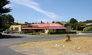
WNelson is a small fishing town in Victoria, Australia. It is located on the mouth of the Glenelg River and on Discovery Bay, a few kilometres from the South Australian border, and 422 kilometres (262 mi) west of Melbourne. At the 2016 census, Nelson and the surrounding area had a population of 190.
 W
WPaynesville is a tourist/holiday resort town in the Gippsland region of Victoria, Australia. At the 2006 census, Paynesville had a population of 2967. The town is located 293 kilometres (182 mi) by road east of the state capital, Melbourne. It is known as the boating capital of Victoria.
 W
WPoint Samson is a small coastal settlement 1,579 km north of Perth and 18 km north of Roebourne in the Pilbara region of Western Australia. The town is a popular holiday location for the nearby mining towns, including Wickham, Karratha and Dampier. Fishing is the main industry.
 W
WPort Broughton is a small South Australian town located at the northern extent of the Yorke Peninsula on the east coast of Spencer Gulf. It is situated about 170 km north-west of Adelaide, and 56 km south of Port Pirie. At the 2011 census, the town of Port Broughton had a population of 1,034.
 W
WPort Douglas is a coastal town and locality in the Shire of Douglas, Queensland, approximately 70 km (40 mi) north of Cairns. In the 2016 census, Port Douglas had a population of 3,504 people. The town's population can often double, however, with the influx of tourists during the peak tourism season from May to September. The town is named in honour of a former Premier of Queensland, John Douglas. Port Douglas developed quickly based on the mining industry. Other parts of the area were established with timber cutting occurring in the area surrounding the Daintree River and with settlement starting to occur on lots around the Mossman River by 1880.
 W
WPort Fairy is a coastal town in south-western Victoria, Australia. It lies on the Princes Highway in the Shire of Moyne, 28 kilometres (17 mi) west of Warrnambool and 290 kilometres (180 mi) west of Melbourne, at the point where the Moyne River enters the Southern Ocean.
 W
WPort Franklin is a small fishing village 182 kilometres (113 mi) south-east of Melbourne in Victoria, Australia. It is about 2 km inland from the coastline of Corner Inlet. At the 2006 census, Port Franklin had a population of 121.
 W
WPort Lincoln is a city on the Lower Eyre Peninsula in the Australian state of South Australia. It is situated on the shore of Boston Bay, which opens eastward into Spencer Gulf. It is the largest city in the West Coast region, and is located approximately 280 km as the crow flies from the State's capital city of Adelaide. In June 2019 Port Lincoln had an estimated population of 16,418, having grown at an average annual rate of 0.55% year-on-year over the preceding five years. The city is reputed to have the most millionaires per capita in Australia. The town claims to be the "Seafood Capital of Australia".
 W
WThe Port of Eden is a small seaport situated in Twofold Bay, adjacent to the town of Eden, located in the South Coast region of New South Wales, Australia.
 W
WPort Phillip , is a horsehead-shaped bay on the central coastline of southern Victoria, Australia, and opens into the Bass Strait through a narrow channel known as The Rip. The bay is surrounded mostly by metropolitan Greater Melbourne in its main eastern portion north of the Mornington Peninsula, and the city of Greater Geelong in the much smaller western portion north of the Bellarine Peninsula. Geographically, the bay covers 1,930 square kilometres and the shore stretches roughly 264 km (164 mi), with the volume of water around 25 cubic kilometres (6.0 cu mi). Most of the bay is navigable, although it is extremely shallow for its size—the deepest portion is only 24 metres (79 ft), and half the bay is shallower than 8 m (26 ft).
 W
WPortland is a city in Victoria, Australia, and is the oldest European settlement in the state. It is also the main urban centre in the Shire of Glenelg and is located on Portland Bay. In June 2018 the estimated population was 10,900, having decreased slowly at an average annual rate of −0.03% year-on-year over the preceding five years.
 W
WQueenscliff is a small town on the Bellarine Peninsula in southern Victoria, Australia, south of Swan Bay at the entrance to Port Phillip. It is the administrative centre for the Borough of Queenscliffe. At the 2016 census, Queenscliff had a population of 1,315.
 W
WRhyll is a small fishing town on Phillip Island in Victoria, Australia. It is located in the north-east corner of the island. It is named after Rhyl, a holiday resort in Denbighshire, Wales. At the 2016 census, Rhyll had a population of 568.
 W
WRobe is a town and fishing port located in the Limestone Coast of South Australia. The town's distinctive combination of historical buildings, ocean, fishing fleets, lakes and dense bush is widely appreciated. Robe lies on the southern shore of Guichen Bay, just off the Princes Highway. At the 2016 census, Robe had a population of 998. Robe is the main town in the District Council of Robe local government area. It is in the state electorate of MacKillop and the federal Division of Barker.
 W
WRushcutters Bay is a harbourside eastern suburb of Sydney, in the state of New South Wales, Australia 3 kilometres east of the Sydney central business district, in the local government area of the City of Sydney.
 W
WSan Remo is a town in southern Victoria, Australia in the Gippsland region. Formed as a fishing village, its economy is now largely based on tourism. It is also notable as the town on the mainland end of the bridge to Phillip Island. At the 2016 census, San Remo had a population of 1212.
 W
WSouthport is an outer rural locality in Darwin. It is based on the site of the abandoned Town of Southport, a thriving river port during the Pine Creek gold rush of the 1870s. It is located at the junction of the Blackmore and Darwin Rivers.
 W
WStreaky Bay is a coastal town on the western side of the Eyre Peninsula, in South Australia just off the Flinders Highway 303 km north west of Port Lincoln and 727 km by road from Adelaide. At the 2011 census, Streaky Bay recorded a population of 1,625.
 W
WThe Torres Strait Islands are a group of at least 274 small islands in Torres Strait, the waterway separating far northern continental Australia's Cape York Peninsula and the island of New Guinea. They span an area of 48,000 km2 (19,000 sq mi), but their total land area is 566 km2 (219 sq mi).
 W
WTweed Heads is a town in New South Wales. It is located on the Tweed River in north-eastern New South Wales, Australia, in Tweed Shire. Tweed Heads is located next to the border with Queensland, adjacent to its "twin town" of Coolangatta, which is a suburb of the Gold Coast. It is often referred to as a town where people can change time zones – even celebrate New Year twice within an hour – simply by crossing the street, due to its proximity to the Queensland border, and the fact that New South Wales observes daylight saving whereas Queensland does not.
 W
WVenus Bay is a small tourist and fishing town sited on the bay of the same name, on the Eyre Peninsula in South Australia. The town population numbers in the twenties for most of the year, but its numbers greatly increase during the summer holidays. At the 2006 census, Venus Bay had a population of 139. The town also serves professional fishermen who fish the Southern Ocean.
 W
WVictor Harbor is a town in the Australian state of South Australia located within the City of Victor Harbor on the south coast of the Fleurieu Peninsula, about 82 kilometres (51 mi) south of the state capital of Adelaide. The town is the largest population centre on the peninsula, with an economy based upon agriculture, fisheries and various industries. It is also a highly popular tourist destination, with the area's population greatly expanded during the summer holidays, usually by Adelaide locals looking to escape the summer heat.
WWalkerville Victoria, Australia, is a tiny village on Waratah Bay in southwest Gippsland, about 190 km southeast of Melbourne. The small town, originally known as Waratah, is separated into Walkerville North and Walkerville South. The Walkerville Promontory View Estate is situated inland 2.3 km north of Walkerville North. At the 2006 census, Walkerville had a population of 262.
 W
WYamba is a locality in northern New South Wales, Australia at the mouth of the Clarence River. The first European to visit the area was Matthew Flinders, who stopped in Yamba Bay for six days in July 1799.