 W
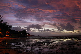
WAnse aux Anglais or English Bay is a small coastal village located in the north of the Mauritian island of Rodrigues in the Indian Ocean. Its name, French for "English Bay," is apparently linked with the fact that English troops landed on its beach in 1809 during the Napoleonic Wars between France and Great Britain.
 W
WAnse Quitor Nature Reserve is a 34 ha nature reserve on the island of Rodrigues, established in 1996, and preserving one of the sole surviving pieces of the island's coastal ecosystem.
 W
WBaie aux Huîtres is a coastal village located on the Mauritian island of Rodrigues in the Indian Ocean.
 W
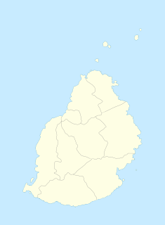
WBaie-du-Tombeau is a village in Mauritius located in the Pamplemousses District, situated near the Rivière du Tombeau. The village is administered by the Baie-du-Tombeau Village Council under the aegis of the Pamplemousses District Council. According to the census made by Statistics Mauritius in 2011, the population was at 14,687.
 W
WBambous is a small town in Mauritius located in the Rivière Noire District. The village is administered by the Bambous Village Council under the aegis of the Rivière Noire District Council. According to the census made by Statistics Mauritius in 2011, the population was at 15,345.
 W
WBeau-Vallon is a village in Mauritius located in Grand Port District. The village is administered by the Beau-Vallon Village Council under the aegis of the Grand Port District Council. According to the census made by Statistics Mauritius in 2011, the population was at 6,904.
 W
WBel Air Rivière Sèche, more often referred to simply as Bel Air, is a village in the Flacq district of Mauritius. The village is administered by the Bel Air Rivière Sèche Village Council under the aegis of the Flacq District Council. According to the census made by Statistics Mauritius in 2011, the population was at 17,605.
 W
WBel-Ombre is a village in Mauritius located in Savanne District. The village is administered by the Bel-Ombre Village Council under the aegis of the Savanne District Council. According to the census made by Statistics Mauritius in 2011, the population was 2,417.
 W
WBelle Vue Harel is a village in Mauritius that is located in the Rivière du Rempart District on the northern part of the island. It is located next to Amaury and Barlow villages. It is part of the larger Plaine des Papayes area which as of 2011 had 7,607 inhabitants.
 W
WBlack River Gorges National Park is a national park in the hilly south-western part of Mauritius. It was proclaimed on June 15, 1994 and is managed by the National Parks and Conservation Service. It covers an area of 67.54 km² including humid upland forest, drier lowland forest and marshy heathland. Facilities for visitors include two information centres, picnic areas and 60 kilometres of trails. There are four field stations in the park which are used for National Parks and Conservation Service and Mauritian Wildlife Foundation research and conservation projects.
 W
WCentre de Flacq or Central Flacq is the metropolitan area of Flacq District, located in the center of the district, the village is one of the most developed and popular villages in Mauritius. Home of several commercials and public institutions, the village topped the list of the most developed village in Flacq District. The village is administered by the Centre de Flacq Village Council under the aegis of the Flacq District Council. According to the census made by Statistics Mauritius in 2011, the population was at 15,791. The main source of transportation are taxi and bus service and English was registered as its official language and is highly exercised for notifications and advertisements.
 W
WEbony Forest Chamarel or just the "Ebony Forest" is a 50 ha conservation area for Mauritian endemic species with a rehabilitated indigenous forest, situated in Chamarel, in the south-west of Mauritius.
 W
WFond du Sac is a village in Mauritius located in Pamplemousses District. The village is administered by the Fond du Sac Village Council under the aegis of the Pamplemousses District Council. According to a census taken by Statistics Mauritius in 2011, the population was at 5,186.
 W
WThe Gerald Durrell Endemic Wildlife Sanctuary is an animal sanctuary founded in 1984, in Western Mauritius. It is an area closed off to the public, in the Black River Gorge region, which is densely forested, and is used for breeding rare, endemic Mauritian species. Among the endangered species in the sanctuary is the Mauritius kestrel, once the rarest bird in the world with only 4 members left. It has been successfully bred and the population has now reached the capacity of Mauritius.
 W
WGoodlands is a medium-sized town in northern Mauritius located in Rivière du Rempart District. The village is administered by the Goodlands Village Council under the aegis of the Rivière du Rempart District Council. It is one of the most populated villages in Mauritius, according to the census made by Statistics Mauritius in 2011, the population was at 20,712.
 W
WGrand Bois is a village located in the Savanne District of Mauritius. According to the Statistics Mauritius census in 2015, the population was 7,982.
 W
WGrand River South East (GRSE) is a historic village in the southeast of Mauritius in the Indian Ocean. It was named Groote River by the Dutch. In the 17th century, GRSE was used for stocking and shipping ebony wood under the Dutch Occupation. The inhabitants of Grand River South East live mostly from fishing. The village has about 1500 households. It also has an active small planters community. The other economic operators are the Deep River Beau Champ Sugar Estates and a hotel known as Laguna Beach. Village life is structured through the Village Council and a number of local organisations exist including those focusing on: women, youth, the aging and fishermen.
 W
WGrand-Baie is a coastal village in Mauritius located in Rivière du Rempart District, the western part also lies in the Pamplemousses District. The village is administered by the Grand-Baie Village Council under the aegis of the Rivière du Rempart District Council. According to the census made by Statistics Mauritius in 2011, the population was at 11,910.
 W
WGrande Montagne Nature Reserve is a 20 ha nature reserve on the island of Rodrigues, preserving one of the last remnants of the island's endemic forest.
 W
WHermitage Island is a small island lying south west of Port Sud-Est in Rodrigues, Mauritius. It is reputed to be the location of buried treasure and is a popular destination for tourists.
 W
WIle aux Aigrettes is an islet off the south-east coast of Mauritius. It functions as a nature reserve and a scientific research station.
 W
WÎle aux Cerfs is a privately owned island near the east coast of Mauritius in the Flacq District.
 W
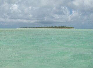
WÎle aux Cocos is a small island lying west of Rodrigues in the Indian Ocean. It is a nature reserve known for its seabird colonies, including the noddy, lesser noddy and fairy tern.
 W
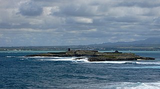
WÎle de la Passe is a rocky islet in the bay off Grand Port on the island of Mauritius. Between 20 and 25 August 1810, during the British campaign to capture the island from the French, it was the scene of the Battle of Grand Port. This was a long and very hard-fought action between roughly equal forces of French and British frigates and, on balance, a defeat for the British, who lost four frigates, though one of these was subsequently recaptured. The French squadron did not survive the British invasion of Mauritius.
 W
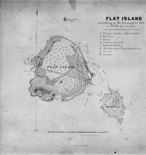
WÎle Plate, also known as Flat Island, is a small island off the north coast of Mauritius. It is located 11 kilometres north of Cap Malheureux, the mainland's northernmost point. The small nature reserve of Coin de Mire lies between the two islands. The similarly sized Île Ronde lies 13 kilometres further east.
 W
WThe Jardin Balfour, is a recreational park, where people come for various activities, such as exercises, watch tortoises, finding some solace moments and especially for kids who come to play in the area provided for them. It is situated in the beautiful location of Beau Bassin, Mauritius.
 W
WLa Preneuse is a public beach in western coast of the island Mauritius in the district of Rivière Noire located in the village of Black River. It was named after a French ship, the frigate Preneuse, which served as a commerce raider at Isle de France and was also involved in a naval battle with the British in the 18th century. The beach is home to the best preserved Martello tower in Mauritius.
 W
WLallmatie is a village in Mauritius—located on the west side of Flacq District—it occupied a latitude around -20.1897222 and a longitude around 57.6611111. It has a density of 793.5/km2 and a total population of around 11,910 inhabitants. Lallmatie is one of the most developed villages in Mauritius and has a wide natural resources which include vast sugarcane fields, dense forests and rivers.
 W
WLe Hochet is a village located in the Pamplemousses District of Mauritius. According to the Statistics Mauritius census in 2011, the population was 15,034.
 W
WMahébourg is a small town on the south-eastern coast of the island of Mauritius, having a population of 15,457 as of 2015. It is considered the main town of the Grand Port District.
 W
WMapou is a village in northern Mauritius, located in Rivière du Rempart District. The village is administered by the Mapou Village Council under the aegis of the Rivière du Rempart District Council. According to the census made by Statistics Mauritius in 2011, the population was 1,275.
 W
WMare aux Vacoas is the largest reservoir in Mauritius. It is located in Plaines Wilhems, in the southwest of the island, to the south of the town of Curepipe. It has a capacity of 25,890,000 cubic metres (914,000,000 cu ft) and provides water to the upper Plaines Wilhems and to Moka.It was constructed in 1885.
 W
WMoka is a district of Mauritius, situated in the central plateau of the island. The district has an area of 230.5 km2 and the population estimate was at 83,251 as of 31 December 2015.
 W
WThe Moka Range is a mountain range in Mauritius. It contains two of Mauritius's three tallest peaks, Pieter Both and Le Pouce. It was formed from a basalt lava dome ten million years ago. The Moka Range forms a semicircle around the capital of Mauritius, Port Louis.
 W
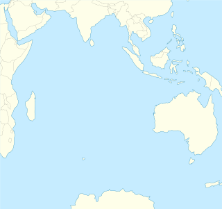
WNazareth Bank is a large submerged bank in the Indian Ocean.
 W
WPamplemousses is a district of Mauritius, located in the north west of the island, and is one of the most densely populated parts of the island. The name of the district comes from the French word for grapefruits. The district has an area of 178.7 km2 and the population estimate was at 139,966 as of 31 December 2015.
 W
WPieter Both, sometimes referred to as Peter Botte Mountain, is the second highest mountain of Mauritius, at 820 metres (2,690 ft) tall. The mountain is shorter than Piton de la Petite Rivière Noire by eight metres. It is named after Pieter Both, the first Governor-General of the Dutch East Indies. It is located in the Moka Range.
 W
WPiton de la Petite Rivière Noire is the highest mountain on the island of Mauritius, in the Indian Ocean. Located in the Rivière Noire District and rising to a height of 828 m (2717 ft) above sea level, it forms part of the Black River mountain range.
 W
WPlaine Magnien is a village in southeast Mauritius located in the Grand Port District. Saint Esprit Prestige Store, one of the most popular retail store of the village, is found on the main road near the Mauritius Commercial bank. Plaine Magnien has an all girls State Secondary School, France Boyer de la Giroday SSS. In addition, it is the birthplace of the former Governor-General of Mauritius, Dayendranath Burrenchobay. According to the Statistics Mauritius census in 2011, the population was at 10,443. The village is the location of the only airport on the island, Sir Seewoosagur Ramgoolam International Airport.
 W
WPlaines Wilhems is a district of Mauritius. It is the most populous district, with its population estimated at 368,621 as of 31 December 2015. The district is mainly urban; it consists of four towns, the village of Midlands and part of two other villages. The Plaines Wilhems district does not have a District Council; it has four Municipal Town Councils. The towns are Beau-Bassin Rose-Hill, Curepipe, Quatre Bornes and Vacoas-Phoenix. The villages are Midlands, Cascavelle and Moka. The district was named after Wilhem Leicknig. Of Prussian origin, he settled on the island of Mauritius, then known as Isle de France, in 1721.
 W
WPort Louis is a district of Mauritius, located in the north west of the island, it is the smallest district and has the highest population density. The district is wholly covered by Port Louis, the capital of the country. Port Louis district has an area of 42.7 km2 and the population estimate was at 119,706 as at 31 December 2015.
 W
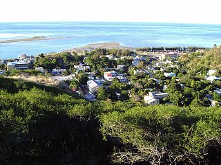
WThe village of Port Mathurin serves as the capital of the island of Rodrigues, a dependency of Mauritius. It lies on the north coast of the Indian Ocean island and functions as the administrative, judicial and economic centre of Rodrigues. As the name suggests, it also operates the main harbour of the island.
 W
WQuatre Bornes also known as La Ville des Fleurs, is a town in Mauritius, located in the Plaines Wilhems District, the western part also lies in the Rivière Noire District. The town is administered by the Municipal Council of Quatre Bornes. Situated between the towns of Beau-Bassin Rose-Hill and Vacoas-Phoenix, Quatre Bornes is linked by roads to the north, east, south and west of Mauritius. According to the census made by Statistics Mauritius in 2015, the population of the town was at 77,308.
 W
WQuatre Cocos is a village in the District of Flacq on the East of the island of Mauritius, the main island of the Republic of Mauritius. It is located at -20.2078 [latitude in decimal degrees], 57.7625 [longitude in decimal degrees] and at an average elevation/altitude of meters of 39 metres above sea level.
 W
WRempart Mountain is a mountain near Tamarin in the western Mauritius district of Rivière Noire.
 W
WRivière Du Poste is a village in the south part of Mauritius located in both Savanne and Grand Port district. The locality is about 19 miles south of Port Louis, the country's capital. The village is administered by the Rivière du Poste Village Council under the aegis of the Savanne District Council. According to the census made by Statistics Mauritius in 2011, the population was at 2,170. The neighboring villages are La Flora, Mare Tabac and Rose Belle and Camp Diable and Riviere Dragon in the south of the village.
 W
WRivière du Rempart is a district of Mauritius, located in the North-East of the island, having an area of 147.6 km². The population estimate was at 108,005 as at 31 December 2015.
 W
WRochester Falls is a waterfall situated in the Savanne district of Mauritius. Highly popular for its rectangular flank rocks, the fall is one of the most popular tourist attractions and the widest waterfall in Mauritius.
 W
WRose-Belle is a small town of southeastern Mauritius. It is located in Grand Port district, ten kilometers west of the district's well known town, Mahébourg.
 W
WSainte-Croix is a suburb of the capital city, Port Louis, in Mauritius, an independent island in the Indian Ocean.
 W
WSavanne or Savannah is a district of Mauritius, situated in the south of the island. The district has an area of 244.8 km2 and the population estimate was at 68,585 as at 31 December 2015. The southern part of the island is one of the most scenic and unspoilt.
 W
WSurinam is a village located in the Savanne District of Mauritius. According to the Statistics Mauritius census in 2011, the population was 10,507.
 W
WTrou aux Cerfs is a dormant volcano with a well-defined cone and crater. It is 605 m (1,985 ft) high and located in Curepipe, Mauritius. The crater has been alternately described as 300 and 350 meters in diameter, and is 80 meters deep.
 W
WTrou-aux-Biches is a small town with a public beach on the northern coast of Mauritius in the district of Pamplemousses. According to the World Travel group, the beach is one of the most beautiful on the island. They awarded it the World's Leading Beach Destination at the World Travel Award for 2011. Many tourist resorts and boutique hotels are situated near the beach, such as the Trou aux Biches Resort & Spa. From Port Louis, the M2 highway heads towards it, with Trou-aux-Biches about 1.5 kilometres (1 mi) west from the end of M2. The airport and the town are connected by a public bus.
 W
WVacoas-Phoenix also known as French: Villes Jumelles, is a town in Mauritius, located in the Plaines Wilhems District, the eastern part also lies in the Moka District. The town is administered by the Municipal Council of Vacoas-Phoenix. The town lies between Quatre Bornes and Curepipe.
 W
WVallée d'Osterlog or Osterlog Valley is a botanical garden of Mauritian endemic species and a rehabilitated indigenous forest, situated in Le Val, in the south-east of Mauritius.
 W
WVingt Cinq is the capital of the Agaléga Islands, two islands in the Indian Ocean, governed by Mauritius. It is located on the North Island, near a small airfield. In the town, there is a primary school and a hospital. The name, Vingt Cinq, is believed to refer to the number of lashes that slaves on the island received as punishment.