 W
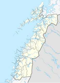
WAnden or Anda is a small island in the municipality of Øksnes in Nordland county, Norway. It lies in the Vesterålen archipelago, about 5 kilometres (3.1 mi) north of the village of Stø on the northern tip of the large island of Langøya, and about 14 kilometres (8.7 mi) west of the large island of Andøya. It is home to the Anda Lighthouse, which was the last lighthouse in Norway to be automated.
 W
WAusterdalsbreen is a glacier in the municipality of Luster in Vestland, Norway. It is a side branch of the Jostedalsbreen glacier, and is included in the Jostedalsbreen National Park. The glacier is fed by the three steep glaciers Odinbreen, Torbreen and Lokebreen. The lower, flat part of the glacier displays a characteristic fishbone or lobster tail pattern.
 W
WBenn Skerries are a small group of rocks which extend up to 0.25 nautical miles (0.5 km) westward from Norvegia Point on the island of Bouvetøya. They were charted and named in December 1927 by a Norwegian expedition in the Norvegia under Captain Harald Horntvedt.
WBolle Bay is a cove indenting the western shore of Bouvetøya, entered on the southern side of Norvegia Point. Roughly charted in 1898 by the German expedition under Carl Chun, it was re-charted and named in December 1927 by a Norwegian expedition under Captain Harald Horntvedt.
 W
WBreheimen National Park is a national park that was established in 2009. The park is located in the municipalities of Skjåk and Lom in Innlandet county and in Luster in Vestland county, Norway. The park covers 1,671 square kilometres (645 sq mi) of the Breheimen mountain range.
WCato Point is a headland forming the southwest extremity of Bouvet Island. It was first charted in 1898 by a German expedition under Carl Chun. The Norwegian expedition under Captain Harald Horntvedt made a landing here from the Norvegia in December 1927; they applied the name.
WChristensen Glacier is a glacier which flows to the south coast of the island of Bouvetøya, 1 nautical mile (2 km) east of Cato Point. It was first charted in 1898 by a German expedition under Carl Chun, and recharted in December 1927 by a Norwegian expedition under Captain Harald Horntvedt. It was named by Horntvedt after Lars Christensen, the sponsor of the expedition.
WCape Circoncision is a peninsula on the north-western edge of subantarctic Bouvetøya. The small peninsula was sighted by the French naval exploration that was led by Jean-Baptiste Charles Bouvet de Lozier on 1 January 1739, which day is the Feast of the Circumcision after which it is named. The cape provided the location for the base-camp of the 1928-29 Norwegian expedition.
WCape Fie, located at 54°27′S 3°28′E, is a cape marking the southeast extremity of Bouvetøya in the South Atlantic Ocean. It was first roughly charted in 1898 by a German expedition under Carl Chun, and was re-charted and named by the Norwegian expedition under Captain Harald Horntvedt who explored the area from the Norvegia in December 1927.
 W
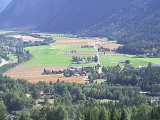
WFlatdal is a village, parish and valley in the municipality of Seljord in Vestfold og Telemark, Norway. The lake Flatsjå has been partly drained to gain more land for agriculture.
Forlandet National Park lies on the Norwegian archipelago of Svalbard. The park was created by a royal resolution on June 1, 1973 and covers the entire island of Prins Karls Forland and well as the sea around it. The Norwegian national park has an area of 616 km2 and a marine area of 4031 km2.
WFresvikbreen is a glacier on the south side of the Sognefjord in the municipality of Vik in Vestland, county, Norway. It lies between the Seljedal valley in the west, and the Storedal valley in the east. It is 9 kilometres (5.6 mi) southwest of the village of Fresvik and 11 kilometres (6.8 mi) southeast of the municipal center of Vikøyri.
 W
WFuglenes is a district in the municipality of Hammerfest in Norway. It is the location of the northernmost point of the Struve Geodetic Arc. It is a geodetic point, one of the 34 points selected for the World Heritage List. It was here that Friedrich Georg Wilhelm von Struve's surveys ended in 1852. Fuglenes means 'the birds' in Norwegian.
 W
WGjøa oilfield is an oilfield in the Norwegian section of the North Sea. It lies about 70 kilometres (43 mi) off the Troll field.
WHardangerjøkulen is the sixth largest glacier in mainland Norway. It is located in the municipalities of Eidfjord and Ulvik in Vestland county. It is located about 16 kilometres (9.9 mi) northeast of the village of Eidfjord, about 5 kilometres (3.1 mi) south of the village of Finse, and about 20 kilometres (12 mi) west of the village of Haugastøl.
 W
WThe Heidrun oil field is an oil and gas field discovered in 1985 in the Norwegian sector of the Norwegian Sea, named after the goat Heiðrún from Norse mythology.
 W
WHemskilen is a plant and wildlife preserve with a wetland area known for its unique vegetation and fauna. It is located near the island Storøya on the Sandefjord-Larvik border in Vestfold County. Hemskilen is, at 335 decares, one of the largest preserves of its kind in the county. A bird sanctuary was established on the outside of the preserve in 2009. The nature preserve was established in 1981 and consists mostly of wetland and mudflats. It is a regionally important site due to its avifauna, including sea birds, ducks, wading birds, geese, and perching birds. It is also one of Vestfold’s most important habitats for the grey heron, while raptors such as the sea hawk and Western marsh harrier can also regularly be observed at Hemskilen. The Pectoral sandpiper is one of the many rare bird species often observed at Hemskilen. It is one of the most important wetlands in Vestfold County. The ancient monument Istrehågan is located 2 km northwest of Hemskilen.
 W
WHermansen Island Bird Sanctuary is a bird reserve at Svalbard, Norway, established in 1973. It includes Hermansen Island on the west coast of Oscar II Land. The protected area covers a total area of around 4,200,000 square metres.
WHorntvedt Glacier is a small glacier flowing to the north coast of the island of Bouvetøya. It is situated immediately east of Cape Circoncision. It was first charted in 1898 by a German expedition under Carl Chun, and recharted in December 1927 by a Norwegian expedition which named it for Harald Horntvedt (1879-1946), the captain of the expedition ship Norvegia.
 W
WKjerulf Glacier is a glacier in Jan Mayen. It begins at the Hakluyttoppen slope, in the outer crater edge of the Beerenberg. The Kjerulf Glacier and both its neighbors, the Weyprecht Glacier in the west and the Svend-Foyn Glacier in the east, are the most active glaciers in the island.
 W
WLangfjordjøkelen is a glacier that is located in Troms og Finnmark county in Norway, making it one of the northernmost glaciers on the mainland of Norway. The 8-square-kilometre (3.1 sq mi) glacier is located on the border of Loppa Municipality and Kvænangen Municipality. The highest point on the glacier reaches 1,050 metres (3,440 ft) above sea level.
WLarsøya, sometimes anglicized as Lars Island, is a rocky island, less than 0.2 nautical miles (0.4 km) long, which lies just off the southwestern extremity of the island of Bouvetøya in the South Atlantic Ocean. It was first roughly charted in 1898 by a German expedition under Carl Chun. The Norwegian expedition under Captain Harald Horntvedt made a landing on the island from the ship Norvegia in December 1927, and named it after Lars Christensen, sponsor of the expedition.
WLille Kari Rock is an insular rock 2 metres (7 ft) high which lies 1.2 nautical miles (2.2 km) northwest of Cape Lollo on the island of Bouvetøya in the South Atlantic Ocean. It was charted from the ship Norvegia in December 1927 by a Norwegian expedition under Captain Harald Horntvedt, and was named by Horntvedt in association with Store Kari Rock which lies 1 nautical mile (2 km) westward.
WLindsay Reef is a reef lying close north of Cape Meteor on the east side of the island of Bouvetøya in the South Atlantic Ocean. The reef was first charted in 1898 by a German expedition under Carl Chun. It was recharted in December 1927 by a Norwegian expedition under Captain Harald Horntvedt, and named by the Norwegians after Captain James Lindsay, a British whaler in command of the Swan who, in the company of Captain Thomas Hopper with the Otter, sighted Bouvetøya in 1808.
WCape Lollo, located at 54°25′S 3°29′E, is a cape which forms the northeastern extremity of Bouvetøya in Norway. It was first charted in 1898 by a German expedition under Carl Chun, and was recharted and named in December 1927 by a Norwegian expedition under Captain Harald Horntvedt.
 W
WLong Forties is an area of the northern North Sea that is fairly consistently forty fathoms deep.
WLykketoppen, occasionally anglicized as Lykke Peak, is a snow-covered, 765-meter (2,510 ft) tall summit that surmounts the southwest part of Bouvetøya, standing 1 nautical mile (2 km) east of Norvegia Point. It was first roughly charted in 1898 by a German expedition under Carl Chun, and was recharted and named in December 1927 by the First Norvegia Expedition under Captain Harald Horntvedt.
WCape Meteor is a cape marked by steep cliffs in the coastal area of Mowinckelkysten, north of Svartstranda beach, and forms the eastern extremity of the Bouvetøya in the South Atlantic.
 W
WMjølnir is a meteorite crater on the floor of Barents Sea off the coast of Norway. It is 40 km (25 mi) in diameter and the age is estimated to be 142.0 ± 2.6 million years. The bolide was an estimated 2 km (1.2 mi) wide.
WMorrell Reef is a reef reported to lie close off the southeast coast of Bouvetøya, about 0.4 nautical miles (0.7 km) northward of Cape Fie. It was first charted in 1898 by a German expedition under Carl Chun, and was recharted in December 1927 by a Norwegian expedition under Captain Harald Horntvedt. The reef was named by the Norwegians after Captain Benjamin Morrell, an American sealer who visited the northwest side of Bouvetøya in the Wasp in 1822, perhaps making the first landing on the island.
WMosbytoppane, are two crags to the southwest of the caldera of the island of Bouvetøya. The tallest is a snow-covered peak 670 meters (2,200 ft) above mean sea level and 1.3 kilometers (0.81 mi) northeast of Norvegiaodden. It was charted by the First Norvegia Expedition in 1927–28, under Captain Harald Horntvedt. It is named for Hakon Mosby, an oceanographer and meteorologist who was one of two scientists on the expedition.
WMowinckelkysten is a coastal area at the southeastern side of the island of Bouvetøya. It is named after Johan Ludwig Mowinckel, the Norwegian Prime Minister at the time when Norwegian sovereignty over the island was established. It extends from Kapp Fie to Kapp Lollo. The coast includes Kapp Meteor, the easternmost point of the island. South of Kapp Meteor is the black sandy beach Svartstranda.
 W
WThe Njord oil field is an oil field 30 kilometres (19 mi) west of the Draugen field, in the Norwegian Sea. The field lies around 130 kilometres (81 mi) northwest of Kristiansund municipality, Norway. Although the field was discovered in 1986, production did not begin until 1997. Operation facilities at the field consist of Njord A, a floating steel platform unit, containing drilling and processing facilities, and Njord Bravo, a storage vessel.
Nordenskiöld Land National Park lies on Spitsbergen island in the Svalbard archipelago, Norway. Its area includes also the icefree Reindalen. The park was opened in 2003.
 W
WNordmarka is the mostly forested region which makes up the northern part of Oslo, Norway. Nordmarka is the largest and most central part of Oslomarka. The area called Nordmarka also extends into the municipalities of Hole, Ringerike, Lunner, Jevnaker and Nittedal. It is the largest part of the Marka borough.
 W
WNordre Isfjorden National Park lies on Spitsbergen Island in the Svalbard archipelago, Norway. It lies across the Isfjorden north of Barentsburg. The park was opened in 2003.
Nordvest-Spitsbergen National Park is located on the Norwegian arctic archipelago of Svalbard and includes parts of north-west Spitsbergen and nearby islands such as Danes Island and Moffen. It contains, among other things, warm springs and remains of volcanoes in Bockfjorden.
WNorris Reef is a reef lying close off the western shore of the island of Bouvetøya, 0.5 nautical miles (0.9 km) southwest of Cape Circoncision. First charted in 1898 by a German expedition under carl Chun. Recharted in December 1927 by a Norwegian expedition under Captain Harald Horntvedt. Named by the Norwegians after British sealer Captain George Norris who, commanding the sealers Sprightly and Lively, visited Bouvetoya in 1825.
WNorvegia Point, is a point 2 nautical miles (3.7 km) south of Cape Circoncision on the west side of the island of Bouvetøya. First roughly charted from the Valdivia in 1898 by a German expedition under Carl Chun. Recharted in December 1927 by a Norwegian expedition under Captain Harald Horntvedt. Named by Horntvedt after his expedition ship, the Norvegia I.
WNorvegia Rock is a submerged rock with less than 2 m of water over it, lying off the north coast of the island of Bouvetøya, approximately 0.5 nautical miles (0.9 km) east-northeast of Cape Valdivia. Norvegia I, the ship of the Norwegian expedition under Captain Harald Horntvedt, struck a rock here on December 3, 1927. Named by the expedition after the Norvegia I.
 W
WThe Norwegian continental shelf is the continental shelf over which Norway exercises sovereign rights as defined by the United Nations Convention on the Law of the Sea.
 W
WØksfjordjøkelen (Norwegian) or Ákšovuonjiehkki (Northern Sami) is the ninth largest glacier in mainland Norway. The glacier is located in Troms og Finnmark county. The 42-square-kilometre (16 sq mi) glacier lies in both Loppa and Kvænangen municipalities.
WOlavtoppen, occasionally anglicised as Olav Peak, is the highest point of Bouvet Island, a volcanic island and dependency of Norway, and the remotest island on Earth. Olavtoppen is located north of the center of the island, immediately south of Kapp Valdivia, and rises 780 meters (2,560 ft) above mean sea level. It was first ascended on 21 February 2012 by Aaron Halstead, Will Allen, Bruno Rodi and Jason Rodi
WPosadowsky Glacier is a glacier which flows to the north coast of the island of Bouvetøya in the Southern Atlantic Ocean. It is 1 nautical mile (1.9 km) eastward of Cape Circoncision.
WRustad Knoll is a rounded, snow-topped elevation which surmounts the south shore of the island of Bouvetøya immediately east of Cato Point. First charted in 1898 by a German expedition under Carl Chun. The knoll was recharted in December 1927 by the Norvegia expedition under Captain Harald Horntvedt. They named it for Ditlef Rustad who was in charge of the biological research of the expedition.
WSachse Rocks is a group of submerged rocks which lie close to the northern coast of the island of Bouvetoya and approximately 0.2 miles (0.3 km) southeast of Cape Valdivia. The rocks were charted and named by the Norwegian expedition, 1927–28, under Captain Harald Horntvedt. Named for Walter Sachse, a navigation officer on the German vessel SS Valdivia who in 1898 accurately fixed the position of the island for the first time.
Sassen–Bünsow Land National Park lies on Spitsbergen island in the Svalbard archipelago, Norway. The park was opened in 2003 and includes both glaciers and several glacially carved valleys. The sealer/whaler Hilmar Nøis built the hunting station Fredheim on the north side of the Sassen river outlet in this area. One of Spitsbergen's highest waterfalls lies in Eskerdalen inside the park.
WSeilandsjøkelen is a glacier that is located on the island of Seiland in Troms og Finnmark county, Norway. The 14-square-kilometre (5.4 sq mi) glacier is located in the municipalities of Hammerfest and Alta. The glacier is located inside Seiland National Park, about 5 kilometres (3.1 mi) southeast of the mountain Seilandstuva.
Sør-Spitsbergen National Park encompasses the southern end of Spitsbergen island in the Svalbard archipelago, Norway. The park was opened in 1973 and includes Wedel Jarlsberg Land, Torell Land and Sørkapp Land. Over 65% of the region is ice cap, with much of the rest tundra.
 W
WSpeilsalen was a natural glacial formation caused by a river underneath a glacier in the Trollheimen mountains in the municipality of Oppdal in Trøndelag county, Norway. It was located at the northeast base of the mountain Blåhøa.
WSpiess Rocks is a group of submerged rocks which extend up to 0.4 nautical miles (0.7 km) northeast of Cape Lollo on the island of Bouvetøya. First charted in December 1927 by a Norwegian expedition under Captain Harald Horntvedt. Named by the Norwegians for Captain Fritz A. Spiess, leader of the German expedition which visited Bouvetoya on board the "Meteor" in 1926.
 W
WStåvatn is a lake located in Vinje municipality in Vestfold and Telemark as well as Ullensvang municipality in Vestland, Norway. It is part of the Skiensvassdraget and has an outlet to the river Kjela which flows down to Kjelavatn and further down towards Haukeli and Edland.
WStrupbreen is a glacier located in Lyngen Municipality in Troms og Finnmark county, Norway. The 8.7-square-kilometre (3.4 sq mi) glacier is located in the Lyngen Alps, about 12 kilometres (7.5 mi) north of the village of Lyngseidet. Historically, the glacier has at times reached all the way down to the Lyngenfjorden. Today the end of the glacier lies about 2 kilometres (1.2 mi) from the shoreline, with a small stream of water flowing from the glacier to the fjord.
 W
WThompson Island was a phantom island in the South Atlantic. According to the Global Volcanism Program, it was thought to be about 70 km north-northeast of Bouvet Island, a small Norwegian dependency between South Africa and Antarctica.
WCape Valdivia is the northernmost point on Bouvet Island in the South Atlantic Ocean. The subantarctic Bouvet Island is administered by Norway.
 W
WWeyprecht Glacier is a glacier in Jan Mayen. It is the longest glacier located in the Beerenberg area.
WWilliams Reef is a reef which extends southward for about 0.5 nautical miles (0.9 km) from Cape Fie in the island of Bouvetøya. The reef was charted in 1898 by a German expedition in the Valdivia under Carl Chun. It was recharted in December 1927 by a Norwegian expedition and named for Captain John Williams, an American sealer who had visited Bouvetoya in the schooner Golden West in 1878, making a landing on the island.