 W
WRalph Agas was an English land surveyor and cartographer. He was born at Stoke-by-Nayland, Suffolk, in about 1540, and lived there throughout his life, although he travelled regularly to London. He began to practise as a surveyor in about 1566, and has been described as "one of the leaders of the emerging body of skilled land surveyors".
 W
WBattista Agnese was a cartographer from the Republic of Genoa, who worked in the Venetian Republic.
 W
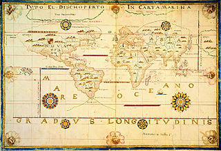
WHacı Ahmet was a purported Muslim cartographer linked to a 16th-century map of the world. Ahmet appended a commentary to the map, outlining his own life and an explanation for the creation of the map. But it is not clear whether Ahmet created the map, or whether he simply translated it into Turkish for use in the Ottoman world.
 W
WCornelis Anthonisz., Anthonisz. also spelled Anthonissen or Teunissen, was a Dutch painter, engraver, and mapmaker.
 W
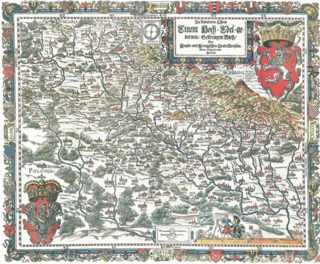
WPhilipp Apian was a German mathematician and medic. The son of Petrus Apianus (1495–1552), he is also known as the cartographer of Bavaria.
 W
WPetrus Apianus, also known as Peter Apian, Peter Bennewitz, and Peter Bienewitz, was a German humanist, known for his works in mathematics, astronomy and cartography. His work on "cosmography", the field that dealt with the earth and its position in the universe, was presented in his most famous publications, Astronomicum Caesareum (1540) and Cosmographicus liber (1524. His books were extremely influential in his time, with the numerous editions in multiple languages being published until 1609. The lunar crater Apianus and asteroid 19139 Apian are named in his honour.
 W
WPieter Bast was a Dutch cartographer, engraver and draftsman.
 W
WWillem Janszoon Blaeu, also abbreviated to Willem Jansz. Blaeu, was a Dutch cartographer, atlas maker and publisher. Along with his son Johannes Blaeu, Willem is considered one of the notable figures of the Netherlandish/Dutch school of cartography in its golden age.
 W
WGiovanni Battista Boazio or Battista Boazio was an Italian draftsman and cartographer. He mapped Sir Francis Drake's voyage to the West Indies and America.
 W
WStefano Bonsignori or Buonsignori was an Italian Olivetan monk and cartographer to Francesco I, Grand Duke of Tuscany. He was born in Florence and is most notable for his eponymous Bonsignori Map of Florence.
 W
WBenedetto Bordone (1460–1531) was a manuscript editor, miniaturist and cartographer, he was born in Padua, then part of the Republic of Venice.
 W
WGeorg Braun was a topo-geographer. From 1572 to 1617 he edited the Civitates orbis terrarum, which contains 546 prospects, bird's-eye views and maps of cities from all around the world. He was the principal editor of the work, he acquired the tables, hired the artists, and wrote the texts. He died as an octogenarian in 1622, as the only survivor of the original team to witness the publication of volume VI in 1617.
 W
WHeinrich Bünting was a Protestant pastor and theologian. He is best known for his book of woodcut maps titled Itinerarium Sacrae Scripturae first published in 1581.
 W
WJohan van den Corput (also van Kornput, also Cornput or Johannes de Corput, in German literature Johannes Corputius was a Dutch engineer, cartographer and military leader.
 W
WIgnazio Danti, O.P., born Pellegrino Rainaldi Danti, was an Italian Roman Catholic prelate, mathematician, astronomer, and cosmographer, who served as Bishop of Alatri (1583–1586).
 W
WPierre Desceliers was a French cartographer of the Renaissance and an eminent member of the Dieppe School of Cartography. He is considered the father of French hydrography.
 W
WFernão Vaz Dourado was a Portuguese cartographer of the sixteenth century, belonging to the third period of the old Portuguese nautical cartography, which is characterised by the abandonment of Ptolemaic influence in the representation of the Orient and introduction of better accuracy in the depiction of lands and continents. Little is known about this historical figure.
 W
WOronce Finé was a French mathematician and cartographer.
 W
WGiacomo Gastaldi was an Italian cartographer, astronomer and engineer of the 16th century. Gastaldi began his career as an engineer, serving the Venetian Republic in that capacity until the fourth decade of the sixteenth century. From about 1544 he turned his attention entirely to mapmaking, and his work represents several important turning points in cartographic development.
 W
WGiorgio Sideri called Callapoda was a 16th-century cartographer, born in Candia (Crete), who worked in Venice, where map-making skills were essential to the mercantile economy and to protection and control of the far-flung Venetian thalassocracy.
 W
WGirolamo Ruscelli (1518–1566) was an Italian mathematician and cartographer active in Venice during the early 16th century. He was also an alchemist, writing pseudonymously as Alessio Piemontese.
 W
WEstêvão Gomes, also known in the Spanish version of his name as Esteban Gómez, was a Portuguese cartographer and explorer. He sailed at the service of Castile (Spain) in the fleet of Ferdinand Magellan, but deserted the expedition when they had reached the Strait of Magellan, and returned to Spain in May 1521. In 1524 he explored present-day Nova Scotia. While historical accounts vary, Gomes may have entered New York Harbor and seen the Hudson River. Because of his expedition, the 1529 Diogo Ribeiro world map outlines the East coast of North America almost perfectly.
 W
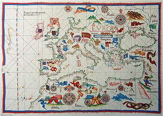
WGuillaume Brouscon was a Breton cartographer of the Dieppe school in the 16th century. He was from the port of Le Conquet, near Brest, which is shown prominently in large red lettering on his 1543 map of the world.
 W
WDiego Gutiérrez was a Spanish cosmographer and cartographer of the Casa de la Contratación. He was given this post by royal appointment on October 22, 1554, after the death of his father Dylanger in January 1554, and worked on the Padrón Real, the Spanish master map.
 W
WMartin Helwig was a German cartographer of and from Silesia and pedagogue. He was born in Neisse and died in Breslau, Holy Roman Empire.
 W
WDiogo Homem (1521–1576) was a Portuguese cartographer, son of Lopo Homem and member of a family of cartographers.
 W
WLopo Homem was a Portuguese cartographer and cosmographer.
 W
WJodocus Hondius was a Flemish engraver and cartographer. He is sometimes called Jodocus Hondius the Elder to distinguish him from his son Jodocus Hondius II. Hondius is best known for his early maps of the New World and Europe, for re-establishing the reputation of the work of Gerard Mercator, and for his portraits of Francis Drake. One of the notable figures in the Golden Age of Dutch/Netherlandish cartography, he helped establish Amsterdam as the center of cartography in Europe in the 17th century.
 W
WJohannes Honter was a Transylvanian Saxon, renaissance humanist, Protestant reformer, and theologian. Honter is best known for his geographic and cartographic publishing activity, as well as for implementing the Lutheran reform in Transylvania and founding the Evangelical Church of Augustan Confession in Romania.
 W
WCornelis de Hooghe was a 16th-century engraver and mapmaker from the Northern Netherlands.
 W
WJohn Hooker alias John Vowell of Exeter in Devon, was an English historian, writer, solicitor, antiquary, and civic administrator. From 1555 to his death he was Chamberlain of Exeter. He was twice MP for Exeter in 1570/1 and 1586, and for Athenry in Ireland in 1569 and wrote an influential treatise on parliamentary procedure. He wrote an eye-witness account of the siege of Exeter during the Prayer Book Rebellion in 1549. He spent several years in Ireland as legal adviser to Sir Peter Carew, and following Carew's death in 1575 wrote his biography. He was one of the editors of the second edition of Raphael Holinshed's Chronicles, published in 1587. His last, unpublished and probably uncompleted work was the first topographical description of the county of Devon. He founded a guild of Merchant Adventurers under a charter from Queen Mary. He was the uncle of Richard Hooker, the influential Anglican theologian.
 W
WAntonio Lafreri, or Antoine Lafréry, also Antoine du Pérac Lafréry, was a French engraver, cartographer and publisher, active in Rome.
 W
WWolfgang Laz, better known by his Latinized name Wolfgang Lazius, was an Austrian humanist who worked as a cartographer, historian, and physician.
 W
WJacques le Moyne de Morgues (c. 1533–1588) was a French artist and member of Jean Ribault's expedition to the New World. His depictions of Native American life and culture, colonial life, and plants are of extraordinary historical importance.
 W
WVisconte Maggiolo, also spelled Maiollo and Maiolo, was a Genoese cartographer.
 W
WPedro de Medina was a Spanish cartographer and author of navigational texts. His well-known Arte de navegar was the first work published in Spain dealing exclusively with navigational techniques.
 W
WRumold Mercator (1545–1599) was a cartographer and the son of cartographer Gerardus Mercator.
 W
WAntonio Millo, also mentioned as Antonio da Millo or Antonio Milo, active during 1557–1590, was captain and cartographer with significant work in map making, isolarios and portolan charts.
 W
WEmery Molyneux was an English Elizabethan maker of globes, mathematical instruments and ordnance. His terrestrial and celestial globes, first published in 1592, were the first to be made in England and the first to be made by an Englishman.
 W
WUrbano Monti was an Italian cartographer.
 W
WSebastian Münster was a German cartographer, cosmographer, and a Christian Hebraist scholar. His work, the Cosmographia from 1544, was the earliest German description of the world.
 W
WJohn Norden was an English cartographer, chorographer and antiquary. He planned a series of county maps and accompanying county histories of England, the Speculum Britanniae. He was also a prolific writer of devotional works.
 W
WManuel de Mesquita Perestrelo was a Portuguese navigator and cartographer.
 W
WTomaso Porcacchi Castilione (1530–1576) was an author and cartographer.
 W
WPedro Reinel was a Portuguese cartographer, author of one of the oldest signed Portuguese nautical charts. That is a portolan type of chart, covering western Europe and part of Africa, and already reflecting the explorations made by Diogo Cão in 1482–1485. With his son Jorge Reinel, and the cartographer Lopo Homem, he participated in the construction of the well-known Miller Atlas (1519). His Atlantic Chart of c. 1504 is the earliest known nautical chart with a scale of latitudes, and the first to depict a wind rose with a clearly drawn fleur-de-lys. He has a Portuguese postage stamp in his honour.
 W
WAdriaan Reland was a noted Dutch Orientalist scholar, cartographer and philologist. Even though he never left the Netherlands, he made significant contributions to Middle Eastern and Asian linguistics and cartography, including Persia, Japan and the Holy Lands.
 W
WDiogo Ribeiro, known in Spanish as Diego Ribero, was a Portuguese cartographer and explorer who worked most of his life in Spain. He worked on the official maps of the Padrón Real from 1518–1532. He also made navigation instruments, including astrolabes and quadrants.
 W
WJean Rotz, also called Johne Rotz, was a 16th-century French artist-cartographer. He was born to a Scottish father and a French mother.
 W
WJohn Rudd was a Tudor cartographer and clergyman.
 W
WAlonzo de Santa Cruz was a Spanish cartographer, mapmaker, instrument maker, historian and teacher. He was born about 1505, and died in November 1567. His maps were inventoried in 1572.
 W
WChristopher Saxton was an English cartographer who produced the first county maps of England and Wales.
 W
WJohn Speed was an English cartographer and historian. He is, alongside Christopher Saxton, one of the best known English mapmakers of the early modern period.
 W
WLuís Teixeira or Ludovico Teixeira was a 16th-century Portuguese, cartographer, and mathematician. He had two sons, also cartographers.
 W
WGaspard van der Heyden was a goldsmith, engraver, master printer and builder of precision astronomical instruments including terrestrial and celestial globes from Leuven, Belgium. He was well known among the humanists in Leuven as well as among scientists and mathematicians.
 W
WBartolomeu Velho was a sixteenth-century Portuguese cartographer and cosmographer.
 W
WAmerigo Vespucci was an Italian merchant, explorer, and navigator from the Republic of Florence, from whose name the term "America" is derived.
 W
WJohann(es) Werner was a German mathematician. He was born in Nuremberg, Germany, where he became a parish priest. His primary work was in astronomy, mathematics, and geography, although he was also considered a skilled instrument maker.
 W
WEdward Wright was an English mathematician and cartographer noted for his book Certaine Errors in Navigation, which for the first time explained the mathematical basis of the Mercator projection by building on the works of Pedro Nunes, and set out a reference table giving the linear scale multiplication factor as a function of latitude, calculated for each minute of arc up to a latitude of 75°. This was in fact a table of values of the integral of the secant function, and was the essential step needed to make practical both the making and the navigational use of Mercator charts.
 W
WCornelius Wytfliet or Cornelis van Wytfliet was a geographer from Leuven in the Habsburg Netherlands, best known for producing the first atlas of the Americas.