 W
WAlpspitz is a mountain in Liechtenstein in the Rätikon range of the Eastern Alps, to the east of Vaduz, with a height of 1,943 metres (6,375 ft) or 1942 m.
 W
WAugstenberg is a mountain in Liechtenstein in the Rätikon range of the Eastern Alps close to the border with Austria and the town of Malbun, with a height of 2,359 metres (7,740 ft).
WDrei Kapuziner is a mountain in Liechtenstein in the Rätikon range of the Eastern Alps, close to the towns of Malbun and Steg, with a height of 2,084 metres (6,837 ft).
 W
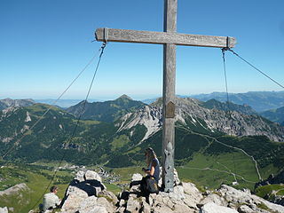
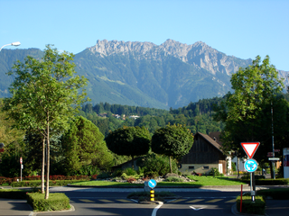
WDrei Schwestern is a mountain located on the border of Austria and Liechtenstein. It forms a natural boundary between Liechtenstein and the Austrian state of Vorarlberg.
 W
WEbenholz is a village of Liechtenstein, located in the municipality of Vaduz. Its name means "ebony" in German.
 W
WEschen is a municipality in the north of Liechtenstein. It has a population of 4,466, and covers an area of 10.3 square kilometres. It is the fourth-largest town in Liechtenstein by population.
WGaflei is a village of Liechtenstein, located in Triesenberg, the highest and largest municipality in the Oberland constituency of the country. It stands at approximately 1500 m above sea level. Gaflei developed from settlements of the Walser people in the Middle Ages. The geographical centre of Liechtenstein is located at the Alp Bargälla, east of Gaflei.
WGafleispitz is a mountain in Liechtenstein in the Rätikon range of the Eastern Alps, to the east of Schaan, with a height of 2,000 metres (6,600 ft).
 W
WGalinakopf is a mountain on the border of Austria and Liechtenstein in the Rätikon range of the Eastern Alps, with a height of 2,198 metres (7,211 ft).
 W
WGamprin is a municipality of Liechtenstein with 1,690 inhabitants.
 W
WGampriner Seele is the only lake in Liechtenstein. It was created by a flood of the Rhine River with enormous erosion in 1927. The lake lies at 435 metres above Sea Level in the village of Bendern–Gamprin.
WGamsgrat is a mountain on the border of Liechtenstein and Austria in the Rätikon range of the Eastern Alps close to the town of Malbun, with a height of 2,246 metres (7,369 ft).
WGarsellakopf is a mountain on the border of Liechtenstein and Austria in the Rätikon range of the Eastern Alps to the east of the town of Schaan, with a height of 2,105 metres (6,906 ft).
WGoldlochspitz is a mountain in Liechtenstein in the Rätikon range of the Eastern Alps with a height of 2,110 metres (6,920 ft).
WGorfion is a mountain on the border of Austria and Liechtenstein in the Rätikon range of the Eastern Alps, with a height of 2,308 metres (7,572 ft).
 W
WThe Grauspitz is a mountain in the Rätikon range of the Alps, located on the border between Liechtenstein and Switzerland. With an elevation of 2,599 metres above sea level, the Grauspitz is the highest mountain in Liechtenstein. It is also the highest summit of the Rätikon range west of the Schesaplana massif.
WHelwangspitz is a mountain in Liechtenstein in the Rätikon range of the Eastern Alps, to the east of Vaduz, with a height of 1,999 metres (6,558 ft) / or 2000 m.
WHeubühl is a mountain in Liechtenstein in the Rätikon range of the Eastern Alps, to the east of the town of Triesen, with a height of 1,936 metres (6,352 ft).
 W
WThe Hinter Grauspitz is a mountain on the border of Switzerland and Liechtenstein in the Rätikon range of the Eastern Alps. With a height of 2,574 metres (8,445 ft) above sea level, it is the second highest summit in Liechtenstein.
 W
WHinterschellenberg is a settlement in Schellenberg, Liechtenstein.
WKirchlespitz is a mountain in Liechtenstein in the Rätikon range of the Eastern Alps between Malbun and Steg, with a height of 1,929 metres (6,329 ft).
 W
WKoraspitz is a mountain in Liechtenstein in the Rätikon range of the Eastern Alps with a height of 1,927 metres (6,322 ft).
 W
WKuhgrat is the highest of a group of three peaks known as the Drei Schwestern which between them form part of the Austria-Liechtenstein border. It reaches a height of 2,123 metres (6,965 ft).
WKulmi is a mountain in Liechtenstein in the Rätikon range of the Eastern Alps with a height of 1,993 metres (6,539 ft).
WLangspitz is a mountain in Liechtenstein in the Rätikon range of the Eastern Alps with a height of 2,006 metres (6,581 ft).
 W
WMalbun is a ski-resort village in the eastern exclave of the municipality of Triesenberg, in Liechtenstein.
Mäls is a village of Liechtenstein, located in the municipality of Balzers.
WMasescha is a village of Liechtenstein, located in the municipality of Triesenberg.
 W
WMauren is a municipality in Liechtenstein that is situated in the north of the country. It has a population of 4,401. The Curta mechanical calculator was produced by Contina AG, in Mauren.
WMaurerberg or Mauerer Berg is a mountain on the border of Liechtenstein and Austria in the Rätikon range of the Eastern Alps to the southeast of the town of Schaanwald, with a height of 1,378 metres (4,521 ft).
 W
WMazorakopf or Falknishorn is a mountain on the border between Switzerland and Liechtenstein. It is the southernmost point of the principality of Liechtenstein.
 W
WMittagspitz is a mountain in Liechtenstein, close to the border with Switzerland in the Rätikon range of the Eastern Alps, east of the town of Balzers, with a height of 1,857 metres (6,093 ft).
WMittlerspitz is a mountain on the border of Liechtenstein and Switzerland in the Rätikon range of the Eastern Alps east of the town of Balzers, with a height of 1,897 metres (6,224 ft).
WMühleholz is a village in Liechtenstein located in the municipality of Vaduz.
 W
WThe Naafkopf is a mountain in the Rätikon range of the Alps, located at the border between Austria, Liechtenstein and Switzerland.
 W
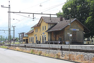
WNendeln is a village of Liechtenstein, located in the municipality of Eschen.
WNospitz is a mountain in Liechtenstein in the Rätikon range of the Eastern Alps close to the town of Malbun, with a height of 2,091 metres (6,860 ft).
WOchsenkopf is a mountain on the border of Liechtenstein and Austria in the Rätikon range of the Eastern Alps close to the town of Malbun, with a height of 2,286 metres (7,500 ft).
WPlasteikopf is a mountain in Liechtenstein in the Rätikon range of the Eastern Alps close to the border with Switzerland, with a height of 2,356 metres (7,730 ft).
WRappenstein is a mountain in Liechtenstein in the Rätikon range of the Eastern Alps with a height of 2,222 metres (7,290 ft).
WRauher Berg is a mountain on the border of Liechtenstein and Austria in the Rätikon range of the Eastern Alps, close to the town of Malbun, with a height of 2,094 metres (6,870 ft).
WRotenboden is a village of Liechtenstein, located in the municipality of Triesenberg
WRotspitz is a mountain in Liechtenstein, located close to the Swiss border, due east of the Swiss town of Wartau. It is in the Rätikon range of the Eastern Alps, and reaches a height of 2,127 metres (6,978 ft).
 W
WRuggell is the most northerly and low-lying of the Liechtenstein communities/municipalities, with population of 2,322 in 2019.
WSarojahöhe or Saroja is a mountain on the border of Liechtenstein and Austria in the Rätikon range of the Eastern Alps to the east of the village of Planken, with a height of 1,659 metres (5,443 ft).
WSattelköpfle is a mountain in on the border of Liechtenstein and Austria in the Rätikon range of the Eastern Alps to the east of the village of Planken, with a height of 1,688 metres (5,538 ft).
 W
WSchaanwald is a village of Liechtenstein, located in the municipality of Mauren.
WScheienkopf is a mountain on the border of Liechtenstein and Austria, although the summit is in Austria, in the Rätikon range of the Eastern Alps with a height of 2,159 metres (7,083 ft).
 W
WSchönberg is a mountain in Liechtenstein in the Rätikon range of the Eastern Alps north-east of the village of Steg, with a height of 2,104 metres (6,903 ft).
WSilberhorn or Hubel is a mountain in Liechtenstein in the Rätikon range of the Eastern Alps close to the border with Switzerland, with a height of 2,150 metres (7,050 ft).
 W
WSilum is a village of Liechtenstein, located in the municipality of Triesenberg.
WSpitz is a mountain in Liechtenstein in the Rätikon range of the Eastern Alps close to the border with Austria and the town of Malbun with a height of 2,186 metres (7,172 ft).
 W
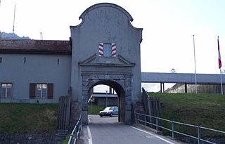
WSt. Luzisteig Pass is a mountain pass in the Alps between the canton of Graubünden in Switzerland and Liechtenstein.
WStachlerkopf is a mountain in Liechtenstein in the Rätikon range of the Eastern Alps, close to the towns of Steg and Malbun, with a height of 2,071 metres (6,795 ft).
 W
WSteg is a village in Liechtenstein, located in the municipality of Triesenberg.
WSücka is a village of Liechtenstein, located in the municipality of Triesenberg.
WWangerberg is a village of Liechtenstein, located in the municipality of Triesenberg.
 W
WWürznerhorn is a mountain on the border of Liechtenstein and Switzerland in the Rätikon range of the Eastern Alps close to the town of Balzers, with a height of 1,713 metres (5,620 ft).
 W
WZigerbergkopf is a mountain on the border of Liechtenstein and Austria in the Rätikon range of the Eastern Alps with a height of 2,051 metres (6,729 ft).