 W
WAbbey Hey is an area of Gorton, in the city of Manchester, England. It is known mainly for Debdale Park, Wright Robinson College, Cat Valley playing field, the donkey sanctuary and Delamere Park.
 W
WAncoats is an area of Manchester in North West England, next to the Northern Quarter, the northern part of Manchester city centre.
 W
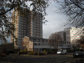
WArdwick is a district of Manchester in North West England, one mile south east of the city centre. The population of the Ardwick Ward at the 2011 census was 19,250.
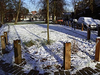
WArdwick Green is a public space in Ardwick, Manchester, England. It began as a private park for the residents of houses surrounding it before Manchester acquired it in 1867 and turned it into a public park with an ornamental pond and a bandstand.
 W
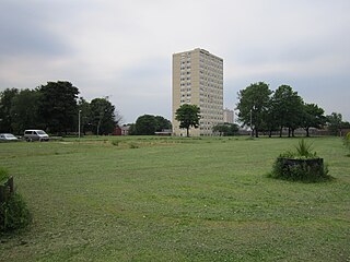
WBaguley is an electoral ward of the city of Manchester in Wythenshawe, England. The population at the 2011 census was 14,794.
 W
WBarlow Moor was in early times an area of moorland between Didsbury and Chorlton-cum-Hardy and was named after the Barlow family of Barlow Hall. Barlow Moor Road runs through the area and connects to Wilmslow Road at the southern end and Manchester Road at the northern end. Southern Cemetery and Chorlton Park are landmarks on the route. Immediately adjacent to the northwest corner of the cemetery, also on Barlow Moor Road, is the Manchester Crematorium which opened in 1892, the second in the United Kingdom. The architects were Steinthal and Solomons who chose to revive the Lombard-Romanesque style. Another notable building is the Chorlton Park Apartments, 2002.
 W
WBelle Vue is an area of Manchester, England, east of the city centre, bordered by the Hope Valley Line on the east and the Glossop Line on the west. It is known for the former Belle Vue Zoological Gardens and Belle Vue Stadium.
 W
WBeswick is an area of east Manchester, England. Historically in Lancashire, it neighbours the district of Bradford to the east and the two are sometimes referred to as Bradford-with-Beswick. The River Medlock and the Ashton Canal both run through it.
 W
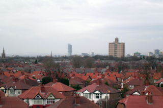
WBlackley is a suburban area of Manchester, England. In the County of Greater Manchester. Historically in Lancashire, it is approximately 4.5 miles (7.2 km) north of Manchester city centre, on the River Irk.
 W
WBradford-with-Beswick is an inner city area in Manchester, England. It consists of the ancient townships of Bradford, Manchester, and Beswick, Manchester, both in the ancient parish of Manchester and hundred of Salford.
 W
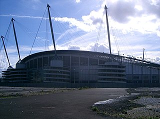
WBradford is a district of east Manchester, England, two miles north east of the city centre. The population at the 2011 census was 15,784. Historically in Lancashire, after the closure of its heavy industries Bradford was for many years an economically deprived area but has undergone regeneration with the building of the City of Manchester Stadium which hosted the 2002 Commonwealth Games and is now home to Manchester City F.C.. Bradford is neighboured by Beswick to the south and the two areas are sometimes referred to as Bradford-with-Beswick. The River Medlock and the Ashton Canal run through Bradford.
 W
WBrooklands is an area and electoral ward of Manchester, England. It is represented in Westminster by Mike Kane MP for Wythenshawe and Sale East. The 2011 Census recorded a population of 14,362.
 W
WBurnage is a suburb of the city of Manchester in North West England, about 4 miles (6.4 km) south of Manchester city centre and bisected by the dual carriageway of Kingsway. The population of the Burnage Ward at the 2011 census was 15,227. It lies between Withington to the west, Levenshulme to the north, Heaton Chapel to the east and Didsbury and Heaton Mersey to the south.
 W
WBurnage is an area and electoral ward of Manchester, England. Different parts of this ward are represented by different MPs following boundary changes in 2018; the majority of the ward is part of the Manchester Withington constituency but a portion is part of the Manchester Gorton constituency. The 2011 Census recorded a population of 15,227.
 W
WCastlefield is an inner city conservation area of Manchester in North West England. The conservation area which bears its name is bounded by the River Irwell, Quay Street, Deansgate and Chester Road. It was the site of the Roman era fort of Mamucium or Mancunium which gave its name to Manchester. It was the terminus of the Bridgewater Canal, the world's first industrial canal, built in 1764; the oldest canal warehouse opened in 1779. The world's first passenger railway terminated here in 1830, at Liverpool Road railway station and the first railway warehouse opened here in 1831.
 W
WCheetham is an inner city area and electoral ward of Manchester, England, which in 2011 had a population of 22,562. It lies on the west bank of the River Irk, 1.4 miles (2.3 km) north of Manchester city centre close to the boundary with Salford, bounded by Broughton to the north, Harpurhey to the east, and Piccadilly and Deansgate to the south.
 W
WChorlton is an electoral ward of Manchester, England. Different parts of this ward are represented by different MPs following boundary changes in 2018; the majority of the ward is part of the Manchester Withington constituency but a portion is part of the Manchester Gorton constituency. The 2011 Census recorded a population of 14,138.
 W
WChorlton Park is an area and electoral ward of Manchester, England. Different parts of this ward are represented by different MPs following boundary changes in 2018; the majority of the ward is part of the Manchester Withington constituency but a portion is part of the Manchester Gorton constituency. The 2011 Census recorded a population of 15,147.
 W
WChorlton-cum-Hardy is a suburban area of Manchester, England, three miles (4.8 km) southwest of the city centre. Chorlton ward had a population of 14,138 at the 2011 census, and Chorlton Park 15,147.
 W
WChorlton-on-Medlock is an inner city area of Manchester, England.
 W
WChorltonville is a garden village dating from 1911 within Chorlton, in Manchester, North West England. It retains much of its original character, including architecture inspired by the Arts and Crafts movement.
 W
WClayton is an area of Manchester, England, 3 miles east of the city centre on Ashton New Road.
 W
WCollyhurst is an inner city area of Manchester, England, 1.5 miles (2.4 km) northeast of the city centre on Rochdale Road (A664) and Oldham Road (A62), bounded by Smedley, Harpurhey and Monsall to the north, Miles Platting to the east, Ancoats to the south, and the River Irk to the west. Prominent buildings include two Roman Catholic churches, St Patrick's and St Malachy's.
 W
WCrumpsall is a suburb and electoral ward of Manchester, England. The population at the 2011 census was 15,959. It is about 3 miles (5 km) north of Manchester city centre, adjacent to Cheetham Hill, Blackley, Harpurhey, Broughton and Prestwich.
 W
WDidsbury is a suburban area of Manchester, England, on the north bank of the River Mersey, 4.5 miles (7.2 km) south of Manchester city centre. The population at the 2011 census was 26,788.
 W
WFallowfield is a suburb of Manchester, England, with a population at the 2011 census of 15,211. Historically in Lancashire, it lies 3 miles (5 km) south of Manchester city centre and is bisected east–west by Wilmslow Road and north–south by Moseley Road and Wilbraham Road. The former Fallowfield Loop railway line, now a cycle path, follows a route nearly parallel with the east–west main road.
 W
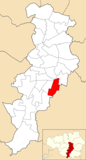
WGorton is an area of Manchester in North West England, southeast of the city centre. The population at the 2011 census was 36,055. Neighbouring areas include Audenshaw, Denton, Levenshulme, Openshaw, and Reddish.
 W
WThe Green Quarter is an area of Manchester, England, just north of the city centre between Cheetham, Strangeways and the River Irk.
 W
WGreenheys is an inner-city area of south Manchester, England, between Hulme to the north and west, Chorlton-on-Medlock to the east and Moss Side to the south.
WHarpurhey is an inner-city area of Manchester in North West England, three miles north east of the city centre. Historically in Lancashire, the population at the 2011 census was 17,652.
 W
WHighfield Country Park is a 70-acre (280,000 m2) area of open land, situated on the east side of Levenshulme, Manchester, that stretches to the east of Broom Avenue across to the rear of Reddish Golf Course and to the junction of Longford Road, Reddish and Nelstrop Road, Levenshulme.
 W
WHulme is an inner city area and electoral ward of Manchester, England, immediately south of Manchester city centre. It has a significant industrial heritage.
 W
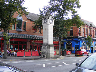
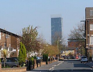
WLevenshulme is an area of Manchester, England, bordering Fallowfield, Longsight, Gorton, Burnage, Heaton Chapel and Reddish, approximately halfway between Stockport and Manchester city centre on the A6. Levenshulme is predominantly residential with numerous fast food shops, public houses and antique stores. It has a multi-cultural and multi-ethnic population of 15,430 at the 2011 Census. The Manchester to London railway line passes through Levenshulme railway station.
 W
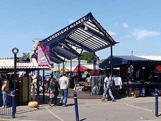
WLongsight is an inner city area of Manchester, England, 3 miles (4.8 km) south of the city centre, bounded by Ardwick and West Gorton to the north, Belle Vue to the east, Levenshulme to the south, and Chorlton-on-Medlock, Victoria Park and Fallowfield to the west. Historically in Lancashire, it had a population of 15,429 at the 2011 census.
 W
WManchester city centre is the central business district of Manchester, England, within the boundaries of Trinity Way, Great Ancoats Street and Whitworth Street. The City Centre ward had a population of 17,861 at the 2011 census.
 W
WMerseybank is a suburb of Chorlton-cum-Hardy situated towards West Didsbury 4 miles south of Manchester city centre, England.
 W
WMiles Platting is an inner city part of Manchester, England, 1.4 miles (2.3 km) northeast of Manchester city centre along the Rochdale Canal and A62 road, bounded by Monsall to the north, Collyhurst to the west, Newton Heath to the east, and Bradford, Holt Town and Ancoats to the south.
 W
WMoss Side is an inner-city area of Manchester, England, 1.9 miles (3.1 km) south of the city centre, It had a population of 18,902 at the 2011 census. Moss Side is bounded by Hulme to the north, Chorlton-on-Medlock, Rusholme and Fallowfield to the east, Whalley Range to the south, and Old Trafford to the west.
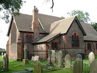
WMoston is a district of Manchester, in North West England, approximately 3 miles (4.8 km) north-east of the city centre. Historically in Lancashire, Moston is a predominantly residential area, with a population of 14,518 at the 2011 census and an area of approximately 1,300 acres (5.3 km2).
 W
WNew Islington is an inner city area of Manchester, in North West England. Historically in Lancashire and part of Ancoats, it has taken a separate identity to reflect its changed status as a regeneration area.
 W
WNew Moston is a district within the City of Manchester, in North West England.
 W
WNewall Green is an area in the Wythenshawe district of Manchester, England. It is on the west side of the M56 motorway, approximately 1 mile from Wythenshawe Town Centre.
 W
WNewton Heath is an area of Manchester, England, 2.8 miles (4.5 km) north-east of Manchester city centre and with a population of 9,883.
 W
WNorthenden is a suburb of Manchester, England, with a population of 14,771 at the 2011 census. It lies on the south side of the River Mersey, 4.2 miles (6.8 km) west of Stockport and 5.2 miles (8.4 km) south of Manchester city centre, it is bounded by Didsbury to the north, Gatley to the east, and Wythenshawe to the south and west.
 W
WThe Northern Quarter is an area of Manchester city centre, England, between Piccadilly station, Victoria station and Ancoats, centred on Oldham Street, just off Piccadilly Gardens. It was defined and named in the 1990s as part of the regeneration and gentrification of Manchester.
WOld Moat is a suburban area of Manchester, England. The population of its electoral ward at the 2011 census was 14,490.
 W
WOld Moat is an area and electoral ward of Manchester, England. It is represented in Westminster by Jeff Smith MP for Manchester Withington. The 2011 Census recorded a population of 14,490.
WOpenshaw is an area of Manchester, England, about three miles east of the city centre. Historically part of Lancashire, Openshaw was incorporated into the city of Manchester in 1890. Its name derives from the Old English Opinschawe, which means an open wood or coppice.
 W
WParrs Wood is an area of East Didsbury, in the southern part of the city of Manchester, England.
 W
WRingway is a civil parish on the southern border of Manchester, England. Historically in Cheshire, it is the only civil parish in the city of Manchester. The population at the 2011 census was 103. Ringway is home to Manchester Airport.
WSharston is an area of Wythenshawe, south Manchester, England. The population at the 2011 census was 16,754.
 W
WSmedley is an area of north Manchester, England, on the banks of the River Irk between Cheetham Hill to the west, Collyhurst to the south, Crumpsall to the north and Harpurhey to the east.
 W
WSpinningfields is an area of Manchester city centre, in North West England, developed in the 2000s between Deansgate and the River Irwell by Allied London Properties. The £1.5 billion project consists of twenty new buildings, totalling approximately 430,000 sq metres of commercial, residential and retail space. It takes its name from Spinningfield, a narrow street which ran westwards from Deansgate. In 1968, Spinningfield and the area to the south were turned into Spinningfield Square, an open paved area. The Manchester Civil Justice Centre is a landmark building of the scheme and construction commenced on 1 Spinningfields, a 90-metre office building, in early 2015.
 W
WSt John's is a proposed £1 bn development of a 6 hectare plot within central Manchester, England. The site is being developed by Manchester Quays Ltd (MQL), a partnership between Manchester City Council and Allied London.
 W
WVictoria Park is a suburban area of Manchester, England. Victoria Park lies approximately two miles south of Manchester city centre, between Rusholme and Longsight.
WGorton is an area of Manchester in North West England, southeast of the city centre. The population at the 2011 census was 36,055. Neighbouring areas include Audenshaw, Denton, Levenshulme, Openshaw, and Reddish.
WWhalley Range is an area of Manchester, England, about 2 miles (3.2 km) southwest of the city centre. The population at the 2011 census was 15,430. Historically in Lancashire, it was one of the earliest of the city's suburbs, built by local businessman Samuel Brooks.
 W
WWithington is a suburb of south Manchester, England. Historically part of Lancashire, it lies 4 miles (6.4 km) from Manchester city centre, about 0.4 miles (0.6 km) south of Fallowfield, 0.5 miles (0.8 km) north-east of Didsbury and 1 mile (1.6 km) east of Chorlton-cum-Hardy. Withington has a population of just over 14,000 people, reducing at the 2011 census to 13,422.
WWoodhouse Park is an area of Wythenshawe in south Manchester, England. The population of the ward at the 2011 census was 13,519.
 W
WWythenshawe is an area of south Manchester, England.