 W
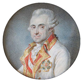
WJoseph Jean François, count de Ferraris was an Austrian general and cartographer. He was married to the daughter of Charles, 2nd Duke d'Ursel.
 W
WCornelis de Jode was a cartographer, engraver and publisher from Antwerp. He was the son of Gerard de Jode, also a cartographer. Cornelis studied science at Academy of Douai
 W
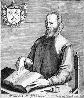
WGerard de Jode was a Netherlandish cartographer, engraver, and publisher who lived and worked in Antwerp.
 W
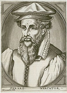
WGerardus Mercator was a 16th-century geographer, cosmographer and cartographer from the County of Flanders. He is most renowned for creating the 1569 world map based on a new projection which represented sailing courses of constant bearing as straight lines—an innovation that is still employed in nautical charts.
 W
WAbraham Ortelius was a Brabantian cartographer, geographer, and cosmographer, conventionally recognized as the creator of the first modern atlas, the Theatrum Orbis Terrarum. Ortelius is often considered one of the founders of the Netherlandish school of cartography and one of the most notable figures of the school in its golden age. The publication of his atlas in 1570 is often considered as the official beginning of the Golden Age of Netherlandish cartography. He is also believed to be the first person to imagine that the continents were joined before drifting to their present positions.
 W
WPhilippe Vandermaelen (1795–1869) was a Belgian geographer.
 W
WCornelius Wytfliet or Cornelis van Wytfliet was a geographer from Leuven in the Habsburg Netherlands, best known for producing the first atlas of the Americas.