 W
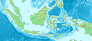
WIndonesia is an archipelagic country located in Southeast Asia, lying between the Indian Ocean and the Pacific Ocean. It is located in a strategic location astride or along major sea lanes connecting East Asia, South Asia and Oceania. Indonesia is the largest archipelago in the world. Indonesia's various regional cultures have been shaped—although not specifically determined—by centuries of complex interactions with its physical environment.
Geospatial Information Agency is the National Mapping Agency of Indonesia. BIG formerly named National Coordinator for Survey and Mapping Agency. This national agency is responsible for Indonesian geospatial information as one map policy implementation. In 2010, Susilo Bambang Yudhoyono stated that Indonesia should has single referenced map, so there wouldn't be any different spatial data for country development.
 W
WCitatah Cliff is a row of cliffs located in Citatah, West Bandung regency, West Java, Indonesia. Its exact location is at 5 km Padalarang. With the morphology of hilly area and formed largely of limestone, Citatah looks different from other hills in general.
 W
WThe countries dependent on the Bay of Bengal include littoral and landlocked countries that depend on the Bay of Bengal for maritime usage. Historically, the Bay of Bengal has been a highway of transport, trade and cultural exchange between diverse peoples encompassing South Asia and Southeast Asia. Today, the Bay of Bengal region is the convergence of two major geopolitical blocs- the Association of Southeast Asian Nations (ASEAN) and the South Asian Association for Regional Cooperation (SAARC). The Bay of Bengal Initiative for Multisectoral Technical and Economic Cooperation (BIMSTEC) promotes regional engagement in the area.
 W
WThe Indonesian Throughflow (ITF) is an ocean current with importance for global climate since it provides a low-latitude pathway for warm, freshwater to move from the Pacific to the Indian Ocean and this serves as the upper branch of the global heat conveyor belt. Higher ocean surface topography in the western Pacific than found in the Indian Ocean drives upper thermocline water from the North Pacific through the western route of the Makassar Strait to either directly exit through the Lombok Strait or flow eastward into the Banda Sea. Weaker flows of saltier and denser South Pacific water pass over the Lifamatola Passage into the Banda Sea, where these waters mass are mixed due to tidal effects, Ekman pumping, and heat and freshwater flux at the ocean surface. From the Banda Sea the ITF exits Timor, Ombai, and Lombok passages.
 W
WKomodo is a village and island of Komodo District, West Manggarai Regency, in East Nusa Tenggara province of Indonesia. The village encompasses the territory of Komodo Island and the small surrounding islands.
 W
WMount Hawu is a small mountain located in Padalarang district in West Bandung Regency, West Java, Indonesia. Padalarang is renowned for its towering limestone mountains. One of the most popular among local climbers is the cliff of Hawu Mountain.