 W
WThe Bentley Subglacial Trench is a vast topographic trench in Marie Byrd Land, West Antarctica, 80°S, 115°W. At 2,555 meters (8,382 ft) below sea level, it is among the lowest points on the surface of the Earth not covered by ocean, although it is covered by ice..
 W
WBrown Valley is a rectangular ice-covered valley between Mount Kauffman and Mount Kosciusko in the northeast end of the Ames Range, Marie Byrd Land. It was mapped by the United States Geological Survey from surveys and from U.S. Navy air photos, 1959–65, and named by the Advisory Committee on Antarctic Names after Thomas I. Brown, United States Antarctic Research Program meteorologist at Byrd Station in 1963.
 W
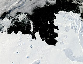
WMartin Peninsula is a peninsula about 96 km (60) mi long and 32 km (20 mi) wide that is ice-covered except for a few rock outcrops along its margins, located between Getz Ice Shelf and Dotson Ice Shelf on the coast of Marie Byrd Land, Antarctica. The farthest point of the peninsula is Jacobsen Head.
 W
WSaunders Coast is that portion of the coast of Marie Byrd Land between Cape Colbeck and Brennan Point, or between Shirase Coast in the west and Ruppert Coast in the east. It stretches from 158°01'W to 146°31'W. The portion west of 150°W is part of Ross Dependency, while the remaining area is unclaimed by any nation. This coast was explored from the air on December 5, 1929, by the Byrd Antarctic Expedition (1928–30) and was first mapped from aerial photographs obtained on that flight by Capt. Harold E. Saunders, USN, for whom the coast is named. The United States Geological Survey (USGS) completely mapped the coast from ground surveys and U.S. Navy air photos, 1959–65.
 W
WUsas Escarpment is an expansive but discontinuous north-facing escarpment in Marie Byrd Land, Antarctica. It is about 320 kilometres (199 mi) long, extending roughly west to east along the 76th parallel south from where the elevation of the snow surface descends toward the Ruppert Coast and Hobbs Coast. The position of the escarpment coincides with the north slopes of the Flood Range, Ames Range, McCuddin Mountains, and the eastern peaks of Mount Galla, Mount Aldaz and Benes Peak. The escarpment was observed by members of the United States Antarctic Service, 1939–41, and in ensuing scientific reports was referred to as 76th Parallel Escarpment. The approved name is an acronym for the discovery expedition.
 W
WThe Walgreen Coast is a portion of the coast of Antarctica between Cape Herlacher and Cape Waite, or between Eights Coast on the east and Bakutis Coast in the west. It extends from 103°24'W to 114°12'Wto. It was discovered by Rear Admiral Richard E. Byrd and members of the US Antarctic Service (USAS) by flights from the USS Bear during February 1940.
 W
WWatson Escarpment is a major escarpment in the Queen Maud Mountains, trending northward along the east margin of Scott Glacier, then eastward to Reedy Glacier where it turns southward along the glacier's west side. Somewhat arcuate, the escarpment is nearly 100 nautical miles (180 km) long, rises 3,550 m above sea level, and 1,000 to 1,500 m above the adjacent terrain.