 W
WThe Bangladesh–Myanmar border is the international border between the countries of Bangladesh and Myanmar. The border stretches 270 kilometres, from the tripoint with India in the north, to the Bay of Bengal in the south. About 210 km (130 mi) of the border is fenced, with the government of Myanmar announcing in 2017 that it was planning to fence off the rest of the border.
 W
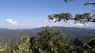
WAiyang Tlang is a mountain on the Bangladesh–Myanmar border. In 2020, Aiyang Tlang was confirmed to be the highest point in Bangladesh. The hill was discovered in the 1980s by Van Rausang Bawm of the local Bawm ethnic community. On 13 November 2019, Jyotirmoy Dhar became the first Bangladeshi to climb the mountain.
 W
WThe Bay of Bengal is the northeastern part of the Indian Ocean, bounded on the west and northwest by India, on the north by Bangladesh, and on the east by Myanmar and the Andaman and Nicobar Islands of India. Its southern limit is a line between Sangaman Kanda, Sri Lanka and the north westernmost point of Sumatra (Indonesia). It is the largest water region called a bay in the world. There are countries dependent on the Bay of Bengal in South Asia and Southeast Asia. In ancient India, Bay of Bengal was known as Kalinga Sagar. Later during the British India, it came forth as the Bay of Bengal after the historic Bengal region, as the Port of Kolkata served as the gateway to the Crown rule in India. Cox's Bazar, the longest sea beach in the world and Sundarbans, the largest mangrove forest and the natural habitat of the Bengal tiger, are located along the bay.
 W
WKutupalong refugee camp is the world's largest refugee camp. It is in Ukhia, Cox's Bazar, Bangladesh, inhabited mostly by Rohingya refugees that fled from ethnic and religious persecution in neighboring Myanmar. It is one of two government-run refugee camps in Cox's Bazaar, the other being the Nayapara refugee camp.
 W
WThe Naf River is an international river marking the border of southeastern Bangladesh and western Myanmar.
 W
WNayapara refugee camp is a refugee camp in Teknaf, Cox's Bazar, Bangladesh. It is located next to the village of Dhumdumia and is inhabited mostly by Rohingya people that have fled from religious persecution in neighboring Myanmar. It is one of two government-run refugee camps in Cox's Bazar, the other being the Kutupalong refugee camp. The two refugee camps had a combined population of around 30,000 refugees in July 2017. In September 2017, the United Nations High Commissioner for Refugees (UNHCR) estimated that the combined population of the two refugee camps had increased to over 77,000. As of 14 January 2018, the estimated population of Nayapara refugee camp is around 23,065.
 W
WSaka Haphong is a peak in Bangladesh, often considered the highest point of the country, with an elevation of 1,052 metres (3,451 ft). Located on the Bangladesh–Burma border, it is situated between Thanchi, Bandarban, Bangladesh and the Chin State of Burma.
 W
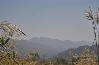
WZow Tlang is a mountain on the Bangladesh–Myanmar border. Height of the mountain is equal to 1,022 m.