 W
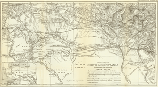
WAl-Hasakah Governorate is one of the fourteen governorates (provinces) of Syria. It is located in the far north-east corner of Syria and distinguished by its fertile lands, plentiful water, natural environment, and more than one hundred archaeological sites. It was formerly known as Al-Jazira Province. Prior to the Syrian Civil War nearly half of Syria's oil was extracted from the region. It is the lower part of Upper Mesopotamia. Most of the governorate's territory is coextensive with the Jazira Region of the Autonomous Administration of North and East Syria, with parts under the Turkish occupation of northern Syria or urban enclaves of the Syrian government. Hasakah is the only governorate with a Kurdish majority.
 W
WThe Abu Hajar Airport is an airfield near the town of Rmelan in the al-Hasakah Governorate of northeast Syria. Before 2010, it was used as an agricultural transport airport and was subsequently abandoned until the end of 2015.
 W
WAl-Malikiyah Municipal Airfield is a basic aerodrome serving Al-Malikiyah, a small city in far northeastern Syria. The airfield is about 8.5 kilometres east of the city.
 W
WThe Arab Belt was the Syrian Baath government's project of Arabization of the north of the Al-Hasakah Governorate to change its ethnic composition of the population in favor of Arabs to the detriment of other ethnic groups, particularly Kurds. It involved the seizure of land which was then settled with Arabs displaced by the creation of Lake Assad.
 W
WThe Jazira Region, formerly Jazira Canton,, is the largest of the three original regions of the de facto Autonomous Administration of North and East Syria (AANES). As part of the ongoing Rojava conflict, its democratic autonomy was officially declared on 21 January 2014. The region is in the Al-Hasakah Governorate of Syria.
 W
WMount Abdulaziz or Abd al-Aziz is a mountain ridge located in the southwestern part of the Hasakah Governorate, some 35 km west-south-west from the center of the city of Hasakah, in northeastern Syria. The mountain extends from east to west and has a length of 85 km, a width of 15 km, and an area of 84,050 hectares. Jabal Abdulaziz consists of a series of hills and valleys whose altitudes ranges between 350 and 920 meters. The mountain has taken its name after Abdul Aziz, a descendant of Abdul-Qadir Gilani, a military commander in Saladin's army, who had once taken the mountain as a fortified place. The former name of the mountain was ʾAl-Ḥiyāl الحيال.
 W
WQamishli is a city in northeastern Syria on the Syria–Turkey border, adjoining the city of Nusaybin in Turkey. According to the 2004 census, Qamishli had a population of 184,231. Qamishli is 680 kilometres (420 mi) northeast of Damascus.
 W
WQamishli Airport is an airport serving Qamishli, a city in northeastern Syria.
 W
WTell Aqab is an ancient Mesopotamian settlement located in northeastern Syria, occupied from the early Halaf period to c. 3800 BCE. It is situated at the northern edge of the Khabur Plain near the headwaters of the Khabur tributary of the Euphrates, 6 km south-southeast of the town of Amuda in Jazira Canton. It is one of the few sites that contain material relating to the Halaf-Ubaid Transitional period, c. 5500–5000 BCE.