 W
WRegions in the province of Manitoba, Canada, showing the census divisions in each.Central Plains Central Manitoba Portage la Prairie Area Whitehorse Plains Eastman Beausejour Area Eastern Manitoba Steinbach Area Interlake North Interlake Selkirk Area South Interlake Northern Churchill/Northern Manitoba Flin Flon/North West North East Manitoba Thompson/North Central Parkland Dauphin Roblin, Russell, Rossburn Area Swan Valley Pembina Valley Pembina Valley Pilot Mound Area Westman Brandon Area South West Area Virden Area Western Manitoba Winnipeg Capital Region Winnipeg census division : City of Winnipeg Headingley Three municipalities from the Central Plains Region : Cartier Macdonald St. François Xavier Three municipalities from the Eastman Region : Ritchot Springfield Taché Eight municipalities from the Interlake Region : East St. Paul Rockwood Rosser Selkirk St. Andrews St. Clements Stonewall West St. Paul
 W
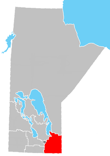
WThe Central Plains Region is located in the south central part of the Canadian province of Manitoba, directly west of Winnipeg. It is bounded on the south by the Pembina Valley Region; on the east by the No. 8, No. 9, and No. 10, which together have a total land area of 10,656.86 square kilometres (4,114.64 sq mi). The region had a population of 48,289 people at the 2001 census.
 W
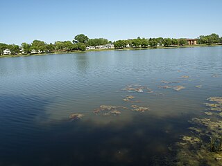
WThe Eastman Region--also known as Division No. 1-- is located in the south-eastern corner of the Canadian province of Manitoba. It is bounded on the north by the Winnipeg River and Lake Winnipeg, on the east by the Manitoba-Ontario border, on the south by the Canada–US border and on the west by the Red River. It is bordered on the north by the Northern Region, on the east by Northwestern Ontario on the south by the state of Minnesota, on the west by the Pembina Valley Region and the Interlake Region.
 W
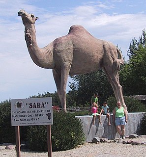
WManitoba's Interlake is a region that lies roughly between Lake Winnipeg and Lake Manitoba in the Canadian province of Manitoba. The region comprises 14 rural municipalities, one city, six towns and one village, Dunnottar. The largest population centre in the region is Selkirk. The second largest is the town of Stonewall. The region is divided into three of Statistics Canada's census divisions of Canada: Manitoba Census Divisions No. 13, No. 14, and No. 18, which together had a population of 91,743 at the 2016 census. The total land area of the region is 15,855.37 km².
 W
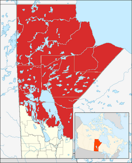
WNorthern Manitoba is the most northerly region of the Canadian province of Manitoba, added to the province during the last major expansion of its boundaries in 1912. Forestry, mining and hydro-electric development are significant economic drivers with long-term consequences to the environment in the region.
 W
WThe Pembina Valley is the name given to the south-central region of the province of Manitoba, Canada. It is named for its major geographical feature, the Pembina Valley, which runs through the southwestern part of the region.
 W
WSouthern Manitoba is the southernmost area of the Canadian province of Manitoba. Southern Manitoba encompasses the Winnipeg Metropolitan Area, Red River Valley, Pembina Valley, Central Plains, Westman and Eastman. It holds just slightly over one million people. Seven out of Manitoba's ten cities are located here- notably its capital city- Winnipeg, as well as Selkirk, Brandon, Portage la Prairie, Morden, Winkler, and Steinbach.
 W
WWestman is a region in the southwestern area of Manitoba, Canada. The region's urban centre is Brandon. The region comprises four of Statistics Canada's census divisions of Canada, Manitoba Census Divisions No. 5, No. 6, No. 7, and No. 15. Together they have a land area of 27,242.06 km² and had a population of 108,868 at the 2011 census.
 W
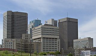
WThe Winnipeg Metro Region is a metropolitan area located in the Red River Valley in the south central portion of the province of Manitoba, Canada. It contains the provincial capital of Winnipeg and its surrounding rural municipalities, cities, and towns.