 W
WThe Centerville Pioneer Cemetery, also known as the Centerville Presbyterian Cemetery or Alameda Presbyterian Cemetery, located at the corner of Post Street and Bonde Way in Fremont, California, was officially designated a State cemetery in 1858 or 1859, depending upon the source, and was listed in the California Register of Historic Resources in 1976. At the time the cemetery was established, the location of the cemetery was known as Washington Township, Alameda County, California, which was then made up of the villages of Mission San Jose, Irvington, Warm Springs, Centerville, Niles, Newark, Alvarado and Decoto. In time all eight villages became towns of the same names, and both the church and cemetery were renamed to reflect their location in the town of Centerville.
 W
WCoyote Hills Regional Park is a regional park encompassing nearly 978 acres of land and administered by the East Bay Regional Park District. The park, which was dedicated to public use in 1967, is located in Fremont, California, USA, on the southeast shore of the San Francisco Bay. The Coyote Hills themselves are a small range of hills at the edge of the bay; though not reaching any great height, they afford tremendous views of the bay, three of the trans-bay bridges, the cities of San Francisco and Oakland, the Peninsula Range of the Santa Cruz Mountains and Mount Tamalpais. In addition to the hills themselves, the park encloses a substantial area of wetlands.
 W
WFremont Central Park is a 450-acre (180 ha) park in the central area of Fremont, California on Paseo Padre Parkway at Stevenson Boulevard. It is easily accessible from I-880 and I-680. It began development in 1960, and contains Lake Elizabeth, a shallow 83-acre (34 ha) man made lake surrounded by picnic areas, sports fields, and walking and biking paths. The lake was dedicated to Fremont's sister city, Elizabeth, South Australia in 1969. A nine-hole golf course and driving range is northeast of the park, while a skateboarding park and water slide swimming facility are southwest.
 W
WThe Hayward Fault Zone is a geologic fault zone capable of generating destructive earthquakes. This fault is about 74 mi (119 km) long, situated mainly along the western base of the hills on the east side of San Francisco Bay. It runs through densely populated areas, including Richmond, El Cerrito, Berkeley, Oakland, San Leandro, Castro Valley, Hayward, Union City, Fremont, and San Jose.
 W
WLake Elizabeth, located in Fremont, California, is a man made 83-acre (34 ha) lake. When at average capacity, water rises to a depth of about seven feet.
 W
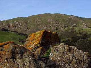
WMission Peak Regional Preserve is a public park east of Fremont, California, operated by the East Bay Regional Park District. It is the northern summit on a ridge that includes Mount Allison and Monument Peak. Mission Peak has symbolic importance, and is depicted on the logo of the City of Fremont.
 W
WMount Allison is a peak of the Diablo Range, located in the East Bay southeast of Fremont, California.
 W
WMowry Slough is a 5.8-mile-long (9.3 km) slough in Don Edwards San Francisco Bay National Wildlife Refuge and is the primary breeding ground for San Francisco Bay harbor seals. It is situated among the salt marshes and salt evaporation ponds in the city of Fremont.
 W
WQuarry Lakes Regional Recreation Area is a regional park located in Fremont, California that is part of the East Bay Regional Parks system. Before being converted into a park, the site was used as a gravel quarry. When water purchased by the public for groundwater recharge of the Niles Cone flooded the gravel pits, the gravel harvesters began to daily pump the seeping water down Alameda Creek into San Francisco Bay. The Alameda County Water District acquired the quarry after the pumping was declared to be an illegal waste in 1976.