 W
WBaghmara is the headquarters of South Garo Hills district in the state of Meghalaya in India. The place is bordered by Bangladesh and is about 113 km from Tura. It has a famous river, Someshwari, also known as Simsang in Garo tribal language, flowing through its expanse and is also covered in hills and tracts along the way.
 W
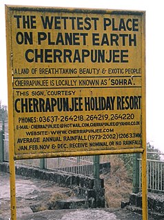
WCherrapunji or Sohra is a subdivisional town in the East Khasi Hills district in the Indian state of Meghalaya. It is the traditional capital of ka hima Sohra.
 W
WJowai is the headquarters of West Jaintia Hills district of the state of Meghalaya, India and is home to the Pnar, a sub-tribe of Hynniewtrep people. It is a scenic place located on a plateau surrounded on three sides by the Myntdu river bordering Bangladesh to the south. Due to its high altitude of 1365 m above sea level, Jowai experiences warm and pleasant summers with cool to chilly winters.
WLaitumkhrah is a census town in Shillong, Meghalaya, India. The name of the place basically means a place where the river "Umkhrah" originates from making its name aptly suited.
WMawsynram is a town in the East Khasi Hills district of Meghalaya state in northeastern India, 60.9 kilometres from Shillong. Mawsynram receives the highest rainfall in India. It is reportedly the wettest place on Earth, with an average annual rainfall of 11,872 millimetres (467.4 in), but that claim is disputed by Lloró, Colombia, which reported an average yearly rainfall of 12,717 millimetres (500.7 in) between 1952 and 1989 and López de Micay, also in Colombia, which reported 12,892 mm (507.6 in) per year between 1960 and 2012. According to the Guinness Book of World Records, Mawsynram received 26,000 millimetres (1,000 in) of rainfall in 1985.
WNongpoh {IPA: nɒŋˈpɒ(ə)} is the administrative centre of Ri-Bhoi district in the Indian state of Meghalaya in the Republic of India. Nongpoh is located on National Highway 40, fifty-two kilometers from the state capital Shillong and forty-eight kilometers from Guwahati in the state of Assam.
WNongstoin is the headquarters of West Khasi Hills district in the state of Meghalaya in India.
WNongtalang is a small town located in West Jaintia Hills district, Meghalaya, India.
 W
WShillong is a hill station in the northeastern part of India and the capital of Meghalaya, which means "The Abode of Clouds". It is the headquarters of the East Khasi Hills district. Shillong is the 330th most populous city in India with a population of 143,229 according to the 2011 census. It is said that the rolling hills around the town reminded the British of Scotland. Hence, they would also refer to it as the "Scotland of the East".