 W
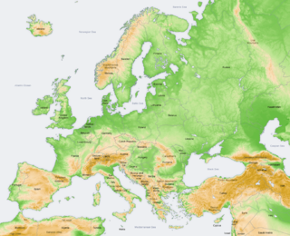
WSlovakia is a landlocked Central European country with mountainous regions in the north and flat terrain in the south.
 W
WThe Central European Highlands, in a broad sense, comprise the high mountains of the Alpine Mountains and the Carpathian Mountains systems along with mountainous ranges of medium elevation, e.g. those belonging to the Bohemian Massif, still prevailingly of mountainous character.
 W
WBratislava, the capital city of Slovakia, is situated in Central Europe and it is located in the extreme south-west within Slovakia. The city borders Austria in the west and Hungary in the south making it the only national capital in the world to border two foreign countries. The state border with the Czech Republic is only 62 kilometres (38.5 mi) distant. Bratislava lies on the foothills of the Little Carpathians mountains and the city straddles both banks of the Danube River. The city has a total area of 367.58 square kilometres (141.9 mi²), making it the second largest city in Slovakia by area. Geomorphologically the city covers the southern tip of the Záhorie Lowland, the entire range of the Devín Carpathians, small westernmost part of the Pezinok Carpahians and the northern tip of the Danubian Lowland.
 W
WThis page gives an overview of the geomorphological division of Slovakia. It is ordered in a hierarchical form, belonging to the Alps-Himalaya System and to the sub-systems of the Carpathian Mountains and of the Pannonian Basin. These subsystems are subsequently divided into provinces, sub-provinces and areas.
 W
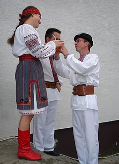
WHauerland is the German name for a region presently located in central Slovakia once inhabited by Carpathian Germans. Arisen from medieval Ostsiedlung population movements, it belonged to three German language islands within a greater Slovakian-speaking area. The other two were situated in Bratislava (Pressburg) and the Spiš (Zips) region.
 W
WLemkivshchyna or Lemkovyna is a region in Europe that is traditionally inhabited by the Lemko people. While the Lemko are a distinct ethnic group, they consider themselves to be part of the broader Rusyn and/or Ukrainian communities. Lemkovyna mostly stretches along the border between Poland and Slovakia covering some western territories of Ukraine.
 W
WObec is the Czech and Slovak word for a municipality. The literal meaning of the word is "commune" or "community". It is the smallest administrative unit that is governed by elected representatives. Cities and towns are also municipalities.
 W
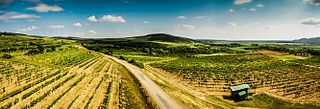
WTokaj wine region is a wine-growing region located in south-eastern Slovakia and north-eastern Hungary. The two vine-growing areas were once part of greater Tokaj wine region of the Kingdom of Hungary. Following the Treaty of Trianon a smaller part became part of Czechoslovakia, and after 1993 Slovakia. The majority of the region remained part of Hungary.
 W
WZáhorie is a region in western Slovakia between by the Little Carpathians to the east and the Morava River to the west. Although not an administrative region, it is one of the 21 official tourism regions in Slovakia. Záhorie lies in the area of three administrative regions: Bratislava Region, Trnava Region and Trenčín Region. The region also creates the borders between Slovakia, the Czech Republic and Austria.